Trail #329, Sec. 15, T7n, R7w To Sec. 28, T8n, R7w River Run
Community Reviews
Been here? Share the conditions.
Reviews, ratings & photos are added in the free Snoflo iOS app — rate a spot, tag the conditions, and your visit is verified by location. Add or manage your reviews from the app.
Trail #329, Sec. 15, T7n, R7w To Sec. 28, T8n, R7w
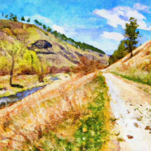
There are several specific rapids and obstacles along the Whitewater River Run Trail, including Purgatory, Harry's Hole, and the Triple Bridges. Purgatory is a class III rapid located near the beginning of the trail and features a large boulder in the middle of the river. Harry's Hole is a class II rapid that can be dangerous at higher water levels. The Triple Bridges are a set of three bridges that signal the end of the trail.
In terms of regulations, there are several things to keep in mind when planning a trip on the Whitewater River Run Trail. First and foremost, all boaters must wear a personal flotation device (PFD) at all times. Additionally, there are restrictions on the use of motorized boats, and all boats must be registered with the state. Finally, visitors should be aware that the area surrounding the trail is designated as wilderness, and as such, visitors are expected to practice Leave No Trace principles.
Plan your run down to the hour
Same weather feed Snoflo's iOS app uses -- updated continuously from NOAA / yr.no. Watch the precipitation column on the meteogram; rain ahead of a run typically lifts flows 12-48 hours later depending on the basin.
Next 5 days, hour by hour
Temperature line with weather symbols on top, snow + rain accumulation as columns, humidity as a dotted line.
5-day forecast table
Every 3 hours, broken out across temperature, snow, rain, humidity, and wind. Each cell is colour-coded relative to the column min/max.
| Time | Condition | Temp (°F) | Snow (in) | Rain (in) | Humidity (%) | Wind (mps) | Wind dir |
|---|---|---|---|---|---|---|---|
| Loading detailed forecast… | |||||||
15-day temperature & precipitation
Daily temperatures, snow, and rain projected over the next two weeks -- the upstream story that drives next week's flows.
Regional streamflow levels
USGS streamgauges around Trail #329, Sec. 15, T7n, R7w To Sec. 28, T8n, R7w -- useful for spotting upstream pulses and gauging which tributary is contributing what.
| Streamgauge | Discharge | View |
|---|---|---|
| Clark Fork At Deer Lodge Mt | 123 cfs | → |
| Tenmile Creek Near Rimini Mt | 3 cfs | → |
| Little Blackfoot River Near Garrison Mt | 151 cfs | → |
| Lost Creek Near Galen | 7 cfs | → |
| Clark Fork Near Galen Mt | 132 cfs | → |
| Silver Bow Creek At Warm Springs Mt | 59 cfs | → |
Plan a longer trip
The closest boat launches, other paddle runs, and campgrounds so a day on the water can grow into a full weekend.
Other river runs
Campgrounds
Fishing spots
Whitewater safety
- Check the flow before you run
- Use the linked-gauge card and Regional Flow panel above. Class ratings change with flow -- a Class III at low water can become Class IV+ at high water.
- Know your skill ceiling
- Pick runs comfortably below your ceiling. Cold-water and big-water runs raise the consequences of any mistake.
- Wear the right gear
- Helmet, PFD, drysuit / wetsuit when water is below 60°F. Throw bag, knife, and whistle on your person, not in the boat.
- Scout, set safety, and run with a team
- Scout new rapids on foot, set safety with throw bags above the consequence pool, and run with at least one other competent paddler.
- Respect the river
- Strainers, undercuts, low-head dams, and wood can kill at any class rating. When in doubt, portage.
Set push alerts in the Snoflo app
Save Trail #329, Sec. 15, T7n, R7w To Sec. 28, T8n, R7w as a favorite, set a discharge threshold (e.g. "alert me when flow hits 600 cfs"), and the iOS app pushes the moment the linked gauge crosses.
About Trail #329, Sec. 15, T7n, R7w To Sec. 28, T8n, R7w
What's the optimal flow for Trail #329, Sec. 15, T7n, R7w To Sec. 28, T8n, R7w?
The optimal flow depends on the section and the craft. Check the Run Details panel for the linked gauge and current status.
How fresh is the cfs reading on this page?
The linked USGS streamgauge reports continuously (every 15 minutes); Snoflo refreshes throughout the day. Hover the streamflow sparkline to read individual datapoints.
What's the whitewater class?
See the Run Details panel for the class rating Snoflo tracks for this run. Class ratings change with flow -- a Class III at low water can become Class IV in high water.
Where do I put in / take out?
Tap Directions in the hero above to open driving directions to the put-in. For shuttle planning, check the Nearby Boat Launches panel and the river run operator's site.
Can I get alerts when flows hit the optimal range?
Yes -- alerts are managed in the Snoflo iOS app. Favorite this run, set a discharge threshold, and you'll get a push the moment the gauge crosses.
Other runs near here
Snoflo-tracked paddle runs within driving distance of Trail #329, Sec. 15, T7n, R7w To Sec. 28, T8n, R7w.