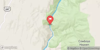
Moose To Storm Castle
This is the most commonly run section of the Gallatin. Putting in at Moose flats campground and taking out at the Storm Castle Bridge provides floaters with nearly every rapid this river has to offer. Depending on time and flows many options are available to make the float shorter.
Suggested river levels for paddling this section of the Gallatin River are between a bare minimum of 300cfs and a high of 10,000cfs.
River conditions sourced from USGS 06043500, the Gallatin River Near Gallatin Gateway Mt
Remember only watercraft are permitted
at Moose to Storm Castle.
Run Stats
Status | Runnable |
Class Level | III+ to IV+ |
Elevation | 5,189 ft |
Run Length | 12.0 Mi |
Gradient | 33 FPM |
Streamflow Discharge | 1680 cfs |
Gage Height | 2.9 ft |
Air Temperature | 47° |
River | Gallatin River |
Reporting Streamgage |
Gallatin River Near Gallatin Gateway Mt
USGS 06043500 |
Gauge | Streamflow | Stage |
---|---|---|
Jefferson River Near Three Forks Mt
USGS 06036650 |
1,130 cfs | 3.2 ft |
Boiling River At Mammoth
USGS 06190540 |
27 cfs | 1.2 ft |
Gallatin River Near Gallatin Gateway Mt
USGS 06043500 |
1,680 cfs | 2.9 ft |
Yellowstone River Near Livingston Mt
USGS 06192500 |
6,430 cfs | 4.3 ft |
Madison River At Kirby Ranch Nr Cameron Mt
USGS 06038800 |
954 cfs | 1.8 ft |
Missouri River At Toston Mt
USGS 06054500 |
4,390 cfs | 4.7 ft |
Henrys Fork Nr Lake Id
USGS 13039500 |
6 cfs | 4.3 ft |
Tantalus Creek At Norris Junction
USGS 06036940 |
5 cfs | 1.6 ft |
Yellowstone River At Corwin Springs Mt
USGS 06191500 |
6,580 cfs | 4.8 ft |
East Gallatin R Bl Bridger C Nr Bozeman Mt
USGS 06048700 |
74 cfs | ft |
Snotel Site | Snowpack | 24hr Change |
---|
Campground | Campsites | Reservations | Toilets | Showers | Elevation |
---|---|---|---|---|---|
Red Cliff | 68 | 6,306 ft | |||
Spire Rock | 22 | 5,608 ft | |||
Greek Creek | 15 | 5,634 ft | |||
Tom Miner | 16 | 7,117 ft | |||
Moose Creek Flat | 15 | 5,716 ft | |||
Swan Creek | 13 | 5,831 ft |
Ski Area | Snowpack | Air Temperature | 5 Day Forecast |
---|---|---|---|
Spanish Peaks Resort | 52" | 32° | 7.06" |
Bridger Bowl Ski Area | 18" | 41° | 6.45" |
Big Sky Resort | 52" | 32° | 7.06" |
Moonlight Basin | 52" | 32° | 7.06" |
Yellowstone Club | 52" | 32° | 7.06" |
River Run | Streamflow | Length | Class |
---|---|---|---|
Yankee Jim Canyon (Joe Brown to Miner) | 1080.0cfs | 5.0 Mi | III to III+ |
Moose to Storm Castle | 308.0cfs | 12.0 Mi | III+ to IV+ |