Leavitt Meadows Campground To Htnf Boundary River Run
Community Reviews
Been here? Share the conditions.
Reviews, ratings & photos are added in the free Snoflo iOS app — rate a spot, tag the conditions, and your visit is verified by location. Add or manage your reviews from the app.
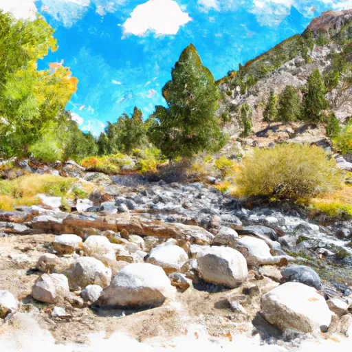
Leavitt Meadows Campground To Htnf Boundary
One of the main rapids on this run is known as "Upper and Lower Toadstool," which is a Class III rapid that requires precise maneuvering through boulders and rocks. Another notable obstacle is "Big Rock Drop," which is a Class II rapid that requires avoiding a large rock in the middle of the river.
In terms of regulations, all participants are required to wear a properly fitting personal flotation device (PFD) at all times while on the river. Additionally, all boats must have a U.S. Coast Guard-approved throwable device on board, and no glass containers are allowed on the river.
Plan your run down to the hour
Same weather feed Snoflo's iOS app uses -- updated continuously from NOAA / yr.no. Watch the precipitation column on the meteogram; rain ahead of a run typically lifts flows 12-48 hours later depending on the basin.
Next 5 days, hour by hour
Temperature line with weather symbols on top, snow + rain accumulation as columns, humidity as a dotted line.
5-day forecast table
Every 3 hours, broken out across temperature, snow, rain, humidity, and wind. Each cell is colour-coded relative to the column min/max.
| Time | Condition | Temp (°F) | Snow (in) | Rain (in) | Humidity (%) | Wind (mps) | Wind dir |
|---|---|---|---|---|---|---|---|
| Loading detailed forecast… | |||||||
15-day temperature & precipitation
Daily temperatures, snow, and rain projected over the next two weeks -- the upstream story that drives next week's flows.
Regional streamflow levels
USGS streamgauges around Leavitt Meadows Campground To Htnf Boundary -- useful for spotting upstream pulses and gauging which tributary is contributing what.
| Streamgauge | Discharge | View |
|---|---|---|
| W Walker R At Hoye Bridge Nr Wellington | 229 cfs | → |
| W Walker R Nr Coleville | 63 cfs | → |
| Aspen C Abv Leviathan Mine Nr Markleeville Ca | 0 cfs | → |
| Leviathan C Ab Mine Nr Markleeville Ca | 0 cfs | → |
| Leviathan Mine Adit Drain Nr Markleeville Ca | 0 cfs | → |
| Aspen C Overburden Seep Nr Markleeville Ca | 0 cfs | → |
Plan a longer trip
The closest boat launches, other paddle runs, and campgrounds so a day on the water can grow into a full weekend.
Boat launches
- Topaz Park Road Douglas County
- Summit Lake Trail Alpine County
- Indian Creek Camp Ground Day Use Area
- Highland Lakes
Other river runs
- Mill Creek
- Source Sec 24, T6n, R21e To Centerville Flat
- Centerville Flat To Hangman's Bridge
- Headwaters To Confluence With East Carsonriver
- Headwaters To Wilderness Boundary
Campgrounds
Fishing spots
Whitewater safety
- Check the flow before you run
- Use the linked-gauge card and Regional Flow panel above. Class ratings change with flow -- a Class III at low water can become Class IV+ at high water.
- Know your skill ceiling
- Pick runs comfortably below your ceiling. Cold-water and big-water runs raise the consequences of any mistake.
- Wear the right gear
- Helmet, PFD, drysuit / wetsuit when water is below 60°F. Throw bag, knife, and whistle on your person, not in the boat.
- Scout, set safety, and run with a team
- Scout new rapids on foot, set safety with throw bags above the consequence pool, and run with at least one other competent paddler.
- Respect the river
- Strainers, undercuts, low-head dams, and wood can kill at any class rating. When in doubt, portage.
Set push alerts in the Snoflo app
Save Leavitt Meadows Campground To Htnf Boundary as a favorite, set a discharge threshold (e.g. "alert me when flow hits 600 cfs"), and the iOS app pushes the moment the linked gauge crosses.
About Leavitt Meadows Campground To Htnf Boundary
What's the optimal flow for Leavitt Meadows Campground To Htnf Boundary?
The optimal flow depends on the section and the craft. Check the Run Details panel for the linked gauge and current status.
How fresh is the cfs reading on this page?
The linked USGS streamgauge reports continuously (every 15 minutes); Snoflo refreshes throughout the day. Hover the streamflow sparkline to read individual datapoints.
What's the whitewater class?
See the Run Details panel for the class rating Snoflo tracks for this run. Class ratings change with flow -- a Class III at low water can become Class IV in high water.
Where do I put in / take out?
Tap Directions in the hero above to open driving directions to the put-in. For shuttle planning, check the Nearby Boat Launches panel and the river run operator's site.
Can I get alerts when flows hit the optimal range?
Yes -- alerts are managed in the Snoflo iOS app. Favorite this run, set a discharge threshold, and you'll get a push the moment the gauge crosses.
Other runs near here
Snoflo-tracked paddle runs within driving distance of Leavitt Meadows Campground To Htnf Boundary.