El Rito Ranger District Boundary To Felipito Bridge River Run
Community Reviews
Been here? Share the conditions.
Reviews, ratings & photos are added in the free Snoflo iOS app — rate a spot, tag the conditions, and your visit is verified by location. Add or manage your reviews from the app.
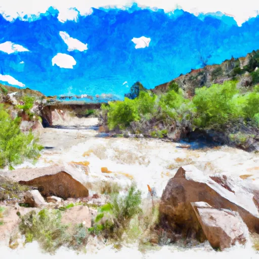
El Rito Ranger District Boundary To Felipito Bridge
This section of the river features several rapids and obstacles, including the Little Arsenic Rapid, the Big Arsenic Rapid, and the Pinball Rapid. The Little Arsenic Rapid is a Class III rapid that requires precise maneuvering to navigate through the rocks and narrow channels. The Big Arsenic Rapid is a Class III+ rapid that features a steep drop and large waves. The Pinball Rapid is also a Class III+ rapid that requires paddlers to navigate through several boulders and turbulent waters.
There are specific regulations that apply to this area. The use of personal flotation devices (PFDs) is mandatory for all watercraft users. Additionally, all kayakers and rafters must wear helmets while on the river. There are also restrictions on the use of alcohol and drugs while on the river.
In conclusion, the Whitewater River Run from the El Rito Ranger District Boundary to Felipito Bridge is a thrilling adventure for experienced kayakers and rafters. With its ideal streamflow range, class rating, specific rapids and obstacles, and specific regulations, it is a must-visit destination for water sports enthusiasts in New Mexico.
Plan your run down to the hour
Same weather feed Snoflo's iOS app uses -- updated continuously from NOAA / yr.no. Watch the precipitation column on the meteogram; rain ahead of a run typically lifts flows 12-48 hours later depending on the basin.
Next 5 days, hour by hour
Temperature line with weather symbols on top, snow + rain accumulation as columns, humidity as a dotted line.
5-day forecast table
Every 3 hours, broken out across temperature, snow, rain, humidity, and wind. Each cell is colour-coded relative to the column min/max.
| Time | Condition | Temp (°F) | Snow (in) | Rain (in) | Humidity (%) | Wind (mps) | Wind dir |
|---|---|---|---|---|---|---|---|
| Loading detailed forecast… | |||||||
15-day temperature & precipitation
Daily temperatures, snow, and rain projected over the next two weeks -- the upstream story that drives next week's flows.
Regional streamflow levels
USGS streamgauges around El Rito Ranger District Boundary To Felipito Bridge -- useful for spotting upstream pulses and gauging which tributary is contributing what.
| Streamgauge | Discharge | View |
|---|---|---|
| Rio Ojo Caliente At La Madera | 4 cfs | → |
| Rio Chama Near La Puente | 21 cfs | → |
| Rio Chama Below Abiquiu Dam | 174 cfs | → |
| Rio Grande At Embudo | 144 cfs | → |
| Rio Grande Near Cerro | 38 cfs | → |
| Rio Chama Above Abiquiu Reservoir | 100 cfs | → |
Plan a longer trip
The closest boat launches, other paddle runs, and campgrounds so a day on the water can grow into a full weekend.
Other river runs
- Headwaters To Nf Boundary
- Hopewell Lake To Nf Boundary
- 15 Springs To Fr 106 Bridge
- Headwaters To Private Land Boundary
- Spring Creek To Private Land Boundary
Campgrounds
- Hopewell Lake Campground
- Hopewell Lake
- Canjilon Lakes Campground
- Canjilon Lakes
- Canjilon Creek
- Trout Lakes Campground
Whitewater safety
- Check the flow before you run
- Use the linked-gauge card and Regional Flow panel above. Class ratings change with flow -- a Class III at low water can become Class IV+ at high water.
- Know your skill ceiling
- Pick runs comfortably below your ceiling. Cold-water and big-water runs raise the consequences of any mistake.
- Wear the right gear
- Helmet, PFD, drysuit / wetsuit when water is below 60°F. Throw bag, knife, and whistle on your person, not in the boat.
- Scout, set safety, and run with a team
- Scout new rapids on foot, set safety with throw bags above the consequence pool, and run with at least one other competent paddler.
- Respect the river
- Strainers, undercuts, low-head dams, and wood can kill at any class rating. When in doubt, portage.
Set push alerts in the Snoflo app
Save El Rito Ranger District Boundary To Felipito Bridge as a favorite, set a discharge threshold (e.g. "alert me when flow hits 600 cfs"), and the iOS app pushes the moment the linked gauge crosses.
About El Rito Ranger District Boundary To Felipito Bridge
What's the optimal flow for El Rito Ranger District Boundary To Felipito Bridge?
The optimal flow depends on the section and the craft. Check the Run Details panel for the linked gauge and current status.
How fresh is the cfs reading on this page?
The linked USGS streamgauge reports continuously (every 15 minutes); Snoflo refreshes throughout the day. Hover the streamflow sparkline to read individual datapoints.
What's the whitewater class?
See the Run Details panel for the class rating Snoflo tracks for this run. Class ratings change with flow -- a Class III at low water can become Class IV in high water.
Where do I put in / take out?
Tap Directions in the hero above to open driving directions to the put-in. For shuttle planning, check the Nearby Boat Launches panel and the river run operator's site.
Can I get alerts when flows hit the optimal range?
Yes -- alerts are managed in the Snoflo iOS app. Favorite this run, set a discharge threshold, and you'll get a push the moment the gauge crosses.
Other runs near here
Snoflo-tracked paddle runs within driving distance of El Rito Ranger District Boundary To Felipito Bridge.