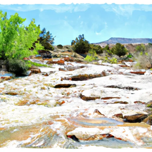
Headwaters Of Horse Spring In Sec 13, T25s, R22e To Confluence Of Horse Spring And Horse Canyon In Sec 11, T25s, R22e River Run
Community Reviews
Been here? Share the conditions.
Reviews, ratings & photos are added in the free Snoflo iOS app — rate a spot, tag the conditions, and your visit is verified by location. Add or manage your reviews from the app.
Headwaters Of Horse Spring In Sec 13, T25s, R22e To Confluence Of Horse Spring And Horse Canyon In Sec 11, T25s, R22e
This section of the river is classified as Class III to IV, which means that it features moderate to difficult rapids and obstacles, such as boulders and small drops. The segment mileage for this section of the river is approximately 9 miles, which can take anywhere from 3 to 6 hours to complete depending on the water flow.
There are specific rapids and obstacles in this section of the river, including the Horse Canyon rapid, which is a Class IV rapid that features a steep drop. Other notable rapids include the Rockpile rapid and the Screaming Left Turn rapid.
There are specific regulations to the area, such as the requirement for a permit to launch a raft or kayak. Additionally, visitors must follow Leave No Trace principles and pack out all trash and waste. There are also restrictions on camping in certain areas along the river.
Overall, the Headwaters of Horse Spring to the Confluence of Horse Spring and Horse Canyon stretch of the Whitewater River in New Mexico is a challenging and exhilarating whitewater run that requires experience and caution.
Plan your run down to the hour
Same weather feed Snoflo's iOS app uses -- updated continuously from NOAA / yr.no. Watch the precipitation column on the meteogram; rain ahead of a run typically lifts flows 12-48 hours later depending on the basin.
Next 5 days, hour by hour
Temperature line with weather symbols on top, snow + rain accumulation as columns, humidity as a dotted line.
5-day forecast table
Every 3 hours, broken out across temperature, snow, rain, humidity, and wind. Each cell is colour-coded relative to the column min/max.
| Time | Condition | Temp (°F) | Snow (in) | Rain (in) | Humidity (%) | Wind (mps) | Wind dir |
|---|---|---|---|---|---|---|---|
| Loading detailed forecast… | |||||||
15-day temperature & precipitation
Daily temperatures, snow, and rain projected over the next two weeks -- the upstream story that drives next week's flows.
Regional streamflow levels
USGS streamgauges around Headwaters Of Horse Spring In Sec 13, T25s, R22e To Confluence Of Horse Spring And Horse Canyon In Sec 11, T25s, R22e -- useful for spotting upstream pulses and gauging which tributary is contributing what.
| Streamgauge | Discharge | View |
|---|---|---|
| Dark Canyon Draw Near Whites City | · | → |
| Rocky Arroyo At Hwy Brd Nr Carlsbad | · | → |
| Black River Above Malaga | 6 cfs | → |
| Dark Canyon At Carlsbad | · | → |
| Pecos R At Damsite 3 Nr Carlsbad | 223 cfs | → |
| Pecos River Below Dark Canyon At Carlsbad | 29 cfs | → |
Plan a longer trip
The closest boat launches, other paddle runs, and campgrounds so a day on the water can grow into a full weekend.
Other river runs
- Confluence Of Horse Canyon Headwaters In Sec 11, T25s, R22e To Confluence Of Horse And Payne Canyons In Sec 1, T25s, R22e
- Headwaters Of Side Channel In Sec 12, T25s, R22e To Horse Canyon In Sec 2, T25s, R22e
- Headwaters Of Cottonwood Canyon In Sec 32, T25s, R22e To Confluence Of Cottonwood And Dark Canyons In Sec 10, T25s, R22e
- Headwaters In Sec 12, T25s, R22e To Payne Canyon In Sec 1, T25s, R22e
- Confluence Of Turkey Canyon And Robinson Draw (Sec 33, T24s, R22e) To Confluence Of Turkey And Dark Canyons In Sec 26, T24s, R22e
Campgrounds
- Wilderness Ridge Campground
- Dog Canyon Campground
- Dog Canyon - Guadalupe Mountains National Park
- Mckittrick Ridge Campground
- Mckittrick Ridge Backcountry Campground
- Chosa Campground
Whitewater safety
- Check the flow before you run
- Use the linked-gauge card and Regional Flow panel above. Class ratings change with flow -- a Class III at low water can become Class IV+ at high water.
- Know your skill ceiling
- Pick runs comfortably below your ceiling. Cold-water and big-water runs raise the consequences of any mistake.
- Wear the right gear
- Helmet, PFD, drysuit / wetsuit when water is below 60°F. Throw bag, knife, and whistle on your person, not in the boat.
- Scout, set safety, and run with a team
- Scout new rapids on foot, set safety with throw bags above the consequence pool, and run with at least one other competent paddler.
- Respect the river
- Strainers, undercuts, low-head dams, and wood can kill at any class rating. When in doubt, portage.
Set push alerts in the Snoflo app
Save Headwaters Of Horse Spring In Sec 13, T25s, R22e To Confluence Of Horse Spring And Horse Canyon In Sec 11, T25s, R22e as a favorite, set a discharge threshold (e.g. "alert me when flow hits 600 cfs"), and the iOS app pushes the moment the linked gauge crosses.
About Headwaters Of Horse Spring In Sec 13, T25s, R22e To Confluence Of Horse Spring And Horse Canyon In Sec 11, T25s, R22e
What's the optimal flow for Headwaters Of Horse Spring In Sec 13, T25s, R22e To Confluence Of Horse Spring And Horse Canyon In Sec 11, T25s, R22e?
The optimal flow depends on the section and the craft. Check the Run Details panel for the linked gauge and current status.
How fresh is the cfs reading on this page?
The linked USGS streamgauge reports continuously (every 15 minutes); Snoflo refreshes throughout the day. Hover the streamflow sparkline to read individual datapoints.
What's the whitewater class?
See the Run Details panel for the class rating Snoflo tracks for this run. Class ratings change with flow -- a Class III at low water can become Class IV in high water.
Where do I put in / take out?
Tap Directions in the hero above to open driving directions to the put-in. For shuttle planning, check the Nearby Boat Launches panel and the river run operator's site.
Can I get alerts when flows hit the optimal range?
Yes -- alerts are managed in the Snoflo iOS app. Favorite this run, set a discharge threshold, and you'll get a push the moment the gauge crosses.
Other runs near here
Snoflo-tracked paddle runs within driving distance of Headwaters Of Horse Spring In Sec 13, T25s, R22e To Confluence Of Horse Spring And Horse Canyon In Sec 11, T25s, R22e.