Headwaters Of Channel In Sec 9, T24s, R22e To Sitting Bull Canyon River Run
Community Reviews
Been here? Share the conditions.
Reviews, ratings & photos are added in the free Snoflo iOS app — rate a spot, tag the conditions, and your visit is verified by location. Add or manage your reviews from the app.
Headwaters Of Channel In Sec 9, T24s, R22e To Sitting Bull Canyon
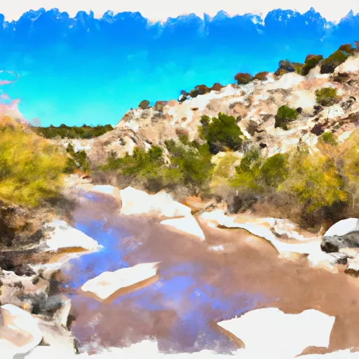
The rapids and obstacles in this section of the river include several Class III rapids, such as The Chute, S-Turn, and Big Kahuna. The most challenging section is the Narrows, a quarter-mile stretch of continuous Class IV rapids. This section requires advanced maneuvering skills and careful navigation.
Visitors to this area should be aware of specific regulations, such as the requirement of a permit to access the river. Additionally, the use of motorized equipment is prohibited, and visitors should be mindful of local wildlife and leave no trace behind.
Overall, the Whitewater River Run offers an exciting and challenging whitewater experience for experienced rafters and kayakers. However, it is important to note that water levels can fluctuate rapidly, and visitors should always check the latest streamflow data before embarking on this adventure.
Plan your run down to the hour
Same weather feed Snoflo's iOS app uses -- updated continuously from NOAA / yr.no. Watch the precipitation column on the meteogram; rain ahead of a run typically lifts flows 12-48 hours later depending on the basin.
Next 5 days, hour by hour
Temperature line with weather symbols on top, snow + rain accumulation as columns, humidity as a dotted line.
5-day forecast table
Every 3 hours, broken out across temperature, snow, rain, humidity, and wind. Each cell is colour-coded relative to the column min/max.
| Time | Condition | Temp (°F) | Snow (in) | Rain (in) | Humidity (%) | Wind (mps) | Wind dir |
|---|---|---|---|---|---|---|---|
| Loading detailed forecast… | |||||||
15-day temperature & precipitation
Daily temperatures, snow, and rain projected over the next two weeks -- the upstream story that drives next week's flows.
Regional streamflow levels
USGS streamgauges around Headwaters Of Channel In Sec 9, T24s, R22e To Sitting Bull Canyon -- useful for spotting upstream pulses and gauging which tributary is contributing what.
| Streamgauge | Discharge | View |
|---|---|---|
| Dark Canyon Draw Near Whites City | · | → |
| Rocky Arroyo At Hwy Brd Nr Carlsbad | · | → |
| Pecos R At Damsite 3 Nr Carlsbad | 214 cfs | → |
| Pecos River Below Brantley Dam Near Carlsbad | 223 cfs | → |
| South Seven Rivers Nr Lakewood | · | → |
| Dark Canyon At Carlsbad | · | → |
Plan a longer trip
The closest boat launches, other paddle runs, and campgrounds so a day on the water can grow into a full weekend.
Other river runs
- Pine Canyon (East Of Private Land In Sec 26, T24s, R21e) To Confluence Of Sitting Bull Canyon And Last Chance Canyon
- Eastern Boundary Of Private Land Along Sitting Bull Canyon In Sec 19, T24s, R22e To Eastern Nf Boundary
- Confluence Of Turkey Canyon And Robinson Draw (Sec 33, T24s, R22e) To Confluence Of Turkey And Dark Canyons In Sec 26, T24s, R22e
- Eastern Boundary Of Private Land In Sec 2, T25s, R22e To Confluence Of Turkey And Dark Canyons In Sec 26, T24s, R22e
- Headwaters In Sec 12, T25s, R22e To Payne Canyon In Sec 1, T25s, R22e
Campgrounds
Whitewater safety
- Check the flow before you run
- Use the linked-gauge card and Regional Flow panel above. Class ratings change with flow -- a Class III at low water can become Class IV+ at high water.
- Know your skill ceiling
- Pick runs comfortably below your ceiling. Cold-water and big-water runs raise the consequences of any mistake.
- Wear the right gear
- Helmet, PFD, drysuit / wetsuit when water is below 60°F. Throw bag, knife, and whistle on your person, not in the boat.
- Scout, set safety, and run with a team
- Scout new rapids on foot, set safety with throw bags above the consequence pool, and run with at least one other competent paddler.
- Respect the river
- Strainers, undercuts, low-head dams, and wood can kill at any class rating. When in doubt, portage.
Set push alerts in the Snoflo app
Save Headwaters Of Channel In Sec 9, T24s, R22e To Sitting Bull Canyon as a favorite, set a discharge threshold (e.g. "alert me when flow hits 600 cfs"), and the iOS app pushes the moment the linked gauge crosses.
About Headwaters Of Channel In Sec 9, T24s, R22e To Sitting Bull Canyon
What's the optimal flow for Headwaters Of Channel In Sec 9, T24s, R22e To Sitting Bull Canyon?
The optimal flow depends on the section and the craft. Check the Run Details panel for the linked gauge and current status.
How fresh is the cfs reading on this page?
The linked USGS streamgauge reports continuously (every 15 minutes); Snoflo refreshes throughout the day. Hover the streamflow sparkline to read individual datapoints.
What's the whitewater class?
See the Run Details panel for the class rating Snoflo tracks for this run. Class ratings change with flow -- a Class III at low water can become Class IV in high water.
Where do I put in / take out?
Tap Directions in the hero above to open driving directions to the put-in. For shuttle planning, check the Nearby Boat Launches panel and the river run operator's site.
Can I get alerts when flows hit the optimal range?
Yes -- alerts are managed in the Snoflo iOS app. Favorite this run, set a discharge threshold, and you'll get a push the moment the gauge crosses.
Other runs near here
Snoflo-tracked paddle runs within driving distance of Headwaters Of Channel In Sec 9, T24s, R22e To Sitting Bull Canyon.