Agua Caliente River Run
Community Reviews
Been here? Share the conditions.
Reviews, ratings & photos are added in the free Snoflo iOS app — rate a spot, tag the conditions, and your visit is verified by location. Add or manage your reviews from the app.
Agua Caliente
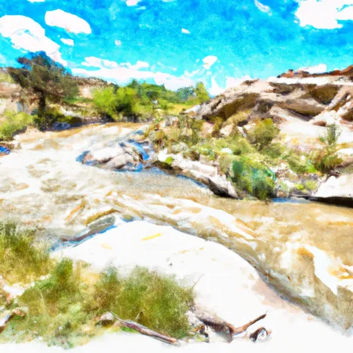
The river is surrounded by scenic desert landscapes and rugged canyons, making it an ideal location for outdoor enthusiasts. However, visitors should be aware of specific regulations to the area, including a permit requirement for commercial use and limitations on the number of people allowed per group.
It is important to note that the Whitewater River can be dangerous due to sudden changes in water levels and the presence of natural hazards such as submerged rocks and fallen trees. Therefore, visitors should exercise caution and wear appropriate safety gear when navigating the river.
Overall, the Agua Caliente section of the Whitewater River provides an exciting and challenging experience for experienced kayakers and rafters, but safety should always be a top priority.
Plan your run down to the hour
Same weather feed Snoflo's iOS app uses -- updated continuously from NOAA / yr.no. Watch the precipitation column on the meteogram; rain ahead of a run typically lifts flows 12-48 hours later depending on the basin.
Next 5 days, hour by hour
Temperature line with weather symbols on top, snow + rain accumulation as columns, humidity as a dotted line.
5-day forecast table
Every 3 hours, broken out across temperature, snow, rain, humidity, and wind. Each cell is colour-coded relative to the column min/max.
| Time | Condition | Temp (°F) | Snow (in) | Rain (in) | Humidity (%) | Wind (mps) | Wind dir |
|---|---|---|---|---|---|---|---|
| Loading detailed forecast… | |||||||
15-day temperature & precipitation
Daily temperatures, snow, and rain projected over the next two weeks -- the upstream story that drives next week's flows.
Regional streamflow levels
USGS streamgauges around Agua Caliente -- useful for spotting upstream pulses and gauging which tributary is contributing what.
| Streamgauge | Discharge | View |
|---|---|---|
| Rio Grande Blw Taos Junction Bridge Near Taos | 137 cfs | → |
| Rio Grande Del Rancho Near Talpa | 0 cfs | → |
| Rio Pueblo Nr Penasco | 2 cfs | → |
| Rio Pueblo De Taos Below Los Cordovas | 11 cfs | → |
| Embudo Creek At Dixon | 1 cfs | → |
| Rio Grande At Embudo | 144 cfs | → |
Plan a longer trip
The closest boat launches, other paddle runs, and campgrounds so a day on the water can grow into a full weekend.
Boat launches
- Lone Juniper Boat Takeout
- Lone Juniper Boat Launch
- Nm 570 Taos County
- Rio Bravo Boat Takeout
- Quartzite Boat Takeout
- Quartzite Boat Launch
Other river runs
- Headwaters To Nf Boundary
- Tierra Amarilla
- Serna Land Grant Boundary To Nf Boundary
- Pilar/Race Course
- Arroyo Hondo
Campgrounds
- Arroyo Hondo Campground
- Lone Juniper Campground
- Orilla Verde Rec Area
- Rio Bravo
- Petaca Campground
- Pilar Campground
Whitewater safety
- Check the flow before you run
- Use the linked-gauge card and Regional Flow panel above. Class ratings change with flow -- a Class III at low water can become Class IV+ at high water.
- Know your skill ceiling
- Pick runs comfortably below your ceiling. Cold-water and big-water runs raise the consequences of any mistake.
- Wear the right gear
- Helmet, PFD, drysuit / wetsuit when water is below 60°F. Throw bag, knife, and whistle on your person, not in the boat.
- Scout, set safety, and run with a team
- Scout new rapids on foot, set safety with throw bags above the consequence pool, and run with at least one other competent paddler.
- Respect the river
- Strainers, undercuts, low-head dams, and wood can kill at any class rating. When in doubt, portage.
Set push alerts in the Snoflo app
Save Agua Caliente as a favorite, set a discharge threshold (e.g. "alert me when flow hits 600 cfs"), and the iOS app pushes the moment the linked gauge crosses.
About Agua Caliente
What's the optimal flow for Agua Caliente?
The optimal flow depends on the section and the craft. Check the Run Details panel for the linked gauge and current status.
How fresh is the cfs reading on this page?
The linked USGS streamgauge reports continuously (every 15 minutes); Snoflo refreshes throughout the day. Hover the streamflow sparkline to read individual datapoints.
What's the whitewater class?
See the Run Details panel for the class rating Snoflo tracks for this run. Class ratings change with flow -- a Class III at low water can become Class IV in high water.
Where do I put in / take out?
Tap Directions in the hero above to open driving directions to the put-in. For shuttle planning, check the Nearby Boat Launches panel and the river run operator's site.
Can I get alerts when flows hit the optimal range?
Yes -- alerts are managed in the Snoflo iOS app. Favorite this run, set a discharge threshold, and you'll get a push the moment the gauge crosses.
Other runs near here
Snoflo-tracked paddle runs within driving distance of Agua Caliente.