Confluence With Echo Creek To Hills Creek Reservoir River Run
Community Reviews
Been here? Share the conditions.
Reviews, ratings & photos are added in the free Snoflo iOS app — rate a spot, tag the conditions, and your visit is verified by location. Add or manage your reviews from the app.
Confluence With Echo Creek To Hills Creek Reservoir
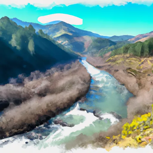
One of the most challenging rapids on this stretch of the river is called "S-Turn," which requires precise maneuvering to navigate safely. Other notable rapids include "Perry's Plunge" and "The Narrows." There are also several large boulders and steep drops that add to the excitement and challenge of the run.
It is important to note that there are specific regulations for this area, including the requirement for all boaters to wear personal flotation devices (PFDs) and to carry a whistle. In addition, there are specific rules regarding camping and fires along the riverbank.
Overall, the Whitewater River run from Confluence With Echo Creek To Hills Creek Reservoir is a thrilling and challenging whitewater experience that requires skill and experience to navigate safely. It is important for boaters to familiarize themselves with the specific regulations for the area and to be prepared for the challenging rapids and obstacles that lie ahead.
Plan your run down to the hour
Same weather feed Snoflo's iOS app uses -- updated continuously from NOAA / yr.no. Watch the precipitation column on the meteogram; rain ahead of a run typically lifts flows 12-48 hours later depending on the basin.
Next 5 days, hour by hour
Temperature line with weather symbols on top, snow + rain accumulation as columns, humidity as a dotted line.
5-day forecast table
Every 3 hours, broken out across temperature, snow, rain, humidity, and wind. Each cell is colour-coded relative to the column min/max.
| Time | Condition | Temp (°F) | Snow (in) | Rain (in) | Humidity (%) | Wind (mps) | Wind dir |
|---|---|---|---|---|---|---|---|
| Loading detailed forecast… | |||||||
15-day temperature & precipitation
Daily temperatures, snow, and rain projected over the next two weeks -- the upstream story that drives next week's flows.
Regional streamflow levels
USGS streamgauges around Confluence With Echo Creek To Hills Creek Reservoir -- useful for spotting upstream pulses and gauging which tributary is contributing what.
| Streamgauge | Discharge | View |
|---|---|---|
| M F Willamette R Ab Salt Cr. | 551 cfs | → |
| Mf Willamette River Blw N Fork | 974 cfs | → |
| N.Umpqua R Blw Warm Springs Ck Nr Toketee Falls | 89 cfs | → |
| N.Umpqua R Blw Soda Spgs Resv | 302 cfs | → |
| Boulder Creek Near Toketee Falls | 6 cfs | → |
| N Umpqua River Abv Copeland Ck Nr Toketee Falls | 693 cfs | → |
Plan a longer trip
The closest boat launches, other paddle runs, and campgrounds so a day on the water can grow into a full weekend.
Boat launches
- Bingham Boat Ramp
- Packard Creek Day Use Area
- Forest Road 2100-019 Lane County
- C.T. Beach Picnic Area
- Black Canyon
- Hampton
Other river runs
- Lower Timpanogas Lake To Confluence With Echo Creek
- Headwaters Of East Fork Steamboat Creek To Confluence With Siwash Creek
- Headwaters To Boulder Creek Wilderness Boundary
- Confluence Of Siwash Creek To Little Falls
- Little Falls To Confluence With North Umpqua River
Campgrounds
- Sand Prairie Campground
- Sand Prairie
- Packard Creek
- Packard Creek Group Campsite
- Packard Creek Campground
- Everage Flat Industrial Camp
Fishing spots
Parks
Whitewater safety
- Check the flow before you run
- Use the linked-gauge card and Regional Flow panel above. Class ratings change with flow -- a Class III at low water can become Class IV+ at high water.
- Know your skill ceiling
- Pick runs comfortably below your ceiling. Cold-water and big-water runs raise the consequences of any mistake.
- Wear the right gear
- Helmet, PFD, drysuit / wetsuit when water is below 60°F. Throw bag, knife, and whistle on your person, not in the boat.
- Scout, set safety, and run with a team
- Scout new rapids on foot, set safety with throw bags above the consequence pool, and run with at least one other competent paddler.
- Respect the river
- Strainers, undercuts, low-head dams, and wood can kill at any class rating. When in doubt, portage.
Set push alerts in the Snoflo app
Save Confluence With Echo Creek To Hills Creek Reservoir as a favorite, set a discharge threshold (e.g. "alert me when flow hits 600 cfs"), and the iOS app pushes the moment the linked gauge crosses.
About Confluence With Echo Creek To Hills Creek Reservoir
What's the optimal flow for Confluence With Echo Creek To Hills Creek Reservoir?
The optimal flow depends on the section and the craft. Check the Run Details panel for the linked gauge and current status.
How fresh is the cfs reading on this page?
The linked USGS streamgauge reports continuously (every 15 minutes); Snoflo refreshes throughout the day. Hover the streamflow sparkline to read individual datapoints.
What's the whitewater class?
See the Run Details panel for the class rating Snoflo tracks for this run. Class ratings change with flow -- a Class III at low water can become Class IV in high water.
Where do I put in / take out?
Tap Directions in the hero above to open driving directions to the put-in. For shuttle planning, check the Nearby Boat Launches panel and the river run operator's site.
Can I get alerts when flows hit the optimal range?
Yes -- alerts are managed in the Snoflo iOS app. Favorite this run, set a discharge threshold, and you'll get a push the moment the gauge crosses.
Other runs near here
Snoflo-tracked paddle runs within driving distance of Confluence With Echo Creek To Hills Creek Reservoir.