Headwaters (Just North Of Confluence Of Mf Five Points Creek) To Wallowa-Whitman Nf Boundary River Run
Community Reviews
Been here? Share the conditions.
Reviews, ratings & photos are added in the free Snoflo iOS app — rate a spot, tag the conditions, and your visit is verified by location. Add or manage your reviews from the app.
Headwaters (Just North Of Confluence Of Mf Five Points Creek) To Wallowa-Whitman Nf Boundary
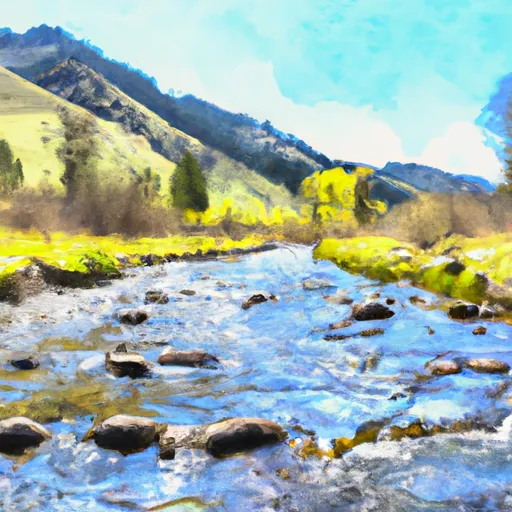
The class rating for this section of the Whitewater River ranges from Class III to IV, depending on the water level, with rapids that include House Rock, Triple Drop, and the infamous Pinball rapid. Paddlers should be prepared for technical rapids, tight channels, and quick drops. It is recommended that only experienced paddlers attempt this run.
In terms of regulations, the Whitewater River is located within the Wallowa-Whitman National Forest and is subject to regulations set forth by the Forest Service. Permits are required to run this section of the river and can be obtained through the Forest Service office. Additionally, visitors must follow Leave No Trace principles and pack out all trash. Camping is permitted along the river, but visitors must adhere to designated campsites and fire regulations.
In conclusion, the Whitewater River run from Headwaters to Wallowa-Whitman NF boundary offers a challenging and thrilling experience for experienced paddlers. With a range of class III to IV rapids, paddlers should be prepared for technical sections and tight channels. Visitors must obtain permits and follow regulations set forth by the Forest Service, including Leave No Trace principles and designated camping areas.
Plan your run down to the hour
Same weather feed Snoflo's iOS app uses -- updated continuously from NOAA / yr.no. Watch the precipitation column on the meteogram; rain ahead of a run typically lifts flows 12-48 hours later depending on the basin.
Next 5 days, hour by hour
Temperature line with weather symbols on top, snow + rain accumulation as columns, humidity as a dotted line.
5-day forecast table
Every 3 hours, broken out across temperature, snow, rain, humidity, and wind. Each cell is colour-coded relative to the column min/max.
| Time | Condition | Temp (°F) | Snow (in) | Rain (in) | Humidity (%) | Wind (mps) | Wind dir |
|---|---|---|---|---|---|---|---|
| Loading detailed forecast… | |||||||
15-day temperature & precipitation
Daily temperatures, snow, and rain projected over the next two weeks -- the upstream story that drives next week's flows.
Regional streamflow levels
USGS streamgauges around Headwaters (Just North Of Confluence Of Mf Five Points Creek) To Wallowa-Whitman Nf Boundary -- useful for spotting upstream pulses and gauging which tributary is contributing what.
| Streamgauge | Discharge | View |
|---|---|---|
| Meacham Creek At Gibbon | 11 cfs | → |
| Umatilla River Above Meacham Creek | 32 cfs | → |
| Minam River Near Minam | 93 cfs | → |
| Umatilla R At W Reservation Bndy Nr Pendleton | 31 cfs | → |
| Mill Creek Near Walla Walla | 32 cfs | → |
| Mill Creek At Walla Walla | 12 cfs | → |
Plan a longer trip
The closest boat launches, other paddle runs, and campgrounds so a day on the water can grow into a full weekend.
Other river runs
- Headwaters To Confluence With Van Patten Creek
- Headwaters To Eagle Cap Wilderness Boundary
- Eagle Cap Wilderness Boundary To Confluence With Eagle Crek
- Joseph Creek
- Grande Ronde River (Lower)
Campgrounds
- Spring Creek Campground
- Bird Track Springs
- Bird Track Springs Campground
- Summit Guard Station
- Rendezvous Rv Resort
- Spool Cart
Whitewater safety
- Check the flow before you run
- Use the linked-gauge card and Regional Flow panel above. Class ratings change with flow -- a Class III at low water can become Class IV+ at high water.
- Know your skill ceiling
- Pick runs comfortably below your ceiling. Cold-water and big-water runs raise the consequences of any mistake.
- Wear the right gear
- Helmet, PFD, drysuit / wetsuit when water is below 60°F. Throw bag, knife, and whistle on your person, not in the boat.
- Scout, set safety, and run with a team
- Scout new rapids on foot, set safety with throw bags above the consequence pool, and run with at least one other competent paddler.
- Respect the river
- Strainers, undercuts, low-head dams, and wood can kill at any class rating. When in doubt, portage.
Set push alerts in the Snoflo app
Save Headwaters (Just North Of Confluence Of Mf Five Points Creek) To Wallowa-Whitman Nf Boundary as a favorite, set a discharge threshold (e.g. "alert me when flow hits 600 cfs"), and the iOS app pushes the moment the linked gauge crosses.
About Headwaters (Just North Of Confluence Of Mf Five Points Creek) To Wallowa-Whitman Nf Boundary
What's the optimal flow for Headwaters (Just North Of Confluence Of Mf Five Points Creek) To Wallowa-Whitman Nf Boundary?
The optimal flow depends on the section and the craft. Check the Run Details panel for the linked gauge and current status.
How fresh is the cfs reading on this page?
The linked USGS streamgauge reports continuously (every 15 minutes); Snoflo refreshes throughout the day. Hover the streamflow sparkline to read individual datapoints.
What's the whitewater class?
See the Run Details panel for the class rating Snoflo tracks for this run. Class ratings change with flow -- a Class III at low water can become Class IV in high water.
Where do I put in / take out?
Tap Directions in the hero above to open driving directions to the put-in. For shuttle planning, check the Nearby Boat Launches panel and the river run operator's site.
Can I get alerts when flows hit the optimal range?
Yes -- alerts are managed in the Snoflo iOS app. Favorite this run, set a discharge threshold, and you'll get a push the moment the gauge crosses.
Other runs near here
Snoflo-tracked paddle runs within driving distance of Headwaters (Just North Of Confluence Of Mf Five Points Creek) To Wallowa-Whitman Nf Boundary.