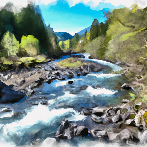
Confluence Clear And Coe Creeks To Mt. Hood Nf Boundary River Run
Community Reviews
Been here? Share the conditions.
Reviews, ratings & photos are added in the free Snoflo iOS app — rate a spot, tag the conditions, and your visit is verified by location. Add or manage your reviews from the app.
Confluence Clear And Coe Creeks To Mt. Hood Nf Boundary
The segment mileage of this run is approximately 9.5 miles, from the confluence of Clear and Coe Creeks to the Mt. Hood National Forest boundary. The run features several notable rapids, including the Entrance, Double Drop, and Rattlesnake, which require precise technical maneuvers to navigate safely. Other obstacles on the run include logs and strainers, which require careful attention and skill to avoid.
Specific regulations for the Whitewater River run include a permit requirement for commercial guiding services, as well as restrictions on the use of motorized boats. Paddlers are also advised to carry appropriate safety gear, including helmets and personal flotation devices, and to be aware of hazards such as cold water, strong currents, and submerged rocks.
Plan your run down to the hour
Same weather feed Snoflo's iOS app uses -- updated continuously from NOAA / yr.no. Watch the precipitation column on the meteogram; rain ahead of a run typically lifts flows 12-48 hours later depending on the basin.
Next 5 days, hour by hour
Temperature line with weather symbols on top, snow + rain accumulation as columns, humidity as a dotted line.
5-day forecast table
Every 3 hours, broken out across temperature, snow, rain, humidity, and wind. Each cell is colour-coded relative to the column min/max.
| Time | Condition | Temp (°F) | Snow (in) | Rain (in) | Humidity (%) | Wind (mps) | Wind dir |
|---|---|---|---|---|---|---|---|
| Loading detailed forecast… | |||||||
15-day temperature & precipitation
Daily temperatures, snow, and rain projected over the next two weeks -- the upstream story that drives next week's flows.
Regional streamflow levels
USGS streamgauges around Confluence Clear And Coe Creeks To Mt. Hood Nf Boundary -- useful for spotting upstream pulses and gauging which tributary is contributing what.
| Streamgauge | Discharge | View |
|---|---|---|
| Hood River At Tucker Bridge | 215 cfs | → |
| Bull Run River At Lower Flume Nr Brightwood | 20 cfs | → |
| Blazed Alder Creek Near Rhododendron | 4 cfs | → |
| Mosier Creek Near Mosier | 1 cfs | → |
| White Salmon River Near Underwood | 533 cfs | → |
| Bull Run River Near Multnomah Falls | 56 cfs | → |
Plan a longer trip
The closest boat launches, other paddle runs, and campgrounds so a day on the water can grow into a full weekend.
Boat launches
- Laurance Lake
- Kingsley Campground
- Lost Lake Resort
- Drano Lake
- Lewis And Clark Trail Highway Skamania County
- Port Of Hood River Marina Park
Other river runs
- Hemlock Road Bridge To Gifford Pinchot Nf Boundary
- Mt. Hood Wilderness Boundary To Confluence With Sandy River
- Sandy River
- Welches Run
- Salmon River Canyon (Split Falls To Road Access)
Campgrounds
- Toll Bridge County Park
- Kinnikinnick Campground
- Kinnikinnick (Laurance Lake) Campground
- Routson
- Gibson Prairie Horse Camp
- Cloud Cap Saddle Campground
Whitewater safety
- Check the flow before you run
- Use the linked-gauge card and Regional Flow panel above. Class ratings change with flow -- a Class III at low water can become Class IV+ at high water.
- Know your skill ceiling
- Pick runs comfortably below your ceiling. Cold-water and big-water runs raise the consequences of any mistake.
- Wear the right gear
- Helmet, PFD, drysuit / wetsuit when water is below 60°F. Throw bag, knife, and whistle on your person, not in the boat.
- Scout, set safety, and run with a team
- Scout new rapids on foot, set safety with throw bags above the consequence pool, and run with at least one other competent paddler.
- Respect the river
- Strainers, undercuts, low-head dams, and wood can kill at any class rating. When in doubt, portage.
Set push alerts in the Snoflo app
Save Confluence Clear And Coe Creeks To Mt. Hood Nf Boundary as a favorite, set a discharge threshold (e.g. "alert me when flow hits 600 cfs"), and the iOS app pushes the moment the linked gauge crosses.
About Confluence Clear And Coe Creeks To Mt. Hood Nf Boundary
What's the optimal flow for Confluence Clear And Coe Creeks To Mt. Hood Nf Boundary?
The optimal flow depends on the section and the craft. Check the Run Details panel for the linked gauge and current status.
How fresh is the cfs reading on this page?
The linked USGS streamgauge reports continuously (every 15 minutes); Snoflo refreshes throughout the day. Hover the streamflow sparkline to read individual datapoints.
What's the whitewater class?
See the Run Details panel for the class rating Snoflo tracks for this run. Class ratings change with flow -- a Class III at low water can become Class IV in high water.
Where do I put in / take out?
Tap Directions in the hero above to open driving directions to the put-in. For shuttle planning, check the Nearby Boat Launches panel and the river run operator's site.
Can I get alerts when flows hit the optimal range?
Yes -- alerts are managed in the Snoflo iOS app. Favorite this run, set a discharge threshold, and you'll get a push the moment the gauge crosses.
Other runs near here
Snoflo-tracked paddle runs within driving distance of Confluence Clear And Coe Creeks To Mt. Hood Nf Boundary.