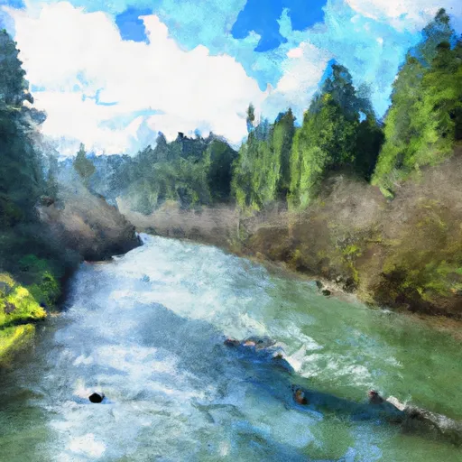
Nehalem River River Run
Community Reviews
Been here? Share the conditions.
Reviews, ratings & photos are added in the free Snoflo iOS app — rate a spot, tag the conditions, and your visit is verified by location. Add or manage your reviews from the app.
Nehalem River
The Nehalem River in Oregon is a popular destination for whitewater enthusiasts. The ideal streamflow range for this river is between 1000-4000 cfs, although it can be run at higher or lower flows depending on skill level and personal preference. The class rating for the Nehalem River ranges from Class II to Class IV, with the majority of the rapids falling in the Class II-III range. The river is divided into several segments, with the most popular being the 10-mile run from Spruce Run Campground to Wheeler. This section features several notable rapids, including Screaming Left, Grey Rock, and the infamous Whorehouse Drop. Other sections of the river include the 13-mile run from Nehalem Falls Campground to Spruce Run, which is primarily Class I-II, and the 8-mile run from Wheeler to Memaloose Bridge, which is Class III-IV.
As with most rivers, there are specific regulations in place to promote safety and protect the environment. The Oregon Department of Fish and Wildlife requires all boaters to carry a valid fishing license, as the Nehalem River is home to several species of fish. Additionally, all boaters must wear a personal flotation device and are encouraged to paddle in groups for added safety. The river is also subject to seasonal closures to protect spawning fish populations, so it's important to check for any restrictions before planning a trip. Overall, the Nehalem River offers a thrilling and scenic whitewater experience for paddlers of all skill levels.
Plan your run down to the hour
Same weather feed Snoflo's iOS app uses -- updated continuously from NOAA / yr.no. Watch the precipitation column on the meteogram; rain ahead of a run typically lifts flows 12-48 hours later depending on the basin.
Next 5 days, hour by hour
Temperature line with weather symbols on top, snow + rain accumulation as columns, humidity as a dotted line.
5-day forecast table
Every 3 hours, broken out across temperature, snow, rain, humidity, and wind. Each cell is colour-coded relative to the column min/max.
| Time | Condition | Temp (°F) | Snow (in) | Rain (in) | Humidity (%) | Wind (mps) | Wind dir |
|---|---|---|---|---|---|---|---|
| Loading detailed forecast… | |||||||
15-day temperature & precipitation
Daily temperatures, snow, and rain projected over the next two weeks -- the upstream story that drives next week's flows.
Regional streamflow levels
USGS streamgauges around Nehalem River -- useful for spotting upstream pulses and gauging which tributary is contributing what.
| Streamgauge | Discharge | View |
|---|---|---|
| Nehalem River Near Vernonia | 9 cfs | → |
| Nehalem River Near Foss | 191 cfs | → |
| East Fork Dairy Creek Near Meacham Corner | 21 cfs | → |
| Wilson River Near Tillamook | 98 cfs | → |
| Tualatin River Near Dilley | 219 cfs | → |
| Trask River Above Cedar Creek | 105 cfs | → |
Plan a longer trip
The closest boat launches, other paddle runs, and campgrounds so a day on the water can grow into a full weekend.
Boat launches
Other river runs
Campgrounds
- Reeher Forest Park
- Gales Creek Campground
- Gales Creek
- Camp R&R
- Elk Creek Campground
- Spruce Run County Park
Parks
Whitewater safety
- Check the flow before you run
- Use the linked-gauge card and Regional Flow panel above. Class ratings change with flow -- a Class III at low water can become Class IV+ at high water.
- Know your skill ceiling
- Pick runs comfortably below your ceiling. Cold-water and big-water runs raise the consequences of any mistake.
- Wear the right gear
- Helmet, PFD, drysuit / wetsuit when water is below 60°F. Throw bag, knife, and whistle on your person, not in the boat.
- Scout, set safety, and run with a team
- Scout new rapids on foot, set safety with throw bags above the consequence pool, and run with at least one other competent paddler.
- Respect the river
- Strainers, undercuts, low-head dams, and wood can kill at any class rating. When in doubt, portage.
Set push alerts in the Snoflo app
Save Nehalem River as a favorite, set a discharge threshold (e.g. "alert me when flow hits 600 cfs"), and the iOS app pushes the moment the linked gauge crosses.
About Nehalem River
What's the optimal flow for Nehalem River?
The optimal flow depends on the section and the craft. Check the Run Details panel for the linked gauge and current status.
How fresh is the cfs reading on this page?
The linked USGS streamgauge reports continuously (every 15 minutes); Snoflo refreshes throughout the day. Hover the streamflow sparkline to read individual datapoints.
What's the whitewater class?
See the Run Details panel for the class rating Snoflo tracks for this run. Class ratings change with flow -- a Class III at low water can become Class IV in high water.
Where do I put in / take out?
Tap Directions in the hero above to open driving directions to the put-in. For shuttle planning, check the Nearby Boat Launches panel and the river run operator's site.
Can I get alerts when flows hit the optimal range?
Yes -- alerts are managed in the Snoflo iOS app. Favorite this run, set a discharge threshold, and you'll get a push the moment the gauge crosses.
Other runs near here
Snoflo-tracked paddle runs within driving distance of Nehalem River.