South Fork Coos River River Run
Community Reviews
Been here? Share the conditions.
Reviews, ratings & photos are added in the free Snoflo iOS app — rate a spot, tag the conditions, and your visit is verified by location. Add or manage your reviews from the app.
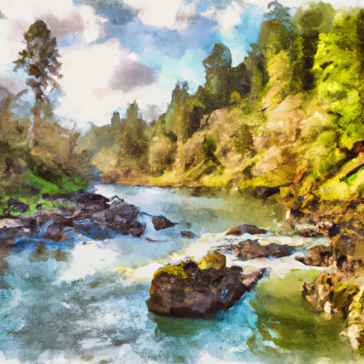
South Fork Coos River
The South Fork Coos River is rated as a Class III-IV run, with some challenging rapids and obstacles to navigate along the way. The run covers a total distance of approximately 8 miles, starting at the South Fork Coos River bridge and ending at the East Fork Coos River bridge.
The river features several notable rapids, including Upper and Lower Gnat Hole, The Chute, and Pinball. These rapids offer a mix of technical maneuvering and high-speed thrills, making them a favorite among experienced whitewater enthusiasts.
To ensure safety and preserve the natural beauty of the area, there are specific regulations in place for the South Fork Coos River. All visitors must obtain a valid permit from the Coos Watershed Association before accessing the river, and there are restrictions in place for camping and fires in the surrounding wilderness areas. Additionally, visitors are expected to practice Leave No Trace principles to minimize their impact on the environment.
Overall, the South Fork Coos River is a challenging and exhilarating whitewater run that offers a unique and rewarding experience for those willing to take on its rapids and obstacles.
Plan your run down to the hour
Same weather feed Snoflo's iOS app uses -- updated continuously from NOAA / yr.no. Watch the precipitation column on the meteogram; rain ahead of a run typically lifts flows 12-48 hours later depending on the basin.
Next 5 days, hour by hour
Temperature line with weather symbols on top, snow + rain accumulation as columns, humidity as a dotted line.
5-day forecast table
Every 3 hours, broken out across temperature, snow, rain, humidity, and wind. Each cell is colour-coded relative to the column min/max.
| Time | Condition | Temp (°F) | Snow (in) | Rain (in) | Humidity (%) | Wind (mps) | Wind dir |
|---|---|---|---|---|---|---|---|
| Loading detailed forecast… | |||||||
15-day temperature & precipitation
Daily temperatures, snow, and rain projected over the next two weeks -- the upstream story that drives next week's flows.
Regional streamflow levels
USGS streamgauges around South Fork Coos River -- useful for spotting upstream pulses and gauging which tributary is contributing what.
| Streamgauge | Discharge | View |
|---|---|---|
| Little Wolf Creek Near Tyee | 0 cfs | → |
| North Umpqua River At Winchester | 736 cfs | → |
| Umpqua River Near Elkton | 789 cfs | → |
| South Umpqua River Near Brockway | 58 cfs | → |
| South Fork Coquille River At Powers | 38 cfs | → |
| Cow Creek Near Riddle | 50 cfs | → |
Plan a longer trip
The closest boat launches, other paddle runs, and campgrounds so a day on the water can grow into a full weekend.
Boat launches
Other river runs
- Umpqua River
- Elk Valley Creek
- Eastern Siuslaw Nf Boundary To East Section Line Of Ne1/4se1/4 Of Sec 16, T21s, R10w
- East Section Line Of Ne1/4se1/4 Of Sec 16, T21s, R10w To Confluence With Smith River
- South Umpqua
Whitewater safety
- Check the flow before you run
- Use the linked-gauge card and Regional Flow panel above. Class ratings change with flow -- a Class III at low water can become Class IV+ at high water.
- Know your skill ceiling
- Pick runs comfortably below your ceiling. Cold-water and big-water runs raise the consequences of any mistake.
- Wear the right gear
- Helmet, PFD, drysuit / wetsuit when water is below 60°F. Throw bag, knife, and whistle on your person, not in the boat.
- Scout, set safety, and run with a team
- Scout new rapids on foot, set safety with throw bags above the consequence pool, and run with at least one other competent paddler.
- Respect the river
- Strainers, undercuts, low-head dams, and wood can kill at any class rating. When in doubt, portage.
Set push alerts in the Snoflo app
Save South Fork Coos River as a favorite, set a discharge threshold (e.g. "alert me when flow hits 600 cfs"), and the iOS app pushes the moment the linked gauge crosses.
About South Fork Coos River
What's the optimal flow for South Fork Coos River?
The optimal flow depends on the section and the craft. Check the Run Details panel for the linked gauge and current status.
How fresh is the cfs reading on this page?
The linked USGS streamgauge reports continuously (every 15 minutes); Snoflo refreshes throughout the day. Hover the streamflow sparkline to read individual datapoints.
What's the whitewater class?
See the Run Details panel for the class rating Snoflo tracks for this run. Class ratings change with flow -- a Class III at low water can become Class IV in high water.
Where do I put in / take out?
Tap Directions in the hero above to open driving directions to the put-in. For shuttle planning, check the Nearby Boat Launches panel and the river run operator's site.
Can I get alerts when flows hit the optimal range?
Yes -- alerts are managed in the Snoflo iOS app. Favorite this run, set a discharge threshold, and you'll get a push the moment the gauge crosses.
Other runs near here
Snoflo-tracked paddle runs within driving distance of South Fork Coos River.