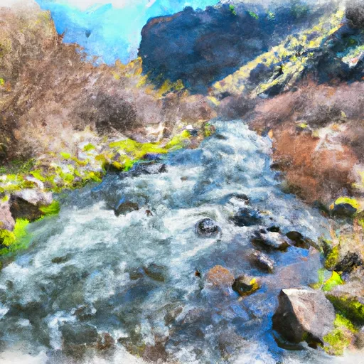
Rock Creek Complex (Klickitat County) river run
Community Reviews
Been here? Share the conditions.
Reviews, ratings & photos are added in the free Snoflo iOS app — rate a spot, tag the conditions, and your visit is verified by location. Add or manage your reviews from the app.
Rock Creek Complex (Klickitat County)
The segment mileage of the river run is approximately 5 miles, with some of the most challenging rapids occurring in the upper section of the river. Some of the specific river rapids and obstacles include "The Slot," "The Notch," and "The Corner," which offer technical and challenging runs for experienced whitewater enthusiasts.
There are specific regulations that apply to the Rock Creek Complex area, including the requirement for all river runners to wear a personal flotation device and the prohibition of alcohol and drugs on the river. Additionally, there are designated launch and take-out areas, and river runners are required to obtain a permit before entering the area.
Plan your run down to the hour
Same weather feed Snoflo's iOS app uses -- updated continuously from NOAA / yr.no. Watch the precipitation column on the meteogram; rain ahead of a run typically lifts flows 12-48 hours later depending on the basin.
Next 5 days, hour by hour
Temperature line with weather symbols on top, snow + rain accumulation as columns, humidity as a dotted line.
5-day forecast table
Every 3 hours, broken out across temperature, snow, rain, humidity, and wind. Each cell is colour-coded relative to the column min/max.
| Time | Condition | Temp (°F) | Snow (in) | Rain (in) | Humidity (%) | Wind (mps) | Wind dir |
|---|---|---|---|---|---|---|---|
| Loading detailed forecast… | |||||||
15-day temperature & precipitation
Daily temperatures, snow, and rain projected over the next two weeks -- the upstream story that drives next week's flows.
Regional streamflow levels
USGS streamgauges around Rock Creek Complex (Klickitat County) -- useful for spotting upstream pulses and gauging which tributary is contributing what.
| Streamgauge | Discharge | View |
|---|---|---|
| John Day River At Mcdonald Ferry | 83 cfs | → |
| Deschutes River At Moody | 3,750 cfs | → |
| Klickitat River Bl Summit Creek Near Glenwood | 1,100 cfs | → |
| Toppenish Creek Near Fort Simcoe | 6 cfs | → |
| Yakima River At Mabton | 1,790 cfs | → |
| Granger Drain At Granger | 44 cfs | → |
Plan a longer trip
The closest boat launches, other paddle runs, and campgrounds so a day on the water can grow into a full weekend.
Boat launches
- Rock Creek Road Klickitat County
- Le Page Park (River Mouth)
- Philippi Park
- Railroad Island
- Sundale Park
- Giles French Park
Campgrounds
- Brooks Memorial State Park
- Rock Creek Park - Columbia River Gorge
- Lepage Park
- Sundale Park - Columbia River Gorge
- Cliffs Park - Columbia River Gorge
- Cliffs Park (Army Corps Of Engineers)
Points of interest
Whitewater safety
- Check the flow before you run
- Use the linked-gauge card and Regional Flow panel above. Class ratings change with flow -- a Class III at low water can become Class IV+ at high water.
- Know your skill ceiling
- Pick runs comfortably below your ceiling. Cold-water and big-water runs raise the consequences of any mistake.
- Wear the right gear
- Helmet, PFD, drysuit / wetsuit when water is below 60°F. Throw bag, knife, and whistle on your person, not in the boat.
- Scout, set safety, and run with a team
- Scout new rapids on foot, set safety with throw bags above the consequence pool, and run with at least one other competent paddler.
- Respect the river
- Strainers, undercuts, low-head dams, and wood can kill at any class rating. When in doubt, portage.
Set push alerts in the Snoflo app
Save Rock Creek Complex (Klickitat County) as a favorite, set a discharge threshold (e.g. "alert me when flow hits 600 cfs"), and the iOS app pushes the moment the linked gauge crosses.
About Rock Creek Complex (Klickitat County)
What's the optimal flow for Rock Creek Complex (Klickitat County)?
The optimal flow depends on the section and the craft. Check the Run Details panel for the linked gauge and current status.
How fresh is the cfs reading on this page?
The linked USGS streamgauge reports continuously (every 15 minutes); Snoflo refreshes throughout the day. Hover the streamflow sparkline to read individual datapoints.
What's the whitewater class?
See the Run Details panel for the class rating Snoflo tracks for this run. Class ratings change with flow -- a Class III at low water can become Class IV in high water.
Where do I put in / take out?
Tap Directions in the hero above to open driving directions to the put-in. For shuttle planning, check the Nearby Boat Launches panel and the river run operator's site.
Can I get alerts when flows hit the optimal range?
Yes -- alerts are managed in the Snoflo iOS app. Favorite this run, set a discharge threshold, and you'll get a push the moment the gauge crosses.
Other runs near here
Snoflo-tracked paddle runs within driving distance of Rock Creek Complex (Klickitat County).