Grande Ronde River (Lower) River Run
Community Reviews
Been here? Share the conditions.
Reviews, ratings & photos are added in the free Snoflo iOS app — rate a spot, tag the conditions, and your visit is verified by location. Add or manage your reviews from the app.
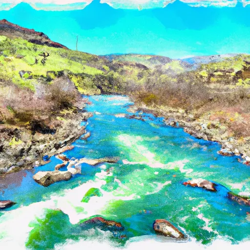
Grande Ronde River (Lower)
Some of the notable rapids and obstacles in the Grande Ronde River (Lower) include the Boulder Garden, Upper and Lower Blackhorse Rapids, and the notorious Mudslide Rapid. The Boulder Garden is a series of boulder gardens and drops, while the Blackhorse Rapids are a series of technical and challenging rapids that require precise navigation. The Mudslide Rapid is a Class III+ rapid that requires advanced paddling skills and experience to navigate safely.
There are specific regulations to the area, including a permit system for overnight camping and a limit on the number of people allowed per group. This is to maintain the natural integrity of the area and ensure safety for all visitors. Additionally, visitors are required to follow Leave No Trace principles to protect the environment and wildlife.
Overall, the Grande Ronde River (Lower) is a thrilling whitewater experience that offers a challenging adventure for intermediate to advanced paddlers. With stunning scenery and varied rapids, it is a must-visit destination for any whitewater enthusiast.
Plan your run down to the hour
Same weather feed Snoflo's iOS app uses -- updated continuously from NOAA / yr.no. Watch the precipitation column on the meteogram; rain ahead of a run typically lifts flows 12-48 hours later depending on the basin.
Next 5 days, hour by hour
Temperature line with weather symbols on top, snow + rain accumulation as columns, humidity as a dotted line.
5-day forecast table
Every 3 hours, broken out across temperature, snow, rain, humidity, and wind. Each cell is colour-coded relative to the column min/max.
| Time | Condition | Temp (°F) | Snow (in) | Rain (in) | Humidity (%) | Wind (mps) | Wind dir |
|---|---|---|---|---|---|---|---|
| Loading detailed forecast… | |||||||
15-day temperature & precipitation
Daily temperatures, snow, and rain projected over the next two weeks -- the upstream story that drives next week's flows.
Regional streamflow levels
USGS streamgauges around Grande Ronde River (Lower) -- useful for spotting upstream pulses and gauging which tributary is contributing what.
| Streamgauge | Discharge | View |
|---|---|---|
| Grande Ronde River At Troy | 442 cfs | → |
| Snake River Near Anatone | 14,000 cfs | → |
| Asotin Creek Below Confluence Near Asotin | 54 cfs | → |
| Snake River Bl Mcduff Rapids At China Gardens | 14,200 cfs | → |
| Asotin Creek At Asotin | 33 cfs | → |
| Webb Creek Near Sweetwater Id | -999,999 cfs | → |
Plan a longer trip
The closest boat launches, other paddle runs, and campgrounds so a day on the water can grow into a full weekend.
Boat launches
- Grande Ronde Road Asotin County
- Cottonwood
- Sr129 Gravel Pit - Grand Ronde
- Troy Access #2
- Redmond Grade Lane Troy
- Troy Access #1
Whitewater safety
- Check the flow before you run
- Use the linked-gauge card and Regional Flow panel above. Class ratings change with flow -- a Class III at low water can become Class IV+ at high water.
- Know your skill ceiling
- Pick runs comfortably below your ceiling. Cold-water and big-water runs raise the consequences of any mistake.
- Wear the right gear
- Helmet, PFD, drysuit / wetsuit when water is below 60°F. Throw bag, knife, and whistle on your person, not in the boat.
- Scout, set safety, and run with a team
- Scout new rapids on foot, set safety with throw bags above the consequence pool, and run with at least one other competent paddler.
- Respect the river
- Strainers, undercuts, low-head dams, and wood can kill at any class rating. When in doubt, portage.
Set push alerts in the Snoflo app
Save Grande Ronde River (Lower) as a favorite, set a discharge threshold (e.g. "alert me when flow hits 600 cfs"), and the iOS app pushes the moment the linked gauge crosses.
About Grande Ronde River (Lower)
What's the optimal flow for Grande Ronde River (Lower)?
The optimal flow depends on the section and the craft. Check the Run Details panel for the linked gauge and current status.
How fresh is the cfs reading on this page?
The linked USGS streamgauge reports continuously (every 15 minutes); Snoflo refreshes throughout the day. Hover the streamflow sparkline to read individual datapoints.
What's the whitewater class?
See the Run Details panel for the class rating Snoflo tracks for this run. Class ratings change with flow -- a Class III at low water can become Class IV in high water.
Where do I put in / take out?
Tap Directions in the hero above to open driving directions to the put-in. For shuttle planning, check the Nearby Boat Launches panel and the river run operator's site.
Can I get alerts when flows hit the optimal range?
Yes -- alerts are managed in the Snoflo iOS app. Favorite this run, set a discharge threshold, and you'll get a push the moment the gauge crosses.
Other runs near here
Snoflo-tracked paddle runs within driving distance of Grande Ronde River (Lower).