I-40 Bridge To Western Boundary Of Catoosa Wildlife Management Area, At Adams Bridge Paddle Report
Last Updated: 2026-02-07
The Whitewater River Run in Tennessee is an ideal location for adventurous river runners, with a streamflow range of 300-700 cubic feet per second (cfs) providing an optimal experience.
Summary
The run is rated as Class II-III, making it suitable for intermediate and experienced paddlers, covering a distance of 7.5 miles from the I-40 Bridge to the western boundary of Catoosa Wildlife Management Area at Adams Bridge.
The run features significant rapids and obstacles, including the Roach Mill Rapid, the Nozzle, and the Sluice Box, providing an exciting and challenging experience for paddlers. However, the river can be dangerous during high water events, which require a high level of experience and specialized equipment.
There are specific regulations in place for the area, including an annual permit requirement for paddlers, which can be obtained from the Tennessee Wildlife Resources Agency. Visitors are also required to follow safety guidelines and regulations, such as wearing a personal flotation device and carrying a whistle and a signaling device.
Overall, the Whitewater River Run offers a thrilling experience for river runners with a suitable streamflow range, challenging rapids, and specific regulations in place to ensure safety for all visitors.
°F
°F
mph
Wind
%
Humidity
15-Day Weather Outlook
River Run Details
| Last Updated | 2026-02-07 |
| River Levels | 9 cfs (1.21 ft) |
| Percent of Normal | 33% |
| Status | |
| Class Level | ii-iii |
| Elevation | ft |
| Run Length | 10.0 Mi |
| Streamflow Discharge | cfs |
| Gauge Height | ft |
| Reporting Streamgage | USGS 03539600 |
5-Day Hourly Forecast Detail
Nearby Streamflow Levels
 Daddys Creek Near Hebbertsburg
|
493cfs |
 Clear Creek At Lilly Bridge Near Lancing
|
396cfs |
 Obed River Near Lancing
|
1590cfs |
 Calfkiller River At Hwy 111 Below Sparta
|
282cfs |
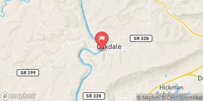 Emory River At Oakdale
|
2590cfs |
 Falling Water River Near Cookeville
|
149cfs |


 I-40 Bridge To Western Boundary Of Catoosa Wildlife Management Area, At Adams Bridge
 Center Bridge To Cumberland-Morgan County Line
 Mill Site To Center Bridge
 U.S. 127 Bridge To Morgan County Line