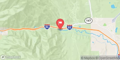
Ogden Play Park
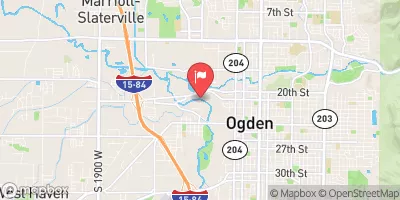
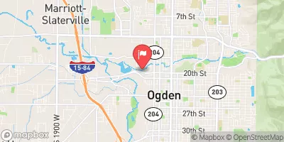
The Ogden Kayak Park offers an urban park-n-play experience just outside of downtown Ogden. The park offers good fun from about 150 cfs up to 1000 cfs. The park was built in the year 2000 at the urging and with the help of local kayakers. It was the first professionally designed play-park in Utah and really drew attention to the area as a kayaking destination. Two years later, in 2002, more rock was brought in, and the bottom two holes were moved, and a the old dam that formed the second hole was demolished, leaving a large pool with amphitheatre style banks. Most of the time boaters will play at the first hole then float through the bottom two when it is time to get out. There is a bike trail on river left and a bridge just upstream of the first hole that provides a good vantage point for onlookers. Fifty yards upstream of the park is a low-head dam or wier that can provide a good popup if one of the gates is open. During late summer and low water years the park is less a destination for kayakers and more a local hangout and swimming hole. During medium flows it is offers a great place for beginning and intermediate boaters to get in some friendly hole surfing. And in high water it consists of three fairly intimidating wide holes that can take a little work to get out of.
Suggested river levels for paddling this section of the Weber River are between a bare minimum of 150cfs and a high of 1,000cfs.
River conditions sourced from USGS 10137000, the Weber River At Ogden
Remember only watercraft are permitted
at Ogden Play Park.
Run Stats
Status | Runnable |
Class Level | III- |
Elevation | 4,279 ft |
Run Length | 0.1 Mi |
Gradient | 80 FPM |
Streamflow Discharge | 147 cfs |
Gage Height | 3.8 ft |
Air Temperature | 55° |
River | Weber River |
Reporting Streamgage |
Weber River At Ogden
USGS 10137000 |
Gauge | Streamflow | Stage |
---|---|---|
Provo River Near Charleston
USGS 10155500 |
157 cfs | 3.4 ft |
Logan River Above State Dam
USGS 10109000 |
109 cfs | 2.5 ft |
Chalk Creek At Coalville
USGS 10131000 |
24 cfs | 3.3 ft |
South Willow Creek Near Grantsville
USGS 10172800 |
5 cfs | 1.5 ft |
Daniels Creek At Charleston
USGS 10157500 |
3 cfs | 4.2 ft |
Mcleod Creek Near Park City
USGS 10133600 |
13 cfs | 6.4 ft |
Ogden River Bl Pineview Res Near Huntsville
USGS 10140100 |
14 cfs | 1.5 ft |
South Fork Ogden River Near Huntsville
USGS 10137500 |
37 cfs | 1.4 ft |
Bear River At Idaho-Utah State Line
USGS 10092700 |
489 cfs | 9.6 ft |
Farmington Cr Abv Div Nr Farmington
USGS 10142000 |
3 cfs | 0.5 ft |
Snotel Site | Snowpack | 24hr Change |
---|---|---|
Dry Fork
SNOTEL 906 |
24" | 1" |
Farmington Lower
SNOTEL 1054 |
29" | -4" |
Rocky Basin-Settleme
SNOTEL 723 |
39" | 2" |
bern
SNOTEL BERI1 |
2.78" | -0.39" |
Ben Lomond Peak
SNOTEL 332 |
46" | 0" |
Snowbird
SNOTEL 766 |
78" | 3" |
alta - guard house
SNOTEL AGD |
66" | 5" |
Garden City Summit
SNOTEL 1114 |
34" | -2" |
Timpanogos Divide
SNOTEL 820 |
24" | 0" |
deer creek dam
SNOTEL DCC_MADIS |
2" | 1.06" |
Parrish Creek
SNOTEL 971 |
42" | -2" |
Klondike Narrows
SNOTEL 1115 |
27" | -4" |
Usu Doc Daniel
SNOTEL 1098 |
70" | 0" |
atwater study plot
SNOTEL ATH20_MADIS |
155" | 93.68" |
Thaynes Canyon
SNOTEL 814 |
56" | 1" |
Vernon Creek
SNOTEL 844 |
5" | 2" |
alta
SNOTEL ATAU1 |
74" | 6" |
Hobble Creek
SNOTEL 1223 |
5" | 0" |
Emigrant Summit
SNOTEL 471 |
41" | 0" |
Mining Fork
SNOTEL 631 |
30" | 1" |
Lightning Ridge
SNOTEL 1056 |
26" | 0" |
Tony Grove Lake
SNOTEL 823 |
53" | -1" |
Temple Fork
SNOTEL 1013 |
30" | -2" |
Ben Lomond Trail
SNOTEL 333 |
9" | -2" |
Monte Cristo
SNOTEL 634 |
50" | 0" |
Franklin Basin
SNOTEL 484 |
44" | 0" |
Bug Lake
SNOTEL 374 |
36" | 0" |
Lookout Peak
SNOTEL 596 |
65" | 1" |
Kilfoil Creek
SNOTEL 1145 |
19" | -5" |
Sedgwick Peak
SNOTEL 741 |
38" | 1" |
Campground | Campsites | Reservations | Toilets | Showers | Elevation |
---|
Ski Area | Snowpack | Air Temperature | 5 Day Forecast |
---|---|---|---|
Snowbird Ski and Summer Resort | 78" | 35° | 1.14" |
Powder Mountain | 0" | 45° | 0.32" |
Snowbasin | 9" | 48° | 0.13" |
River Run | Streamflow | Length | Class |
---|---|---|---|
Mouth of Weber Canyon to Riverdale | 67.1cfs | 10.0 Mi | III |
Park and Ride to Old Mill Catch Pond | 41.8cfs | 1.25 Mi | IV to V |
Rainbow Gardens | 43.8cfs | 3.0 Mi | III to IV- |
Staircase Section - 2nd Dam to 1st Dam | 125.0cfs | None Mi | IV+ to V- |
Morgan Waterfall | 67.1cfs | 0.1 Mi | III+ |
Scrambled Eggs Bend | 124.0cfs | 4.0 Mi | IV |
Logan Town Run | 109.0cfs | None Mi | II+ to III- |
3rd Dam to 2nd Dam | 109.0cfs | None Mi | II+ to III |
Lower Ogden | 36.8cfs | 2.5 Mi | III+ |
Ogden Narrows | 43.8cfs | 2.0 Mi | III+ to IV |
Riverdale Wave | 67.1cfs | 0.18 Mi | III- |
Ogden Play Park | 203.0cfs | 0.06 Mi | III- |
Below Ogden Play Park | 147.0cfs | 3.0 Mi | II |