Dwight D. Eisenhower Highway Magna Boat Launch
Community Reviews
Been here? Share the conditions.
Reviews, ratings & photos are added in the free Snoflo iOS app — rate a spot, tag the conditions, and your visit is verified by location. Add or manage your reviews from the app.
Dwight D. Eisenhower Highway Magna
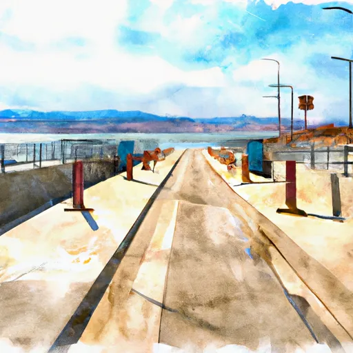
The boat ramp is approximately 20 feet wide and can accommodate boats of various sizes. It provides access to the Great Salt Lake, which is a large, shallow, and highly saline lake located in the northern part of the state.
The Great Salt Lake is home to a variety of aquatic species and is a popular destination for boating, fishing, and other water-based activities. The lake is also a significant landmark and tourist attraction in Utah, attracting visitors from around the world.
According to the latest information available, the boating regulations at the Great Salt Lake permit the use of motorized and non-motorized watercraft, including sailboats, powerboats, kayaks, canoes, and other types of boats. However, boaters are required to adhere to certain rules and regulations, such as boating speed limits, safety equipment requirements, and the prohibition of certain activities in designated areas.
In conclusion, the Dwight D. Eisenhower Highway Magna boat ramp in Utah is a concrete boat ramp that provides access to the Great Salt Lake. It is open to the public and can accommodate boats of various sizes. The lake permits the use of various types of watercraft, including motorized and non-motorized boats, subject to certain regulations and restrictions.
Plan your launch down to the hour
Same weather feed Snoflo's iOS app uses -- updated continuously from NOAA / yr.no.
Next 5 days, hour by hour
Temperature line with weather symbols on top, snow + rain accumulation as columns, humidity as a dotted line.
5-day forecast table
Every 3 hours, broken out across temperature, snow, rain, humidity, and wind.
| Time | Condition | Temp (°F) | Snow (in) | Rain (in) | Humidity (%) | Wind (mps) | Wind dir |
|---|---|---|---|---|---|---|---|
| Loading detailed forecast… | |||||||
15-day temperature & precipitation
Daily temperatures, snow, and rain projected over the next two weeks.
Area streamflow levels
USGS streamgauges around Dwight D. Eisenhower Highway Magna -- the same readings that determine whether your launch is safe and your boat is the right craft.
| Streamgauge | Discharge | View |
|---|---|---|
| Goggin Drain Near Magna Utah | 5 cfs | → |
| Surplus Canal @ Salt Lake City | 178 cfs | → |
| Jordan River @ 1700 South @ Salt Lake City | 165 cfs | → |
| Little Cottonwood Creek @ Jordan River Nr Slc | 3 cfs | → |
| Red Butte Creek At Fort Douglas | 1 cfs | → |
| West Canyon Creek Near Cedar Fort | 2 cfs | → |
Plan a longer trip
The closest paddle runs, fishing spots, and other boat launches so you can extend a day on the water.
River runs
- Source To Red Butte Reservoir
- Park And Ride To Old Mill Catch Pond
- Source To Murray City Diversion
- Mouth Of Weber Canyon To Riverdale
- Riverdale Wave
- Eastern Boundary Of National Monument To Western Boundary Of National Monument
Boating safety & etiquette
- Check the conditions before you launch
- Use the streamflow numbers, weather, and wind forecast on this page. High-cfs whitewater requires whitewater-specific craft and skill.
- Wear your life jacket
- Statistically the single biggest survival factor in a boating incident. State law often requires one per passenger.
- File a float plan
- Tell someone on shore your put-in, take-out, and expected return time. Especially for multi-day or remote trips.
- Yield at the ramp
- Prep gear in the parking lot, not on the ramp. Launch and clear quickly so others can use the lane.
- Clean, drain, dry
- Inspect, clean, drain and dry your boat between waters to prevent the spread of aquatic invasive species.
Set push alerts in the Snoflo app
Save Dwight D. Eisenhower Highway Magna as a favorite, set a discharge threshold or a wind/precipitation alert, and the iOS app will push the moment conditions cross.
About Dwight D. Eisenhower Highway Magna
Can I launch a motorboat here?
Most Snoflo-tracked launches support motorboats; check the operator for any horsepower restrictions, paddle-only zones, or seasonal closures.
How fresh is the streamflow data?
USGS streamgauges report continuously (every 15 minutes); the table on this page pulls the latest reading at page load.
Is there a fee?
Many federal and state boat launches charge a day-use fee. Check the operator's site before driving out.
What boat is right for these conditions?
Use the nearby streamflow numbers and river-run panel on this page to gauge current conditions. Wider, slower water is friendly for casual paddling and powerboats; high-cfs whitewater requires whitewater-specific craft and skill.
Can I get alerts when conditions change?
Yes -- alerts are managed in the Snoflo iOS app. Favorite this launch, set a threshold (discharge, wind), and you'll get a push the moment it crosses.
Other launches near here
Snoflo-tracked boat launches within driving distance of Dwight D. Eisenhower Highway Magna.