The Gulch river run
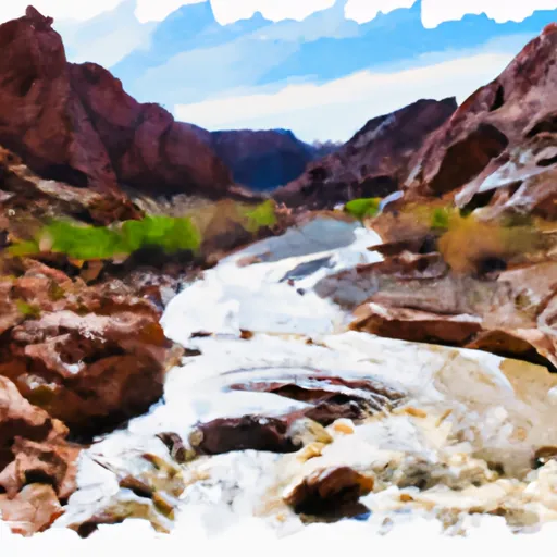
The Gulch
The segment mileage for The Gulch is approximately 8 miles long, and it takes around 3 to 4 hours to complete. Along the way, there are several challenging rapids, including the Entrance Rapid, the Three-Foot Falls, the Wall Rapid, and the Squeeze Rapid, which add an exciting element to the rafting experience. Additionally, there are beautiful natural scenery and wildlife to enjoy, including towering canyon walls, lush vegetation, and native animals like bighorn sheep and eagles.
Specific regulations for The Gulch include mandatory life jackets and helmets, as well as restrictions on alcohol and smoking. Visitors are also encouraged to practice Leave No Trace principles to minimize their impact on the environment and ensure the area remains pristine for future generations. The river is managed by the Bureau of Land Management (BLM), which has set guidelines to ensure the safety and enjoyment of all visitors.
In conclusion, The Gulch offers an exhilarating whitewater rafting experience in a stunning natural setting in Utah. With its ideal streamflow range, class rating, segment mileage, specific river rapids/obstacles, and regulations, The Gulch is a must-visit destination for any enthusiast seeking a challenging and memorable adventure.
Plan your run down to the hour
Same weather feed Snoflo's iOS app uses -- updated continuously from NOAA / yr.no. Watch the precipitation column on the meteogram; rain ahead of a run typically lifts flows 12-48 hours later depending on the basin.
Next 5 days, hour by hour
Temperature line with weather symbols on top, snow + rain accumulation as columns, humidity as a dotted line.
5-day forecast table
Every 3 hours, broken out across temperature, snow, rain, humidity, and wind. Each cell is colour-coded relative to the column min/max.
| Time | Condition | Temp (°F) | Snow (in) | Rain (in) | Humidity (%) | Wind (mps) | Wind dir |
|---|---|---|---|---|---|---|---|
| Loading detailed forecast… | |||||||
15-day temperature & precipitation
Daily temperatures, snow, and rain projected over the next two weeks -- the upstream story that drives next week's flows.
Regional streamflow levels
USGS streamgauges around The Gulch -- useful for spotting upstream pulses and gauging which tributary is contributing what.
| Streamgauge | Discharge | View |
|---|---|---|
| Pine Creek Near Escalante | 1 cfs | → |
| Escalante River Near Escalante | 0 cfs | → |
| Fremont River Near Bicknell | 58 cfs | → |
| Dirty Devil R Abv Poison Sp Wash Nr Hanksville | 25 cfs | → |
| Seven Mile Creek Near Fish Lake | 5 cfs | → |
| East Fork Sevier River Near Kingston | 196 cfs | → |
Plan a longer trip
The closest boat launches, other paddle runs, and campgrounds so a day on the water can grow into a full weekend.
Whitewater safety
- Check the flow before you run
- Use the linked-gauge card and Regional Flow panel above. Class ratings change with flow -- a Class III at low water can become Class IV+ at high water.
- Know your skill ceiling
- Pick runs comfortably below your ceiling. Cold-water and big-water runs raise the consequences of any mistake.
- Wear the right gear
- Helmet, PFD, drysuit / wetsuit when water is below 60°F. Throw bag, knife, and whistle on your person, not in the boat.
- Scout, set safety, and run with a team
- Scout new rapids on foot, set safety with throw bags above the consequence pool, and run with at least one other competent paddler.
- Respect the river
- Strainers, undercuts, low-head dams, and wood can kill at any class rating. When in doubt, portage.
Set push alerts in the Snoflo app
Save The Gulch as a favorite, set a discharge threshold (e.g. "alert me when flow hits 600 cfs"), and the iOS app pushes the moment the linked gauge crosses.
About The Gulch
What's the optimal flow for The Gulch?
The optimal flow depends on the section and the craft. Check the Run Details panel for the linked gauge and current status.
How fresh is the cfs reading on this page?
The linked USGS streamgauge reports continuously (every 15 minutes); Snoflo refreshes throughout the day. Hover the streamflow sparkline to read individual datapoints.
What's the whitewater class?
See the Run Details panel for the class rating Snoflo tracks for this run. Class ratings change with flow -- a Class III at low water can become Class IV in high water.
Where do I put in / take out?
Tap Directions in the hero above to open driving directions to the put-in. For shuttle planning, check the Nearby Boat Launches panel and the river run operator's site.
Can I get alerts when flows hit the optimal range?
Yes -- alerts are managed in the Snoflo iOS app. Favorite this run, set a discharge threshold, and you'll get a push the moment the gauge crosses.
Other runs near here
Snoflo-tracked paddle runs within driving distance of The Gulch.