Bridge To Confluence With North Fork Skykomish River River Run
Community Reviews
Been here? Share the conditions.
Reviews, ratings & photos are added in the free Snoflo iOS app — rate a spot, tag the conditions, and your visit is verified by location. Add or manage your reviews from the app.
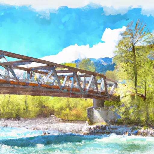
Bridge To Confluence With North Fork Skykomish River
The segment of the river that runs from the Bridge to Cable Drop is approximately 5.5 miles long, while the segment from Cable Drop to the Confluence is roughly 3 miles long. The river features several rapids and obstacles that provide a thrilling experience for paddlers. Some of the notable rapids include Cable Drop, Boulder Drop, and Pin Cushion.
In terms of regulations, the Washington State Parks and Recreation Commission requires all boaters to have a valid Washington State Boater Education Card. Additionally, all vessels must have a Type III or V US Coast Guard-approved personal flotation device (PFD) for each person on board. Boaters are also required to carry a whistle or horn to signal for help in case of an emergency.
Overall, the Bridge to Confluence with North Fork Skykomish River is a challenging and exciting whitewater river run that offers a unique experience for paddlers. However, it is important for paddlers to follow all regulations and safety guidelines to ensure a safe and enjoyable trip.
Plan your run down to the hour
Same weather feed Snoflo's iOS app uses -- updated continuously from NOAA / yr.no. Watch the precipitation column on the meteogram; rain ahead of a run typically lifts flows 12-48 hours later depending on the basin.
Next 5 days, hour by hour
Temperature line with weather symbols on top, snow + rain accumulation as columns, humidity as a dotted line.
5-day forecast table
Every 3 hours, broken out across temperature, snow, rain, humidity, and wind. Each cell is colour-coded relative to the column min/max.
| Time | Condition | Temp (°F) | Snow (in) | Rain (in) | Humidity (%) | Wind (mps) | Wind dir |
|---|---|---|---|---|---|---|---|
| Loading detailed forecast… | |||||||
15-day temperature & precipitation
Daily temperatures, snow, and rain projected over the next two weeks -- the upstream story that drives next week's flows.
Regional streamflow levels
USGS streamgauges around Bridge To Confluence With North Fork Skykomish River -- useful for spotting upstream pulses and gauging which tributary is contributing what.
| Streamgauge | Discharge | View |
|---|---|---|
| South Fork Sultan River Near Sultan | 8 cfs | → |
| Skykomish River Near Gold Bar | 512 cfs | → |
| South Fork Tolt River Near Index | 3 cfs | → |
| Sauk River Ab Whitechuck River Near Darrington | 220 cfs | → |
| Sultan River Below Diversion Dam Near Sultan | 108 cfs | → |
| Sultan River Below Powerplant Near Sultan | 314 cfs | → |
Plan a longer trip
The closest boat launches, other paddle runs, and campgrounds so a day on the water can grow into a full weekend.
Other river runs
- Headwaters At Outlet Of Blanca Lake To Usfs Road 63
- Headwaters In Nw 1/4 Of Sec 30, T29n, R14e To End Of Usfs Road 63 In Nw1/4 Of Sec 10, T28n, R12e
- Usfs Road 63 To Confluence With North Fork Skykomish River
- End Of Usfs Road 63 To Confluence With Troublesome Creek
- Headwaters In Ne1/4 Of Sec 13, T28n, R12e To Bridge In Sec 21, T28n, R12e
Campgrounds
- San Juan
- Troublesome Creek
- Troublesome Creek Campground
- Monte Cristo
- Sauk River Campground
- Hops Hill Campground
Whitewater safety
- Check the flow before you run
- Use the linked-gauge card and Regional Flow panel above. Class ratings change with flow -- a Class III at low water can become Class IV+ at high water.
- Know your skill ceiling
- Pick runs comfortably below your ceiling. Cold-water and big-water runs raise the consequences of any mistake.
- Wear the right gear
- Helmet, PFD, drysuit / wetsuit when water is below 60°F. Throw bag, knife, and whistle on your person, not in the boat.
- Scout, set safety, and run with a team
- Scout new rapids on foot, set safety with throw bags above the consequence pool, and run with at least one other competent paddler.
- Respect the river
- Strainers, undercuts, low-head dams, and wood can kill at any class rating. When in doubt, portage.
Set push alerts in the Snoflo app
Save Bridge To Confluence With North Fork Skykomish River as a favorite, set a discharge threshold (e.g. "alert me when flow hits 600 cfs"), and the iOS app pushes the moment the linked gauge crosses.
About Bridge To Confluence With North Fork Skykomish River
What's the optimal flow for Bridge To Confluence With North Fork Skykomish River?
The optimal flow depends on the section and the craft. Check the Run Details panel for the linked gauge and current status.
How fresh is the cfs reading on this page?
The linked USGS streamgauge reports continuously (every 15 minutes); Snoflo refreshes throughout the day. Hover the streamflow sparkline to read individual datapoints.
What's the whitewater class?
See the Run Details panel for the class rating Snoflo tracks for this run. Class ratings change with flow -- a Class III at low water can become Class IV in high water.
Where do I put in / take out?
Tap Directions in the hero above to open driving directions to the put-in. For shuttle planning, check the Nearby Boat Launches panel and the river run operator's site.
Can I get alerts when flows hit the optimal range?
Yes -- alerts are managed in the Snoflo iOS app. Favorite this run, set a discharge threshold, and you'll get a push the moment the gauge crosses.
Other runs near here
Snoflo-tracked paddle runs within driving distance of Bridge To Confluence With North Fork Skykomish River.