Western Boundary Of Agate Fossil Beds National Monument To Eastern Boundary Of Agate Fossil Beds National Monument River Run
Community Reviews
Been here? Share the conditions.
Reviews, ratings & photos are added in the free Snoflo iOS app — rate a spot, tag the conditions, and your visit is verified by location. Add or manage your reviews from the app.
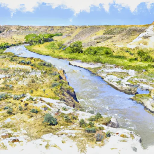
Western Boundary Of Agate Fossil Beds National Monument To Eastern Boundary Of Agate Fossil Beds National Monument
The river is rated as Class III, which means it has moderate rapids and requires some technical skill to navigate effectively. Paddlers must be experienced and confident in their abilities to handle the river's twists, turns, and obstacles. Some of the specific rapids and obstacles on this segment of the river include the "Kitchen Sink" and "Double Drop" rapids, which provide exciting challenges for paddlers.
There are specific regulations in place to protect the natural resources and ensure the safety of those who visit the area. Paddlers must obtain a permit from the National Park Service before entering the river. Additionally, motorized boats are not allowed on the river, and all visitors must follow Leave No Trace principles to minimize their impact on the environment.
In summary, the Whitewater River Run in Wyoming is a thrilling adventure for experienced paddlers. With its Class III rapids, specific obstacles, and regulations in place to protect the river and its visitors, this segment of the river promises a challenging and memorable experience.
Plan your run down to the hour
Same weather feed Snoflo's iOS app uses -- updated continuously from NOAA / yr.no. Watch the precipitation column on the meteogram; rain ahead of a run typically lifts flows 12-48 hours later depending on the basin.
Next 5 days, hour by hour
Temperature line with weather symbols on top, snow + rain accumulation as columns, humidity as a dotted line.
5-day forecast table
Every 3 hours, broken out across temperature, snow, rain, humidity, and wind. Each cell is colour-coded relative to the column min/max.
| Time | Condition | Temp (°F) | Snow (in) | Rain (in) | Humidity (%) | Wind (mps) | Wind dir |
|---|---|---|---|---|---|---|---|
| Loading detailed forecast… | |||||||
15-day temperature & precipitation
Daily temperatures, snow, and rain projected over the next two weeks -- the upstream story that drives next week's flows.
Regional streamflow levels
USGS streamgauges around Western Boundary Of Agate Fossil Beds National Monument To Eastern Boundary Of Agate Fossil Beds National Monument -- useful for spotting upstream pulses and gauging which tributary is contributing what.
| Streamgauge | Discharge | View |
|---|---|---|
| North Platte River At Wyoming-Nebraska State Line | 193 cfs | → |
| Laramie River Near Fort Laramie | 42 cfs | → |
| North Platte River Below Whalen Diversion Dam | 1,690 cfs | → |
| Hat Cr Near Edgemont Sd | · | → |
| North Platte River Below Glendo Reservoir | 5,710 cfs | → |
| Horsehead Cr At Oelrichs Sd | · | → |
Plan a longer trip
The closest boat launches, other paddle runs, and campgrounds so a day on the water can grow into a full weekend.
Whitewater safety
- Check the flow before you run
- Use the linked-gauge card and Regional Flow panel above. Class ratings change with flow -- a Class III at low water can become Class IV+ at high water.
- Know your skill ceiling
- Pick runs comfortably below your ceiling. Cold-water and big-water runs raise the consequences of any mistake.
- Wear the right gear
- Helmet, PFD, drysuit / wetsuit when water is below 60°F. Throw bag, knife, and whistle on your person, not in the boat.
- Scout, set safety, and run with a team
- Scout new rapids on foot, set safety with throw bags above the consequence pool, and run with at least one other competent paddler.
- Respect the river
- Strainers, undercuts, low-head dams, and wood can kill at any class rating. When in doubt, portage.
Set push alerts in the Snoflo app
Save Western Boundary Of Agate Fossil Beds National Monument To Eastern Boundary Of Agate Fossil Beds National Monument as a favorite, set a discharge threshold (e.g. "alert me when flow hits 600 cfs"), and the iOS app pushes the moment the linked gauge crosses.
About Western Boundary Of Agate Fossil Beds National Monument To Eastern Boundary Of Agate Fossil Beds National Monument
What's the optimal flow for Western Boundary Of Agate Fossil Beds National Monument To Eastern Boundary Of Agate Fossil Beds National Monument?
The optimal flow depends on the section and the craft. Check the Run Details panel for the linked gauge and current status.
How fresh is the cfs reading on this page?
The linked USGS streamgauge reports continuously (every 15 minutes); Snoflo refreshes throughout the day. Hover the streamflow sparkline to read individual datapoints.
What's the whitewater class?
See the Run Details panel for the class rating Snoflo tracks for this run. Class ratings change with flow -- a Class III at low water can become Class IV in high water.
Where do I put in / take out?
Tap Directions in the hero above to open driving directions to the put-in. For shuttle planning, check the Nearby Boat Launches panel and the river run operator's site.
Can I get alerts when flows hit the optimal range?
Yes -- alerts are managed in the Snoflo iOS app. Favorite this run, set a discharge threshold, and you'll get a push the moment the gauge crosses.
Other runs near here
Snoflo-tracked paddle runs within driving distance of Western Boundary Of Agate Fossil Beds National Monument To Eastern Boundary Of Agate Fossil Beds National Monument.