Begins Approximately At Kepler Cascades To The Confluence With The Madison River River Run
Community Reviews
Been here? Share the conditions.
Reviews, ratings & photos are added in the free Snoflo iOS app — rate a spot, tag the conditions, and your visit is verified by location. Add or manage your reviews from the app.
Begins Approximately At Kepler Cascades To The Confluence With The Madison River
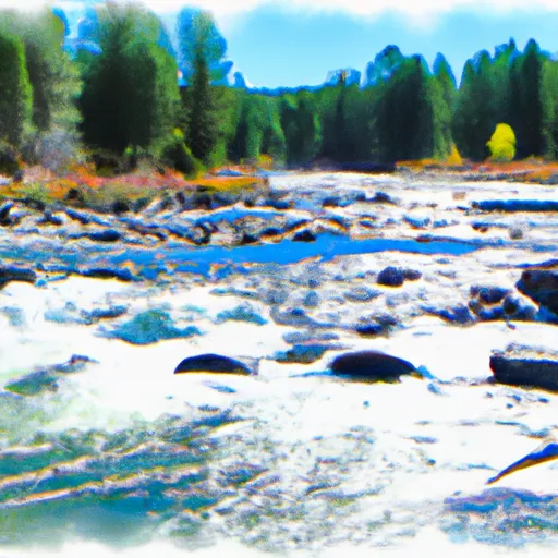
The class rating for this river run is a class III-IV, which is considered intermediate to advanced rapids. The segment is divided into several sections, including the Upper Whitewater, Lower Whitewater, and Yankee Jim Canyon. The Upper Whitewater section contains several class III rapids, including Big Kahuna, Lunch Counter, and the famous Champagne Rapid. The Lower Whitewater section contains more technical class IV rapids, including the Narrows, No Name, and Stovepipe. Yankee Jim Canyon is a narrow section of the river with steep canyon walls and several class III-IV rapids.
There are specific regulations to the area, including the requirement for all boaters to wear personal flotation devices and helmets. It is also recommended to have an experienced guide or to have previous whitewater rafting experience before attempting this river run. Additionally, there are restrictions on the number of boats allowed on the river per day to limit overcrowding and maintain the natural beauty of the area.
In summary, the Whitewater River Run in Wyoming is an exciting and challenging segment of the river with a class III-IV rating. It spans approximately 16 miles and is divided into several sections with specific rapids and obstacles. The ideal streamflow range for this river run is between 1,000 and 4,000 cfs, and there are specific regulations in place to ensure the safety of boaters and preserve the natural environment.
Plan your run down to the hour
Same weather feed Snoflo's iOS app uses -- updated continuously from NOAA / yr.no. Watch the precipitation column on the meteogram; rain ahead of a run typically lifts flows 12-48 hours later depending on the basin.
Next 5 days, hour by hour
Temperature line with weather symbols on top, snow + rain accumulation as columns, humidity as a dotted line.
5-day forecast table
Every 3 hours, broken out across temperature, snow, rain, humidity, and wind. Each cell is colour-coded relative to the column min/max.
| Time | Condition | Temp (°F) | Snow (in) | Rain (in) | Humidity (%) | Wind (mps) | Wind dir |
|---|---|---|---|---|---|---|---|
| Loading detailed forecast… | |||||||
15-day temperature & precipitation
Daily temperatures, snow, and rain projected over the next two weeks -- the upstream story that drives next week's flows.
Regional streamflow levels
USGS streamgauges around Begins Approximately At Kepler Cascades To The Confluence With The Madison River -- useful for spotting upstream pulses and gauging which tributary is contributing what.
| Streamgauge | Discharge | View |
|---|---|---|
| Firehole River Near West Yellowstone Mt | 200 cfs | → |
| Gibbon River At Madison Jct | 88 cfs | → |
| Madison River Near West Yellowstone Mt | 303 cfs | → |
| Big Springs At Big Springs Id | 128 cfs | → |
| Yellowstone River At Yellowstone Lk Outlet Ynp | 2,170 cfs | → |
| Tantalus Creek At Norris Junction | 2 cfs | → |
Plan a longer trip
The closest boat launches, other paddle runs, and campgrounds so a day on the water can grow into a full weekend.
Other river runs
- The Headwaters To Ends Approximately At Kepler Cascades
- The Headwaters To The Confluence With Falls River
- The Junction Of The Firehole And Gibbon Rivers To The Western Yellowstone National Park Boundary
- The Headwaters To The Southern Yellowstone National Park Boundary
- Begins Above Blanding Hill And The Road Access To Virginia Cascades To The Confluence With Firehole River
Campgrounds
Whitewater safety
- Check the flow before you run
- Use the linked-gauge card and Regional Flow panel above. Class ratings change with flow -- a Class III at low water can become Class IV+ at high water.
- Know your skill ceiling
- Pick runs comfortably below your ceiling. Cold-water and big-water runs raise the consequences of any mistake.
- Wear the right gear
- Helmet, PFD, drysuit / wetsuit when water is below 60°F. Throw bag, knife, and whistle on your person, not in the boat.
- Scout, set safety, and run with a team
- Scout new rapids on foot, set safety with throw bags above the consequence pool, and run with at least one other competent paddler.
- Respect the river
- Strainers, undercuts, low-head dams, and wood can kill at any class rating. When in doubt, portage.
Set push alerts in the Snoflo app
Save Begins Approximately At Kepler Cascades To The Confluence With The Madison River as a favorite, set a discharge threshold (e.g. "alert me when flow hits 600 cfs"), and the iOS app pushes the moment the linked gauge crosses.
About Begins Approximately At Kepler Cascades To The Confluence With The Madison River
What's the optimal flow for Begins Approximately At Kepler Cascades To The Confluence With The Madison River?
The optimal flow depends on the section and the craft. Check the Run Details panel for the linked gauge and current status.
How fresh is the cfs reading on this page?
The linked USGS streamgauge reports continuously (every 15 minutes); Snoflo refreshes throughout the day. Hover the streamflow sparkline to read individual datapoints.
What's the whitewater class?
See the Run Details panel for the class rating Snoflo tracks for this run. Class ratings change with flow -- a Class III at low water can become Class IV in high water.
Where do I put in / take out?
Tap Directions in the hero above to open driving directions to the put-in. For shuttle planning, check the Nearby Boat Launches panel and the river run operator's site.
Can I get alerts when flows hit the optimal range?
Yes -- alerts are managed in the Snoflo iOS app. Favorite this run, set a discharge threshold, and you'll get a push the moment the gauge crosses.
Other runs near here
Snoflo-tracked paddle runs within driving distance of Begins Approximately At Kepler Cascades To The Confluence With The Madison River.