Begins Above Slough Creek Campground, Located On A Secondary Spur Road To The Park's Main Road To The Confluence With Lamar River River Run
Community Reviews
Been here? Share the conditions.
Reviews, ratings & photos are added in the free Snoflo iOS app — rate a spot, tag the conditions, and your visit is verified by location. Add or manage your reviews from the app.
Begins Above Slough Creek Campground, Located On A Secondary Spur Road To The Park's Main Road To The Confluence With Lamar River
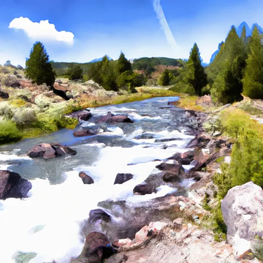
Along the 2.5-mile stretch of river, paddlers will encounter several notable rapids, including the "Ledges," "House Rock," and "Rock Garden." Each of these rapids offers a unique challenge, with the Ledges featuring a series of narrow channels and House Rock and Rock Garden requiring careful navigation through boulder fields.
To ensure the safety of paddlers and preserve the natural environment, there are specific regulations for the area. For example, boaters must carry a throwable personal flotation device and a sound-producing device. Additionally, it is recommended that paddlers wear a personal flotation device at all times while on the water.
Overall, the Whitewater River Run is an exciting and challenging stretch of river that requires skill and experience to navigate safely. It is important to respect the regulations in place and to always prioritize safety when enjoying this beautiful natural resource.
Plan your run down to the hour
Same weather feed Snoflo's iOS app uses -- updated continuously from NOAA / yr.no. Watch the precipitation column on the meteogram; rain ahead of a run typically lifts flows 12-48 hours later depending on the basin.
Next 5 days, hour by hour
Temperature line with weather symbols on top, snow + rain accumulation as columns, humidity as a dotted line.
5-day forecast table
Every 3 hours, broken out across temperature, snow, rain, humidity, and wind. Each cell is colour-coded relative to the column min/max.
| Time | Condition | Temp (°F) | Snow (in) | Rain (in) | Humidity (%) | Wind (mps) | Wind dir |
|---|---|---|---|---|---|---|---|
| Loading detailed forecast… | |||||||
15-day temperature & precipitation
Daily temperatures, snow, and rain projected over the next two weeks -- the upstream story that drives next week's flows.
Regional streamflow levels
USGS streamgauges around Begins Above Slough Creek Campground, Located On A Secondary Spur Road To The Park's Main Road To The Confluence With Lamar River -- useful for spotting upstream pulses and gauging which tributary is contributing what.
| Streamgauge | Discharge | View |
|---|---|---|
| Lamar River Nr Tower Falls Ranger Station Ynp | 297 cfs | → |
| Soda Butte Cr At Park Bndry At Silver Gate | 34 cfs | → |
| Boiling River At Mammoth | 22 cfs | → |
| Gardner River Near Mammoth Ynp | 145 cfs | → |
| Tantalus Creek At Norris Junction | 2 cfs | → |
| Yellowstone River At Corwin Springs Mt | 2,960 cfs | → |
Plan a longer trip
The closest boat launches, other paddle runs, and campgrounds so a day on the water can grow into a full weekend.
Other river runs
- Begins 1/4 Mile Downstream From Northeast Entrance Road Bridge In The Area Of Tower Falls/ Roosevelt To Northern Park Boundary
- Begins 1/4 Mile Upstream From Northeast Entrance Road Bridge In The Area Of Tower Falls/ Roosevelt To Ends 1/4 Mile Downstream From Northeast Entrance Road Bridge In The Area Of Tower Falls/ Roosevelt
- The Confluence With Soda Butte Creek To The Confluence With The Yellowstone River
- The Headwaters To Ends Above Slough Creek Campground, Located On A Secondary Spur Road To The Park's Main Road
- Northeast Yellowstone National Park Boundary, Near Cooke City To The Confluence With Lamar River
Campgrounds
- Slough Creek Campground
- Slough Creek - Yellowstone National Park
- Lower Slough Creek
- Hornaday Creek
- Slough Creek
- Upper Slough Ck Stock S.
Fishing spots
Whitewater safety
- Check the flow before you run
- Use the linked-gauge card and Regional Flow panel above. Class ratings change with flow -- a Class III at low water can become Class IV+ at high water.
- Know your skill ceiling
- Pick runs comfortably below your ceiling. Cold-water and big-water runs raise the consequences of any mistake.
- Wear the right gear
- Helmet, PFD, drysuit / wetsuit when water is below 60°F. Throw bag, knife, and whistle on your person, not in the boat.
- Scout, set safety, and run with a team
- Scout new rapids on foot, set safety with throw bags above the consequence pool, and run with at least one other competent paddler.
- Respect the river
- Strainers, undercuts, low-head dams, and wood can kill at any class rating. When in doubt, portage.
Set push alerts in the Snoflo app
Save Begins Above Slough Creek Campground, Located On A Secondary Spur Road To The Park's Main Road To The Confluence With Lamar River as a favorite, set a discharge threshold (e.g. "alert me when flow hits 600 cfs"), and the iOS app pushes the moment the linked gauge crosses.
About Begins Above Slough Creek Campground, Located On A Secondary Spur Road To The Park's Main Road To The Confluence With Lamar River
What's the optimal flow for Begins Above Slough Creek Campground, Located On A Secondary Spur Road To The Park's Main Road To The Confluence With Lamar River ?
The optimal flow depends on the section and the craft. Check the Run Details panel for the linked gauge and current status.
How fresh is the cfs reading on this page?
The linked USGS streamgauge reports continuously (every 15 minutes); Snoflo refreshes throughout the day. Hover the streamflow sparkline to read individual datapoints.
What's the whitewater class?
See the Run Details panel for the class rating Snoflo tracks for this run. Class ratings change with flow -- a Class III at low water can become Class IV in high water.
Where do I put in / take out?
Tap Directions in the hero above to open driving directions to the put-in. For shuttle planning, check the Nearby Boat Launches panel and the river run operator's site.
Can I get alerts when flows hit the optimal range?
Yes -- alerts are managed in the Snoflo iOS app. Favorite this run, set a discharge threshold, and you'll get a push the moment the gauge crosses.
Other runs near here
Snoflo-tracked paddle runs within driving distance of Begins Above Slough Creek Campground, Located On A Secondary Spur Road To The Park's Main Road To The Confluence With Lamar River .