Confluence With Snowslide Creek To West Boundary Of Patented Mining Claim Just Inside The Caribou Nf Boundary River Run
Community Reviews
Been here? Share the conditions.
Reviews, ratings & photos are added in the free Snoflo iOS app — rate a spot, tag the conditions, and your visit is verified by location. Add or manage your reviews from the app.
Confluence With Snowslide Creek To West Boundary Of Patented Mining Claim Just Inside The Caribou Nf Boundary
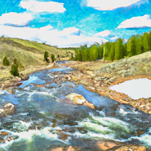
One of the main obstacles on this run is a large boulder located in the middle of the river, just downstream of "The Wall" rapid. This boulder creates a dangerous hole that can easily flip a raft or kayak. It is important to stay to the left of this obstacle to avoid any potential hazards.
In terms of regulations, boaters are required to obtain a permit from the Caribou-Targhee National Forest Service before embarking on this run. Additionally, boaters must adhere to Leave No Trace principles and pack out all trash and waste. Finally, boaters must respect private property rights and avoid trespassing on any private land adjacent to the river.
Plan your run down to the hour
Same weather feed Snoflo's iOS app uses -- updated continuously from NOAA / yr.no. Watch the precipitation column on the meteogram; rain ahead of a run typically lifts flows 12-48 hours later depending on the basin.
Next 5 days, hour by hour
Temperature line with weather symbols on top, snow + rain accumulation as columns, humidity as a dotted line.
5-day forecast table
Every 3 hours, broken out across temperature, snow, rain, humidity, and wind. Each cell is colour-coded relative to the column min/max.
| Time | Condition | Temp (°F) | Snow (in) | Rain (in) | Humidity (%) | Wind (mps) | Wind dir |
|---|---|---|---|---|---|---|---|
| Loading detailed forecast… | |||||||
15-day temperature & precipitation
Daily temperatures, snow, and rain projected over the next two weeks -- the upstream story that drives next week's flows.
Regional streamflow levels
USGS streamgauges around Confluence With Snowslide Creek To West Boundary Of Patented Mining Claim Just Inside The Caribou Nf Boundary -- useful for spotting upstream pulses and gauging which tributary is contributing what.
| Streamgauge | Discharge | View |
|---|---|---|
| Bear River At Pescadero | 1,330 cfs | → |
| Bear River At Border | 68 cfs | → |
| Bear River Below Smiths Fork | 109 cfs | → |
| Bear River At Idaho-Utah State Line | 934 cfs | → |
| Bear River Below Pixley Dam | 0 cfs | → |
| Logan | 65 cfs | → |
Plan a longer trip
The closest boat launches, other paddle runs, and campgrounds so a day on the water can grow into a full weekend.
Boat launches
Other river runs
- Idaho State Line To Confluence With Beaver Creek
- Southern Boundary Of State Land To Mouth
- Source To Mouth
- Hgh Creek Lake To Nf Boundary
Campgrounds
- St. Charles Campground
- Davis Canyon Campground
- Cloverleaf Campground
- North Fork Campground - St Charles Canyon, Id
- Paris Springs Campground
- Willow Flat
Parks
Whitewater safety
- Check the flow before you run
- Use the linked-gauge card and Regional Flow panel above. Class ratings change with flow -- a Class III at low water can become Class IV+ at high water.
- Know your skill ceiling
- Pick runs comfortably below your ceiling. Cold-water and big-water runs raise the consequences of any mistake.
- Wear the right gear
- Helmet, PFD, drysuit / wetsuit when water is below 60°F. Throw bag, knife, and whistle on your person, not in the boat.
- Scout, set safety, and run with a team
- Scout new rapids on foot, set safety with throw bags above the consequence pool, and run with at least one other competent paddler.
- Respect the river
- Strainers, undercuts, low-head dams, and wood can kill at any class rating. When in doubt, portage.
Set push alerts in the Snoflo app
Save Confluence With Snowslide Creek To West Boundary Of Patented Mining Claim Just Inside The Caribou Nf Boundary as a favorite, set a discharge threshold (e.g. "alert me when flow hits 600 cfs"), and the iOS app pushes the moment the linked gauge crosses.
About Confluence With Snowslide Creek To West Boundary Of Patented Mining Claim Just Inside The Caribou Nf Boundary
What's the optimal flow for Confluence With Snowslide Creek To West Boundary Of Patented Mining Claim Just Inside The Caribou Nf Boundary?
The optimal flow depends on the section and the craft. Check the Run Details panel for the linked gauge and current status.
How fresh is the cfs reading on this page?
The linked USGS streamgauge reports continuously (every 15 minutes); Snoflo refreshes throughout the day. Hover the streamflow sparkline to read individual datapoints.
What's the whitewater class?
See the Run Details panel for the class rating Snoflo tracks for this run. Class ratings change with flow -- a Class III at low water can become Class IV in high water.
Where do I put in / take out?
Tap Directions in the hero above to open driving directions to the put-in. For shuttle planning, check the Nearby Boat Launches panel and the river run operator's site.
Can I get alerts when flows hit the optimal range?
Yes -- alerts are managed in the Snoflo iOS app. Favorite this run, set a discharge threshold, and you'll get a push the moment the gauge crosses.
Other runs near here
Snoflo-tracked paddle runs within driving distance of Confluence With Snowslide Creek To West Boundary Of Patented Mining Claim Just Inside The Caribou Nf Boundary.