Nf Tongue From Burgess Picnic Ground To Pole Creek River Run
Community Reviews
Been here? Share the conditions.
Reviews, ratings & photos are added in the free Snoflo iOS app — rate a spot, tag the conditions, and your visit is verified by location. Add or manage your reviews from the app.
Nf Tongue From Burgess Picnic Ground To Pole Creek
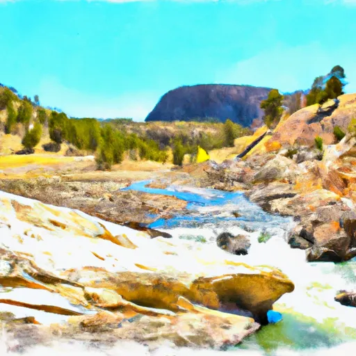
The segment mileage for this river run is approximately 5.5 miles, with rapids such as "Burgess Falls," "Elkhorn Rapid," and "Pole Creek Rapid" being the main attractions. Burgess Falls is a class IV rapid, offering a steep drop and a technical route. Elkhorn Rapid is a class III-IV rapid, with a large boulder in the middle of the river that requires careful maneuvering. Pole Creek Rapid is a class III-IV rapid, with a tight and technical route.
Specific regulations to the area include a permit requirement for overnight camping, which can be obtained through the Forest Service. Additionally, all boaters are required to wear personal flotation devices (PFDs) and carry a whistle and a throw rope. It is also important to note that the river flows through public and private land, so respect for private property is necessary.
Overall, the North Fork of the Tongue River offers a challenging and exciting whitewater river run for experienced kayakers and rafters. With its ideal streamflow range, class rating, and specific rapids and obstacles, this river run is sure to provide an unforgettable adventure.
Plan your run down to the hour
Same weather feed Snoflo's iOS app uses -- updated continuously from NOAA / yr.no. Watch the precipitation column on the meteogram; rain ahead of a run typically lifts flows 12-48 hours later depending on the basin.
Next 5 days, hour by hour
Temperature line with weather symbols on top, snow + rain accumulation as columns, humidity as a dotted line.
5-day forecast table
Every 3 hours, broken out across temperature, snow, rain, humidity, and wind. Each cell is colour-coded relative to the column min/max.
| Time | Condition | Temp (°F) | Snow (in) | Rain (in) | Humidity (%) | Wind (mps) | Wind dir |
|---|---|---|---|---|---|---|---|
| Loading detailed forecast… | |||||||
15-day temperature & precipitation
Daily temperatures, snow, and rain projected over the next two weeks -- the upstream story that drives next week's flows.
Regional streamflow levels
USGS streamgauges around Nf Tongue From Burgess Picnic Ground To Pole Creek -- useful for spotting upstream pulses and gauging which tributary is contributing what.
| Streamgauge | Discharge | View |
|---|---|---|
| Tongue River Near Dayton | 48 cfs | → |
| West Pass Creek Near Parkman | 10 cfs | → |
| East Pass Creek Near Dayton | 12 cfs | → |
| Little Bighorn River At State Line Nr Wyola Mt | 86 cfs | → |
| Shell Creek Near Shell | 74 cfs | → |
| Shell Creek Above Shell Creek Reservoir | 12 cfs | → |
Plan a longer trip
The closest boat launches, other paddle runs, and campgrounds so a day on the water can grow into a full weekend.
Other river runs
- Sf Tongue- Johnson Creek To Confluence With Nf Tongue
- Bridge At Tongue River Canyon To Burgess Picnic Grounds
- Fools Gold Crossing (Fdr 480) To Wagon Box Creek
- Dry Fork River From Its Confluence With Lake Creek To Confluence With Little Big Horn
- Wagon Box Creek To Dry Fork Trail
Campgrounds
- North Tongue
- North Tongue Campground
- North Tongue River Campground
- Pine Island Group Campground
- Arrowhead Lodge
- Prune Creek Campground
Whitewater safety
- Check the flow before you run
- Use the linked-gauge card and Regional Flow panel above. Class ratings change with flow -- a Class III at low water can become Class IV+ at high water.
- Know your skill ceiling
- Pick runs comfortably below your ceiling. Cold-water and big-water runs raise the consequences of any mistake.
- Wear the right gear
- Helmet, PFD, drysuit / wetsuit when water is below 60°F. Throw bag, knife, and whistle on your person, not in the boat.
- Scout, set safety, and run with a team
- Scout new rapids on foot, set safety with throw bags above the consequence pool, and run with at least one other competent paddler.
- Respect the river
- Strainers, undercuts, low-head dams, and wood can kill at any class rating. When in doubt, portage.
Set push alerts in the Snoflo app
Save Nf Tongue From Burgess Picnic Ground To Pole Creek as a favorite, set a discharge threshold (e.g. "alert me when flow hits 600 cfs"), and the iOS app pushes the moment the linked gauge crosses.
About Nf Tongue From Burgess Picnic Ground To Pole Creek
What's the optimal flow for Nf Tongue From Burgess Picnic Ground To Pole Creek?
The optimal flow depends on the section and the craft. Check the Run Details panel for the linked gauge and current status.
How fresh is the cfs reading on this page?
The linked USGS streamgauge reports continuously (every 15 minutes); Snoflo refreshes throughout the day. Hover the streamflow sparkline to read individual datapoints.
What's the whitewater class?
See the Run Details panel for the class rating Snoflo tracks for this run. Class ratings change with flow -- a Class III at low water can become Class IV in high water.
Where do I put in / take out?
Tap Directions in the hero above to open driving directions to the put-in. For shuttle planning, check the Nearby Boat Launches panel and the river run operator's site.
Can I get alerts when flows hit the optimal range?
Yes -- alerts are managed in the Snoflo iOS app. Favorite this run, set a discharge threshold, and you'll get a push the moment the gauge crosses.
Other runs near here
Snoflo-tracked paddle runs within driving distance of Nf Tongue From Burgess Picnic Ground To Pole Creek.