Samuel Taylor State Park
Community Reviews
Been here? Share the conditions.
Reviews, ratings & photos are added in the free Snoflo iOS app — rate a spot, tag the conditions, and your visit is verified by location. Add or manage your reviews from the app.
Samuel Taylor State Park
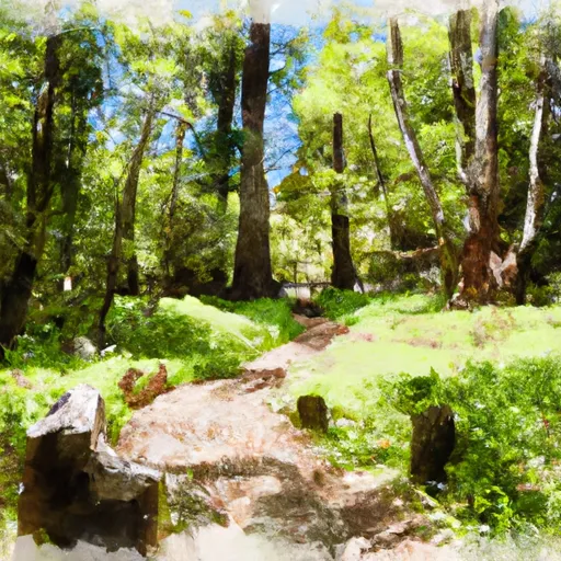
One of the main attractions of Samuel Taylor State Park is its old-growth redwood forest. These majestic trees, some of which are over 600 years old and reach heights of 200 feet, create a stunning and peaceful atmosphere. Visitors can meander along the park's numerous hiking trails, such as the Pioneer Tree Trail or the Cross Marin Trail, which wind through the towering redwoods, providing an immersive and awe-inspiring experience.
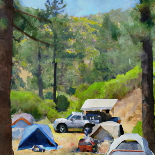
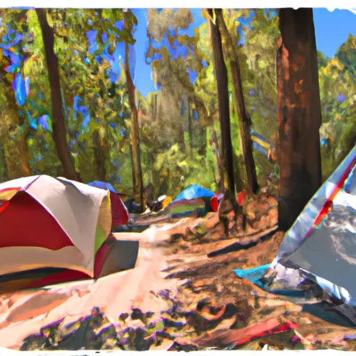
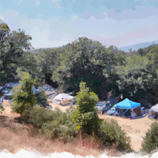
The park is also home to several points of interest worth exploring. One such area is the park's namesake, Samuel P. Taylor Campground, which offers camping facilities amidst the redwoods. The campground features amenities such as picnic tables, fire rings, and even hot showers, making it an ideal spot for a weekend getaway. Additionally, the park's picnic areas, such as Azalea Hill and the Day-Use Picnic Area, offer picturesque spots for visitors to enjoy a meal surrounded by nature.
For history enthusiasts, Samuel Taylor State Park has an intriguing past. The park once served as a vital stop on the Northwestern Pacific Railroad, and remnants of this historic railway can still be seen today. The park's Cross Marin Trail follows the old rail bed and provides a unique glimpse into the area's transportation history.
Furthermore, Samuel Taylor State Park's diverse flora and fauna make it an excellent spot for wildlife observation and photography. Visitors may encounter various bird species, including woodpeckers, owls, and hawks, as well as mammals like gray foxes and black-tailed deer. Explorers can also find an assortment of wildflowers that bloom throughout the park during spring, adding bursts of color to the already stunning landscape.
In terms of the best time to visit Samuel Taylor State Park, multiple independent sources suggest that spring and fall offer the most favorable conditions. During these seasons, the weather is generally mild and pleasant, with less fog than in summer. Additionally, the park tends to be less crowded during these times, allowing visitors to fully immerse themselves in the tranquility and natural beauty of the surroundings.
To ensure accuracy, it is always recommended to cross-reference information from multiple independent sources when planning a visit to Samuel Taylor State Park in California.
Streamflow in Samuel Taylor State Park
Live USGS discharge at streamgauges inside the park boundary.
Trails in Samuel Taylor State Park
Named trails whose route falls inside the park.
Camping in Samuel Taylor State Park
Campgrounds inside the park, with today's conditions score.
Plan your visit down to the hour
Same weather feed Snoflo's iOS app uses -- updated continuously from NOAA / yr.no.
Next 5 days, hour by hour
Temperature line with weather symbols on top, snow + rain accumulation as columns, humidity as a dotted line.
5-day forecast table
Every 3 hours, broken out across temperature, snow, rain, humidity, and wind.
| Time | Condition | Temp (°F) | Snow (in) | Rain (in) | Humidity (%) | Wind (mps) | Wind dir |
|---|---|---|---|---|---|---|---|
| Loading detailed forecast… | |||||||
15-day temperature & precipitation
Daily temperatures, snow, and rain projected over the next two weeks.
Responsible recreation & Leave No Trace
- Know before you go
- Check the operator's site for hours, permit requirements, seasonal closures, and fire restrictions before heading out.
- Stay on trail
- Stick to marked paths to protect vegetation, prevent erosion, and avoid disturbing wildlife habitat.
- Respect wildlife
- Observe from a distance, never feed wildlife, and store food securely if camping is permitted on-site.
- Pack it in, pack it out
- Carry out all trash, food scraps, and gear. Many parks have limited or no trash service.
- Leave what you find
- Don't take rocks, plants, or artifacts. They make the park what it is for the next visitor.
Set push alerts in the Snoflo app
Save Samuel Taylor State Park as a favorite, set a custom threshold (precipitation, freezing temperatures, fire-restriction days), and the iOS app will push the moment conditions cross.
About Samuel Taylor State Park
What can I do at Samuel Taylor State Park?
Most Snoflo-tracked parks support hiking, picnicking, and wildlife viewing. Check the operator's site for activity-specific rules (camping, fishing, paddling, hunting).
How fresh is the weather data?
The hourly forecast updates throughout the day from NOAA / yr.no. Streamflow comes live from USGS streamgauges.
When is the best time to visit?
Use the 15-day temperature & precipitation outlook on this page to plan -- pick a window with comfortable temperatures and low precipitation.
How do I get to Samuel Taylor State Park?
Tap Directions in the hero above to open driving directions in Google Maps, or Open in map to center the Snoflo interactive map on the park.
Can I get alerts when conditions change?
Yes -- alerts are managed in the Snoflo iOS app. Favorite this park, set a threshold (temperature, precipitation), and you'll get a push the moment it crosses.
Park & land designation reference
A quick legend for the federal and state land categories Snoflo tracks. Each designation comes with different rules around access, recreation, and resource extraction.
- National Park
- Large protected natural areas managed by the federal government to preserve significant landscapes, ecosystems, and cultural resources; recreation is allowed but conservation is the priority.
- State Park
- Public natural or recreational areas managed by a state government, typically smaller than national parks and focused on regional natural features, recreation, and education.
- Local Park
- Community-level parks managed by cities or counties, emphasizing recreation, playgrounds, sports, and green space close to populated areas.
- Wilderness Area
- The highest level of land protection in the U.S.; designated areas where nature is left essentially untouched, with no roads, structures, or motorized motorized access permitted.
- National Recreation Area
- Areas set aside primarily for outdoor recreation (boating, hiking, fishing, often around reservoirs, rivers, or scenic landscapes); may allow more development.
- National Conservation Area (BLM)
- BLM-managed areas with special ecological, cultural, or scientific value; more protection than typical BLM land but less strict than Wilderness Areas.
- State Forest
- State-managed forests focused on habitat, watershed, recreation, and sustainable timber harvest.
- Bureau of Land Management (BLM) Land
- Vast federal lands managed for mixed use -- recreation, grazing, mining, conservation -- with fewer restrictions than national parks or forests.