Starved Rock State Park
Community Reviews
Been here? Share the conditions.
Reviews, ratings & photos are added in the free Snoflo iOS app — rate a spot, tag the conditions, and your visit is verified by location. Add or manage your reviews from the app.
Starved Rock State Park
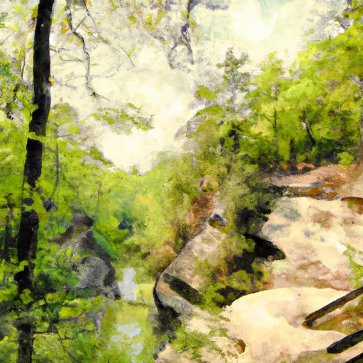
Starved Rock State Park offers a diverse range of attractions that draw visitors from all over. Its immense popularity stems from its scenic views, towering canyons, waterfalls, abundant wildlife, and a wide array of recreational activities. The park is situated along the Illinois River, encompassing over 2,630 acres of natural wonders.
Reasons to visit Starved Rock State Park are plentiful. Nature enthusiasts will find ample opportunities for hiking, bird watching, fishing, boating, and wildlife observation. The park boasts a network of 18 trails, covering approximately 13 miles, which take visitors through stunning canyons and offer breathtaking panoramas from atop sandstone bluffs. Whether you're an experienced hiker or a casual nature lover, there are trails suitable for all skill levels.
Some notable points of interest within the park include the iconic Starved Rock, a sandstone butte towering 125 feet above the Illinois River. The rock gets its name from a Native American legend involving a siege and subsequent starvation of the Illiniwek tribe. Additionally, visitors can explore the stunning canyons, including French, Wildcat, and St. Louis canyons, each offering unique geological formations and cascading waterfalls.
Interesting facts about Starved Rock State Park include its rich Native American heritage, with evidence of human inhabitation dating back over 10,000 years. The park was established in 1911 and was designated a National Historic Landmark in 1966. It is home to a wide variety of flora and fauna, including over 200 species of birds, making it a haven for birdwatchers. Furthermore, the park hosts numerous annual events such as eagle-watching tours, guided hikes, and educational programs.
When planning your visit, the best time of year to go to Starved Rock State Park largely depends on personal preferences and the activities you wish to engage in. Spring and fall are generally considered the prime seasons, as the weather is mild, and the park's foliage displays vibrant colors. Springtime brings the added bonus of wildflowers in bloom, while autumn showcases stunning foliage. Winter is also a popular time for photography and exploring frozen waterfalls, but be prepared for colder temperatures.
To ensure accuracy, it is recommended to cross-verify the information provided with multiple independent sources, such as the official website of Starved Rock State Park, local tourism websites, and reputable travel guides.
Trails in Starved Rock State Park
Named trails whose route falls inside the park.
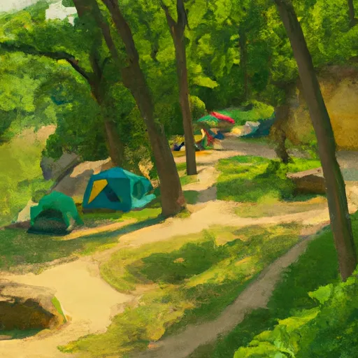
Camping in Starved Rock State Park
Campgrounds inside the park, with today's conditions score.
Plan your visit down to the hour
Same weather feed Snoflo's iOS app uses -- updated continuously from NOAA / yr.no.
Next 5 days, hour by hour
Temperature line with weather symbols on top, snow + rain accumulation as columns, humidity as a dotted line.
5-day forecast table
Every 3 hours, broken out across temperature, snow, rain, humidity, and wind.
| Time | Condition | Temp (°F) | Snow (in) | Rain (in) | Humidity (%) | Wind (mps) | Wind dir |
|---|---|---|---|---|---|---|---|
| Loading detailed forecast… | |||||||
15-day temperature & precipitation
Daily temperatures, snow, and rain projected over the next two weeks.
Responsible recreation & Leave No Trace
- Know before you go
- Check the operator's site for hours, permit requirements, seasonal closures, and fire restrictions before heading out.
- Stay on trail
- Stick to marked paths to protect vegetation, prevent erosion, and avoid disturbing wildlife habitat.
- Respect wildlife
- Observe from a distance, never feed wildlife, and store food securely if camping is permitted on-site.
- Pack it in, pack it out
- Carry out all trash, food scraps, and gear. Many parks have limited or no trash service.
- Leave what you find
- Don't take rocks, plants, or artifacts. They make the park what it is for the next visitor.
Set push alerts in the Snoflo app
Save Starved Rock State Park as a favorite, set a custom threshold (precipitation, freezing temperatures, fire-restriction days), and the iOS app will push the moment conditions cross.
About Starved Rock State Park
What can I do at Starved Rock State Park?
Most Snoflo-tracked parks support hiking, picnicking, and wildlife viewing. Check the operator's site for activity-specific rules (camping, fishing, paddling, hunting).
How fresh is the weather data?
The hourly forecast updates throughout the day from NOAA / yr.no. Streamflow comes live from USGS streamgauges.
When is the best time to visit?
Use the 15-day temperature & precipitation outlook on this page to plan -- pick a window with comfortable temperatures and low precipitation.
How do I get to Starved Rock State Park?
Tap Directions in the hero above to open driving directions in Google Maps, or Open in map to center the Snoflo interactive map on the park.
Can I get alerts when conditions change?
Yes -- alerts are managed in the Snoflo iOS app. Favorite this park, set a threshold (temperature, precipitation), and you'll get a push the moment it crosses.
Park & land designation reference
A quick legend for the federal and state land categories Snoflo tracks. Each designation comes with different rules around access, recreation, and resource extraction.
- National Park
- Large protected natural areas managed by the federal government to preserve significant landscapes, ecosystems, and cultural resources; recreation is allowed but conservation is the priority.
- State Park
- Public natural or recreational areas managed by a state government, typically smaller than national parks and focused on regional natural features, recreation, and education.
- Local Park
- Community-level parks managed by cities or counties, emphasizing recreation, playgrounds, sports, and green space close to populated areas.
- Wilderness Area
- The highest level of land protection in the U.S.; designated areas where nature is left essentially untouched, with no roads, structures, or motorized motorized access permitted.
- National Recreation Area
- Areas set aside primarily for outdoor recreation (boating, hiking, fishing, often around reservoirs, rivers, or scenic landscapes); may allow more development.
- National Conservation Area (BLM)
- BLM-managed areas with special ecological, cultural, or scientific value; more protection than typical BLM land but less strict than Wilderness Areas.
- State Forest
- State-managed forests focused on habitat, watershed, recreation, and sustainable timber harvest.
- Bureau of Land Management (BLM) Land
- Vast federal lands managed for mixed use -- recreation, grazing, mining, conservation -- with fewer restrictions than national parks or forests.