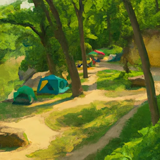
Starved Rock State Park campground
Community Reviews
Been here? Share the conditions.
Reviews, ratings & photos are added in the free Snoflo iOS app — rate a spot, tag the conditions, and your visit is verified by location. Add or manage your reviews from the app.
Starved Rock State Park
The best time to visit Starved Rock State Park for camping is during the spring and fall seasons when the weather is pleasant, and the park offers beautiful scenery. The park is known for its stunning canyons and waterfalls, which are especially breathtaking during these seasons. Visitors should be cautious during the summer months, as the park can become crowded, and the heat can be intense.
While enjoying camping at Starved Rock State Park, campers should be mindful of the wildlife that inhabits the area, including raccoons and deer. It is important to properly store food and trash to avoid encounters with these animals. Additionally, hikers should exercise caution when exploring the canyons and be aware of potential slippery conditions near waterfalls. By following these guidelines and enjoying the amenities and beauty of Starved Rock State Park, campers are sure to have a memorable and enjoyable experience.
What's on-site at Starved Rock State Park
Key facilities Snoflo tracks for this campground. Confirm with the operator before booking -- amenities can change seasonally.
Plan your trip down to the hour
Same weather feed Snoflo's iOS app uses -- updated continuously from NOAA / yr.no.
Next 5 days, hour by hour
Temperature line with weather symbols on top, snow + rain accumulation as columns, humidity as a dotted line.
5-day forecast table
Every 3 hours, broken out across temperature, snow, rain, humidity, and wind. Each cell is colour-coded relative to the column min/max so trends jump out at a glance.
| Time | Condition | Temp (°F) | Snow (in) | Rain (in) | Humidity (%) | Wind (mps) | Wind dir |
|---|---|---|---|---|---|---|---|
| Loading detailed forecast… | |||||||
15-day temperature & precipitation
Daily temperatures, snow, and rain projected over the next two weeks. Hover any point for the full breakdown.
Other campgrounds in the area
Snoflo-tracked campsites within driving distance of Starved Rock State Park, with reservations status.
| Campground | Reservations | Toilets | View |
|---|---|---|---|
| Horseback Campground @ Matthiessen State Park | ✗ | ✗ | → |
| Pleasant Creek Campground | ✗ | ✗ | → |
| Illini State Park | ✓ | ✗ | → |
| Lake De Pue City Park | ✗ | ✗ | → |
| Illini State Park Campground | ✗ | ✗ | → |
Nearby streamflow
USGS streamgauges within reach of Starved Rock State Park -- pulled live from the National Water Information System.
| Streamgauge | Discharge | View |
|---|---|---|
| Vermilion River Near Leonore | 672 cfs | → |
| Fox River At Dayton | 2,010 cfs | → |
| Illinois River At Marseilles | 10,800 cfs | → |
| East Bureau Creek Near Bureau | 2 cfs | → |
| Illinois River At Henry | 17,200 cfs | → |
| Big Bureau Creek At Princeton | 308 cfs | → |
Nearby snow depths
NRCS SNOTEL stations within reach of Starved Rock State Park -- relevant when planning a shoulder-season or alpine trip.
| SNOTEL station | Snowpack | 24h Snowfall | View |
|---|---|---|---|
| La Salle 0.1 W | 0.0 in | 0.0 in | → |
| Peru 0.7 Ene | 1.5 in | 0.0 in | → |
| Earlville | 0.0 in | 0.0 in | → |
| Hennepin | 0.0 in | 0.0 in | → |
| Princeton 1.1 Se | 0.0 in | 0.0 in | → |
| Amboy 0.5 Ssw | 0.0 in | 0.0 in | → |
Plan a longer trip
The closest parks, lakes, boat launches, and paddle runs so a camping night can grow into a full weekend.
Parks
- Lehigh Memorial Park
- Matthiessen State Park
- Dickinson Field
- Starved Rock State Park
- Matthiessen Park
- Hegeler Park
Boat launches
- Starved Rock State Park
- Ed Hand Highway 95, Deer Park
- Starved Rock Marina
- Il 71 Lasalle County
- Courtney Street Ottawa
- Calumet Street Ottawa
Camping essentials & Leave No Trace
- Pack it in, pack it out
- Take all trash, food scraps, and gear back with you to keep campsites clean and protect wildlife.
- Respect wildlife
- Observe animals from a distance, store food securely, and never feed wildlife to maintain natural behavior and safety.
- Know before you go
- Check weather, fire restrictions, trail conditions, and permit requirements to ensure a safe and well-planned trip.
- Minimize campfire impact
- Use established fire rings, keep fires small, fully extinguish them, or opt for a camp stove when fires are restricted.
- Leave what you find
- Preserve natural and cultural features by avoiding removal of plants, rocks, artifacts, or other elements of the environment.
Set push alerts in the Snoflo app
Save Starved Rock State Park as a favorite, set a custom threshold (precipitation, snowpack, freezing temperatures), and the iOS app will push the moment conditions cross.
About Starved Rock State Park
Can I make reservations at Starved Rock State Park?
Yes -- this campground accepts reservations. Snoflo recommends booking early for peak season; check the operator (Recreation.gov / state park system / private operator) for the booking window and cancellation policy.
How fresh is the weather data on this page?
The hourly forecast updates throughout the day from the NOAA / yr.no public feeds. Streamflow data is pulled live from USGS streamgauges and snowpack from the NRCS SNOTEL network.
What's the best time of year to visit?
Use the 15-day temperature & precipitation outlook on this page to plan -- pick a window with comfortable temperatures and low precipitation. For longer trips, the 5-day hourly meteogram shows snow + rain accumulation hour-by-hour.
How do I get to Starved Rock State Park?
Tap Directions in the hero above to open driving directions in Google Maps, or Open in map to center the Snoflo interactive map on the campground.
Can I get alerts when conditions change?
Yes -- alerts are managed through the Snoflo iOS app. Favorite this campground, set a threshold (temperature, snowpack, precipitation), and you'll get a push the moment it crosses.
Other campgrounds near here
Snoflo-tracked campgrounds within driving distance of Starved Rock State Park.