Wingfoot Lake State Park
Community Reviews
Been here? Share the conditions.
Reviews, ratings & photos are added in the free Snoflo iOS app — rate a spot, tag the conditions, and your visit is verified by location. Add or manage your reviews from the app.
Wingfoot Lake State Park
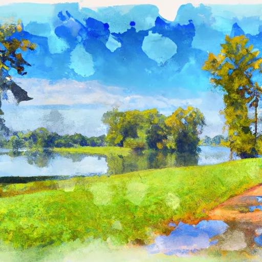
One of the main attractions at Wingfoot Lake State Park is the stunning lake itself. Spanning over 444 acres, Wingfoot Lake offers opportunities for boating, fishing, and swimming. With its calm waters and scenic surroundings, it is the perfect spot for a peaceful day out on the water.
For visitors interested in hiking and exploring nature, Wingfoot Lake State Park features several trails that wind through the park's forests and wetlands. These trails provide an opportunity to observe various species of plants and wildlife. Birdwatching is particularly popular here, as the park is home to a wide variety of bird species, including bald eagles, herons, and waterfowl.
Another notable attraction within the park is the Goodyear Wildlife Area, which is adjacent to Wingfoot Lake. Here, visitors can observe diverse habitats and wildlife in their natural surroundings. The wildlife area is known for its excellent opportunities for hunting and trapping during the designated seasons.
Wingfoot Lake State Park also holds historical significance. It was originally developed as a private recreational area by the Goodyear Tire and Rubber Company in the early 20th century. The park's name comes from the Goodyear blimps, which were once housed and launched from a hangar near the lake. Although the hangar is no longer present, visitors can still learn about this interesting piece of history through interpretive displays at the park.
The best time to visit Wingfoot Lake State Park largely depends on personal preferences and desired activities. Spring and fall are generally considered to be the best seasons due to the pleasant weather and vibrant foliage. Summer is a popular time for boating and swimming, while winter offers opportunities for ice fishing and cross-country skiing.
To ensure accuracy, it is recommended to cross-reference this summary with information from multiple independent sources such as the official Ohio State Parks website, travel guides, and reputable outdoor recreation websites.
Trails in Wingfoot Lake State Park
Named trails whose route falls inside the park.
Plan your visit down to the hour
Same weather feed Snoflo's iOS app uses -- updated continuously from NOAA / yr.no.
Next 5 days, hour by hour
Temperature line with weather symbols on top, snow + rain accumulation as columns, humidity as a dotted line.
5-day forecast table
Every 3 hours, broken out across temperature, snow, rain, humidity, and wind.
| Time | Condition | Temp (°F) | Snow (in) | Rain (in) | Humidity (%) | Wind (mps) | Wind dir |
|---|---|---|---|---|---|---|---|
| Loading detailed forecast… | |||||||
15-day temperature & precipitation
Daily temperatures, snow, and rain projected over the next two weeks.
Responsible recreation & Leave No Trace
- Know before you go
- Check the operator's site for hours, permit requirements, seasonal closures, and fire restrictions before heading out.
- Stay on trail
- Stick to marked paths to protect vegetation, prevent erosion, and avoid disturbing wildlife habitat.
- Respect wildlife
- Observe from a distance, never feed wildlife, and store food securely if camping is permitted on-site.
- Pack it in, pack it out
- Carry out all trash, food scraps, and gear. Many parks have limited or no trash service.
- Leave what you find
- Don't take rocks, plants, or artifacts. They make the park what it is for the next visitor.
Set push alerts in the Snoflo app
Save Wingfoot Lake State Park as a favorite, set a custom threshold (precipitation, freezing temperatures, fire-restriction days), and the iOS app will push the moment conditions cross.
About Wingfoot Lake State Park
What can I do at Wingfoot Lake State Park?
Most Snoflo-tracked parks support hiking, picnicking, and wildlife viewing. Check the operator's site for activity-specific rules (camping, fishing, paddling, hunting).
How fresh is the weather data?
The hourly forecast updates throughout the day from NOAA / yr.no. Streamflow comes live from USGS streamgauges.
When is the best time to visit?
Use the 15-day temperature & precipitation outlook on this page to plan -- pick a window with comfortable temperatures and low precipitation.
How do I get to Wingfoot Lake State Park?
Tap Directions in the hero above to open driving directions in Google Maps, or Open in map to center the Snoflo interactive map on the park.
Can I get alerts when conditions change?
Yes -- alerts are managed in the Snoflo iOS app. Favorite this park, set a threshold (temperature, precipitation), and you'll get a push the moment it crosses.
Park & land designation reference
A quick legend for the federal and state land categories Snoflo tracks. Each designation comes with different rules around access, recreation, and resource extraction.
- National Park
- Large protected natural areas managed by the federal government to preserve significant landscapes, ecosystems, and cultural resources; recreation is allowed but conservation is the priority.
- State Park
- Public natural or recreational areas managed by a state government, typically smaller than national parks and focused on regional natural features, recreation, and education.
- Local Park
- Community-level parks managed by cities or counties, emphasizing recreation, playgrounds, sports, and green space close to populated areas.
- Wilderness Area
- The highest level of land protection in the U.S.; designated areas where nature is left essentially untouched, with no roads, structures, or motorized motorized access permitted.
- National Recreation Area
- Areas set aside primarily for outdoor recreation (boating, hiking, fishing, often around reservoirs, rivers, or scenic landscapes); may allow more development.
- National Conservation Area (BLM)
- BLM-managed areas with special ecological, cultural, or scientific value; more protection than typical BLM land but less strict than Wilderness Areas.
- State Forest
- State-managed forests focused on habitat, watershed, recreation, and sustainable timber harvest.
- Bureau of Land Management (BLM) Land
- Vast federal lands managed for mixed use -- recreation, grazing, mining, conservation -- with fewer restrictions than national parks or forests.