Exit Check Station Overview
Community Reviews
Been here? Share the conditions.
Reviews, ratings & photos are added in the free Snoflo iOS app — rate a spot, tag the conditions, and your visit is verified by location. Add or manage your reviews from the app.
Exit Check Station
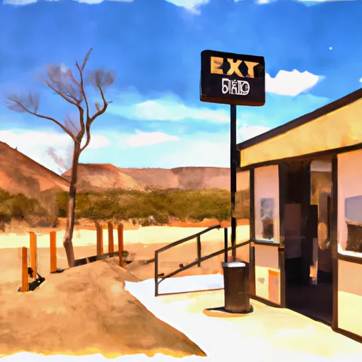
While the primary purpose of the Exit Check Station is to prevent the introduction and spread of invasive species, it also provides visitors with a unique opportunity to learn about the Mojave watershed and the importance of protecting its natural resources. The station is situated in a scenic desert landscape and offers views of the surrounding mountains, as well as informational displays about the area's flora and fauna. Visitors can also interact with the knowledgeable staff, who can answer questions about the checkpoint's operations and the ecosystem of the Mojave watershed. Overall, the Exit Check Station is a worthwhile stop for anyone traveling through the area who wants to learn more about the region's ecology and conservation efforts.
Plan your visit down to the hour
Same weather feed Snoflo's iOS app uses -- updated continuously from NOAA / yr.no.
Next 5 days, hour by hour
Temperature line with weather symbols on top, snow + rain accumulation as columns, humidity as a dotted line.
5-day forecast table
Every 3 hours, broken out across temperature, snow, rain, humidity, and wind.
| Time | Condition | Temp (°F) | Snow (in) | Rain (in) | Humidity (%) | Wind (mps) | Wind dir |
|---|---|---|---|---|---|---|---|
| Loading detailed forecast… | |||||||
15-day temperature & precipitation
Daily temperatures, snow, and rain projected over the next two weeks.
Plan a longer trip
The closest parks, campgrounds, fishing spots, and other landmarks so a quick visit can grow into a full day.
Parks
- Sunrise Motorcycle Park
- Howard Loy Park
- Adelanto Park
- Westwinds Sport Center
- Schmidt Park
- Mesa Linda Park
Campgrounds
- El Mirage Dry Lake Ohv
- Adelanto City Park
- Saddleback Butte State Park
- Mojave Narrows Regional Park
- Table Mountain Campground
Responsible visitation & Leave No Trace
- Know before you go
- Check the operator's site (BLM, NPS, state agency, or private owner) for access rules, permits, and seasonal closures before driving out.
- Stay on trail
- Many points of interest sit in fragile ecosystems. Stick to marked paths to protect vegetation and prevent erosion.
- Respect wildlife
- Observe from a distance, never feed wildlife, and give nesting birds and denning mammals plenty of space.
- Pack it in, pack it out
- Take all trash, food scraps, and gear back with you. Remote sites often have no trash service.
- Leave what you find
- Don't take rocks, plants, fossils, or artifacts. Federal law protects cultural and natural resources on public land.
Set push alerts in the Snoflo app
Save Exit Check Station as a favorite, set a weather threshold (precipitation, freezing temperatures), and the iOS app will push the moment conditions cross.
About Exit Check Station
What is Exit Check Station?
A point of interest in California tracked by Snoflo -- typically a scenic landmark, named summit, monument, or viewpoint.
How fresh is the weather data?
The hourly forecast updates throughout the day from NOAA / yr.no public feeds.
When is the best time to visit?
Use the 15-day temperature & precipitation outlook on this page to pick a window with comfortable temperatures and low precipitation.
How do I get there?
Tap Directions in the hero above for Google Maps driving directions, or Open in map to center the Snoflo interactive map on the spot.
Can I get alerts when conditions change?
Yes -- alerts are managed in the Snoflo iOS app. Favorite this POI, set a threshold (temperature, precipitation), and you'll get a push the moment it crosses.
Other points of interest near here
Snoflo-tracked landmarks within driving distance of Exit Check Station.