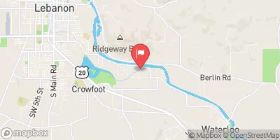
Streamflow discharge was last observed at 75 cfs, and a gauge height of 2.55 feet.
With the
% decrease since yesterday,
the streamflow average over the past 10 days is 81 .
Weather today, Tomorrow,
The canal is primarily fed by the North Santiam River, and there are no major tributaries or dams specifically related to this streamgauge. Seasonal trends show higher flows in the winter and spring due to increased precipitation and snowmelt. Interesting facts about the hydrology of the area include the presence of numerous underground lava tubes, which can impact water flow and create unique conditions for aquatic life. Overall, this streamgauge provides important data for monitoring water resources in the area and understanding the hydrologic processes at play.
| Elevation | 362.0 ft |
| Last Updated | |
| Gage height, ft | 2.55 ft |
| Streamflow, ft³/s | 75.0 ft3/s |
| Percent of Normal | 100% |
| Year Over Year Average | 75 cfs |
| 24hr Flow Prediction | cfs |
| Maximum Recorded | 237 cfs |
| Geolocation | 44.51, -122.86 |