

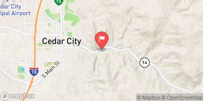
Coal Creek Near Cedar City, Ut Realtime Data
COAL CREEK NEAR CEDAR CITY, UT
Realtime Data • Report • Conditions
215
Discharge (cfs)
5.3
Gauge Height (ft)
Streamflow discharge was last observed at 215 cfs, and a gauge height of 5.33 feet.
With the
% decrease since yesterday,
the streamflow average over the past 10 days is 55 .
Weather today, Tomorrow,
The stream's flow is primarily provided by snowmelt runoff and precipitation. The watershed is home to several small tributaries, including Shurtz Creek and Sullivan Creek. There are no dams on Coal Creek itself. The stream experiences seasonal trends, with peak flows occurring in the spring and early summer due to snowmelt. The hydrology of the Coal Creek watershed is influenced by the surrounding geology, including the presence of volcanic rocks and sedimentary formations. Overall, the Coal Creek streamgauge provides important data for understanding the water resources in this region of Utah.
October 23, 2026
| Elevation | 6,018.0 ft |
| Last Updated | |
| Gage height, ft | 5.33 ft |
| Precipitation, total, in | 0.0 in |
| Streamflow, ft³/s | 215.0 ft3/s |
| Percent of Normal | 1,791% |
| Year Over Year Average | 12 cfs |
| 24hr Flow Prediction | cfs |
| Maximum Recorded | 831 cfs |
| Geolocation | 37.67, -113.03 |
 Continue with Snoflo Premium