

Little Bear River At Paradise, Ut Realtime Data
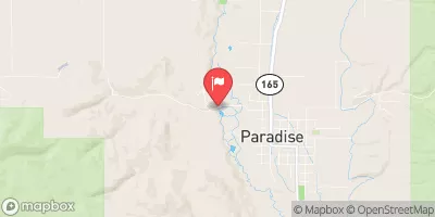
LITTLE BEAR RIVER AT PARADISE, UT
Realtime Data • Report • Conditions
41
Discharge (cfs)
4.9
Gauge Height (ft)
USGS 10105900
Streamflow discharge was last observed at 41 cfs, and a gauge height of 4.91 feet.
With the
% decrease since yesterday,
the streamflow average over the past 10 days is 29 .
Weather today, Tomorrow,
The river is fed by several smaller tributaries and is regulated by the Cutler Dam downstream. Seasonally, the flow tends to peak in the spring and early summer as snowmelt increases, while the fall and winter months see lower flows. Interestingly, the streamgauge is located near the site of a historic flooding event in 1983, which caused significant damage in the area. Understanding the hydrology of the Little Bear River is important for managing water resources in the region and mitigating flood risk.
October 14, 2026
| Elevation | 4,762.0 ft |
| Last Updated | |
| Gage height, ft | 4.91 ft |
| Streamflow, ft³/s | 40.8 ft3/s |
| Percent of Normal | 100% |
| Year Over Year Average | 41 cfs |
| 24hr Flow Prediction | cfs |
| Maximum Recorded | 1,430 cfs |
 Continue with Snoflo Premium