

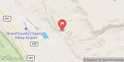
Mill Creek Below Sheley Tunnel, Near Moab, Ut Realtime Data
MILL CREEK BELOW SHELEY TUNNEL, NEAR MOAB, UT
Realtime Data • Report • Conditions
3
Discharge (cfs)
1.4
Gauge Height (ft)
USGS 09183600
Streamflow discharge was last observed at 3 cfs, and a gauge height of 1.36 feet.
With the
% decrease since yesterday,
the streamflow average over the past 10 days is 3 .
Weather today, Tomorrow,
The gauge is located downstream from the Sheley Tunnel, which diverts water from the Provo River. There are no major tributaries or dams in the immediate vicinity of the gauge. Seasonal trends show higher flows in the spring due to snowmelt, and lower flows in the summer and fall. Interestingly, the Mill Creek watershed was the site of a significant flash flood in 1998, which caused extensive damage to homes and infrastructure in the area. Monitoring the flow of the stream is important for flood prevention and management in the watershed.
October 14, 2026
| Elevation | 5,345.0 ft |
| Last Updated | |
| Gage height, ft | 1.36 ft |
| Precipitation, total, in | 0.0 in |
| Temperature, water, °C | 8.9 deg C |
| Streamflow, ft³/s | 2.85 ft3/s |
| Percent of Normal | 88% |
| Year Over Year Average | 3 cfs |
| 24hr Flow Prediction | cfs |
| Maximum Recorded | 752 cfs |
| Geolocation | 38.49, -109.41 |
 Continue with Snoflo Premium