

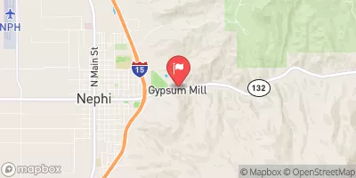
Salt Creek At Nephi, Utah Realtime Data
SALT CREEK AT NEPHI, UTAH
Realtime Data • Report • Conditions
4
Discharge (cfs)
1.4
Gauge Height (ft)
Streamflow discharge was last observed at 6 cfs, and a gauge height of 1.44 feet.
With the
% decrease since yesterday,
the streamflow average over the past 10 days is 5 .
Weather today, Tomorrow,
The main contributors to the flow are snowmelt and precipitation, with minor contributions from agricultural irrigation. There are no significant tributaries or dams directly related to the stream gauge. Flow levels tend to be highest in the spring due to snowmelt, and lowest in the fall and winter. Interestingly, the Salt Creek has been known to occasionally dry up completely during drought years, despite its relatively large watershed. Despite this, the stream provides valuable irrigation water for local agriculture and supports a variety of aquatic life.
October 23, 2026
| Elevation | 5,287.0 ft |
| Last Updated | |
| Gage height, ft | 1.44 ft |
| Streamflow, ft³/s | 6.0 ft3/s |
| Percent of Normal | 87% |
| Year Over Year Average | 5 cfs |
| 24hr Flow Prediction | cfs |
| Maximum Recorded | 452 cfs |
| Geolocation | 39.71, -111.80 |
 Continue with Snoflo Premium