

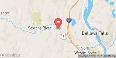
Saxtons River At Saxtons River, Vt Realtime Data
SAXTONS RIVER AT SAXTONS RIVER, VT
Realtime Data • Report • Conditions
19
Discharge (cfs)
2.5
Gauge Height (ft)
USGS 01154000
Streamflow discharge was last observed at 19 cfs, and a gauge height of 2.45 feet.
With the
% decrease since yesterday,
the streamflow average over the past 10 days is 39 .
Weather today, Tomorrow,
The river is fed by several smaller streams, including the Bartonsville Brook and the Rock River. There are no significant dams along the river. Seasonal trends show that the flow is highest in the spring due to snowmelt, and lowest in the fall. The river has a unique history, as it was used to transport logs during the heyday of the lumber industry in Vermont. Today, the river is used for recreation, including fishing and kayaking.
October 23, 2026
| Elevation | 406.0 ft |
| Last Updated | |
| Gage height, feet | 2.45 ft |
| Streamflow, ft3/s | 19.1 ft3/s |
| Percent of Normal | 11% |
| Year Over Year Average | 187 cfs |
| 24hr Flow Prediction | cfs |
| Maximum Recorded | 21,600 cfs |
 Continue with Snoflo Premium