Frenchie Lake Dam Dam

Frenchie Lake Dam
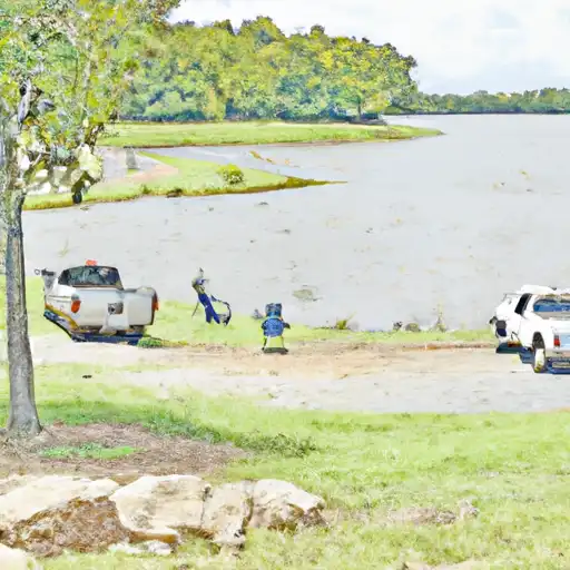
Frenchie Lake Dam, located in Halley, Arkansas, was completed in 1954 and serves as a recreational spot for water enthusiasts in the area. With a primary purpose of recreation, this earth dam stands at a hydraulic height of 6 feet and a structural height of 9 feet. It has a storage capacity of 60 acre-feet, with a normal storage level of 30 acre-feet. The dam spans 335 feet in length and is situated on Bayou Macon-Tr, providing a picturesque backdrop for outdoor activities.
Despite not being regulated by the state, Frenchie Lake Dam is classified as having a significant hazard potential, although its condition has not been officially rated. Emergency action plans and risk assessments for the dam are currently not documented, raising concerns among local water resource and climate enthusiasts. With no recent inspection date provided, the safety and maintenance of the dam remain uncertain, highlighting the need for increased monitoring and evaluation to ensure the protection of surrounding communities and the environment.
As water resource and climate enthusiasts explore the beauty of Frenchie Lake Dam and its recreational offerings, there is a pressing need for improved oversight and risk management measures to safeguard against potential hazards. With its significant hazard potential and lack of state regulation, the dam's condition and safety should be closely monitored to prevent any unforeseen emergencies. As the local community enjoys the benefits of this water feature, it is essential to prioritize the implementation of emergency preparedness plans and regular inspections to ensure the long-term sustainability of Frenchie Lake Dam and its surrounding ecosystem.
Plan around the weather
Same NOAA / yr.no feed Snoflo's iOS app uses. Watch the precipitation column on the meteogram -- rain on the basin upstream typically lifts inflow 24-72 hours later.
Next 5 days, hour by hour
Temperature line with weather symbols on top, snow + rain accumulation as columns, humidity as a dotted line.
5-day forecast table
Every 3 hours, broken out across temperature, snow, rain, humidity, and wind. Each cell is colour-coded relative to the column min/max.
| Time | Condition | Temp (°F) | Snow (in) | Rain (in) | Humidity (%) | Wind (mps) | Wind dir |
|---|---|---|---|---|---|---|---|
| Loading detailed forecast… | |||||||
15-day temperature & precipitation
Daily temperatures, snow, and rain projected over the next two weeks.
Nearby streamflow gauges
USGS streamgauges around Frenchie Lake Dam -- inflows here typically show up in storage 24-72 hours later.
| Streamgauge | Discharge | View |
|---|---|---|
| Bayou Bartholomew Near Mcgehee | 173 cfs | → |
| Bayou Bartholomew At Garrett Bridge | 47 cfs | → |
| Bayou Bartholomew Near Portland | 262 cfs | → |
| Bogue Phalia Nr Leland | 518 cfs | → |
| Bayou Macon At Eudora | 17 cfs | → |
| Big Sunflower River Nr Merigold | 679 cfs | → |


About Frenchie Lake Dam
Where does the data for Frenchie Lake Dam come from?
Structural and regulatory data come from the U.S. Army Corps of Engineers' National Inventory of Dams (NID). Weather forecast comes from NOAA / yr.no -- the same feed Snoflo's iOS app uses.
How often is the report updated?
NID structural data refreshes annually as the Corps publishes updated assessments. The weather forecast refreshes throughout the day.
What does the Significant hazard rating mean?
The Corps of Engineers' hazard potential classification grades probable consequences if the dam fails: High = probable loss of human life; Significant = no probable loss of human life but possible economic loss / environmental damage; Low = no probable loss of human life, only minor economic / environmental losses. See the Dam Data Reference card below for the full definitions.
What's "% of normal"?
The current storage value compared to the historical average storage on this calendar day. 100% = right on average; values above 100% mean above-normal storage (wet year); values below mean below-normal (dry year or drought).
Can I get alerts when storage crosses a threshold?
Yes -- alerts are managed in the Snoflo iOS app. Favorite this dam, set a threshold, and you'll get a push the moment conditions cross.
Dam data reference
Condition Assessment
- Satisfactory
- No existing or potential dam safety deficiencies are recognized. Acceptable performance is expected under all loading conditions (static, hydrologic, seismic) in accordance with the minimum applicable state or federal regulatory criteria or tolerable risk guidelines.
- Fair
- No existing dam safety deficiencies are recognized for normal operating conditions. Rare or extreme hydrologic and/or seismic events may result in a dam safety deficiency. Risk may be in the range to take further action.
- Poor
- A dam safety deficiency is recognized for normal operating conditions which may realistically occur. Remedial action is necessary. POOR may also be used when uncertainties exist as to critical analysis parameters which identify a potential dam safety deficiency.
- Unsatisfactory
- A dam safety deficiency is recognized that requires immediate or emergency remedial action for problem resolution.
- Not Rated
- The dam has not been inspected, is not under state or federal jurisdiction, or has been inspected but, for whatever reason, has not been rated.
Hazard Potential Classification
- High
- Dams assigned the high hazard potential classification are those where failure or mis-operation will probably cause loss of human life.
- Significant
- Dams assigned the significant hazard potential classification are those dams where failure or mis-operation results in no probable loss of human life but can cause economic loss, environmental damage, disruption of lifeline facilities, or impact other concerns. Significant hazard potential classification dams are often located in predominantly rural or agricultural areas but could be in areas with population and significant infrastructure.
- Low
- Dams assigned the low hazard potential classification are those where failure or mis-operation results in no probable loss of human life and low economic and/or environmental losses. Losses are principally limited to the owner's property.
- Undetermined
- Dams for which a downstream hazard potential has not been designated or is not provided.