


Garrison Creek Dam Reservoir Report
Last Updated: April 24, 2026
Nearby: Willow Creek Dam Muldrow Lake
°F
°F
mph
Wind
%
Humidity
Garrison Creek Dam, also known as Roland Dam, is a crucial structure located in Sequoyah County, Oklahoma.
Summary
Built in 2003 by HOLLOWAY UPDIKE & BELLEN, this earth dam stands at a height of 66 feet and serves as a primary water supply source for the surrounding area. The dam has a storage capacity of 1700 acre-feet, with a normal storage level of 1150 acre-feet and a surface area of 47.2 acres.
With a controlled spillway type and a hazard potential rated as high, Garrison Creek Dam is regularly inspected and maintained to ensure its structural integrity. The dam's condition assessment as of January 2022 was reported as satisfactory, but its risk assessment indicates a very high risk level (1). Despite this, the dam meets state permitting, inspection, and enforcement requirements, and is under the jurisdiction of the Oklahoma Water Resources Board.
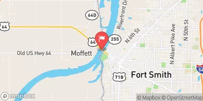
Located on the Garrison Creek in Roland, Oklahoma, Garrison Creek Dam plays a vital role in providing water supply for the region. With its strategic design and functionality, the dam continues to serve its primary purpose effectively while meeting regulatory standards and ensuring the safety of the surrounding community.
Regional Streamflow Levels
 Arkansas River At Ft. Smith
|
51100cfs |
 Lee Creek Near Short
|
224cfs |
 Lee Creek At Short
|
118cfs |
 Little Lee Creek Near Short
|
73cfs |
 James Fork Near Hackett
|
24cfs |
 Poteau River Near Panama
|
211cfs |
15-Day Long Term Forecast
Year Completed |
2003 |
Dam Length |
1000 |
Dam Height |
66 |
River Or Stream |
GARRISON CREEK |
Primary Dam Type |
Earth |
Surface Area |
47.2 |
Hydraulic Height |
52 |
Drainage Area |
3020 |
Nid Storage |
1700 |
Structural Height |
66 |
Outlet Gates |
Valve - 1 |
Hazard Potential |
High |
Nid Height |
66 |
Seasonal Comparison
5-Day Hourly Forecast Detail
Dam Data Reference
Condition Assessment
SatisfactoryNo existing or potential dam safety deficiencies are recognized. Acceptable performance is expected under all loading conditions (static, hydrologic, seismic) in accordance with the minimum applicable state or federal regulatory criteria or tolerable risk guidelines.
Fair
No existing dam safety deficiencies are recognized for normal operating conditions. Rare or extreme hydrologic and/or seismic events may result in a dam safety deficiency. Risk may be in the range to take further action. Note: Rare or extreme event is defined by the regulatory agency based on their minimum
Poor A dam safety deficiency is recognized for normal operating conditions which may realistically occur. Remedial action is necessary. POOR may also be used when uncertainties exist as to critical analysis parameters which identify a potential dam safety deficiency. Investigations and studies are necessary.
Unsatisfactory
A dam safety deficiency is recognized that requires immediate or emergency remedial action for problem resolution.
Not Rated
The dam has not been inspected, is not under state or federal jurisdiction, or has been inspected but, for whatever reason, has not been rated.
Not Available
Dams for which the condition assessment is restricted to approved government users.
Hazard Potential Classification
HighDams assigned the high hazard potential classification are those where failure or mis-operation will probably cause loss of human life.
Significant
Dams assigned the significant hazard potential classification are those dams where failure or mis-operation results in no probable loss of human life but can cause economic loss, environment damage, disruption of lifeline facilities, or impact other concerns. Significant hazard potential classification dams are often located in predominantly rural or agricultural areas but could be in areas with population and significant infrastructure.
Low
Dams assigned the low hazard potential classification are those where failure or mis-operation results in no probable loss of human life and low economic and/or environmental losses. Losses are principally limited to the owner's property.
Undetermined
Dams for which a downstream hazard potential has not been designated or is not provided.
Not Available
Dams for which the downstream hazard potential is restricted to approved government users.
 Lee Creek At Lee Creek Reservoir Near Van Buren