Los Banos Creek Detention Dam Dam

Los Banos Creek Detention Dam
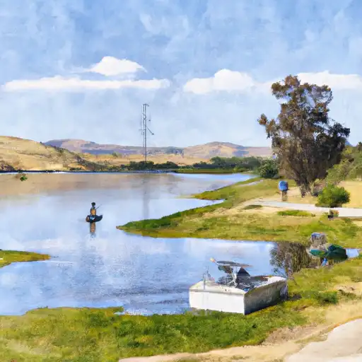
Los Banos Creek Detention Dam, located in Los Banos, California, is a federal-owned earth dam designed for flood risk reduction along the Los Banos Creek. Completed in 1965 by the Bureau of Reclamation, this dam stands at a height of 167 feet and has a maximum storage capacity of 51,920 acre-feet. With a normal storage capacity of 34,500 acre-feet, the dam plays a crucial role in managing water levels during periods of heavy rainfall or snowmelt.
This high-hazard potential dam features an uncontrolled spillway with a width of 20 feet, and a maximum discharge capacity of 8,600 cubic feet per second. While its primary purpose is flood risk reduction, the dam also offers recreational opportunities in the area. Despite its age, the condition assessment of the dam is currently not available, and the last inspection was conducted in March 2020. With a moderate risk rating and emergency action plan last revised in May 2017, Los Banos Creek Detention Dam remains an essential structure for water resource management in Merced County.
For water resource and climate enthusiasts, Los Banos Creek Detention Dam serves as a significant example of federal infrastructure designed to mitigate flood risks and manage water levels in California. With a rich history dating back to the 1960s, this earth dam continues to play a vital role in protecting the surrounding area from potential inundation. As a key feature in the Bureau of Reclamation's portfolio, the dam's operational and regulatory aspects are overseen by the federal agency, ensuring its continued effectiveness in flood risk reduction and water resource management.
Plan around the weather
Same NOAA / yr.no feed Snoflo's iOS app uses. Watch the precipitation column on the meteogram -- rain on the basin upstream typically lifts inflow 24-72 hours later.
Next 5 days, hour by hour
Temperature line with weather symbols on top, snow + rain accumulation as columns, humidity as a dotted line.
5-day forecast table
Every 3 hours, broken out across temperature, snow, rain, humidity, and wind. Each cell is colour-coded relative to the column min/max.
| Time | Condition | Temp (°F) | Snow (in) | Rain (in) | Humidity (%) | Wind (mps) | Wind dir |
|---|---|---|---|---|---|---|---|
| Loading detailed forecast… | |||||||
15-day temperature & precipitation
Daily temperatures, snow, and rain projected over the next two weeks.
Nearby streamflow gauges
USGS streamgauges around Los Banos Creek Detention Dam -- inflows here typically show up in storage 24-72 hours later.
| Streamgauge | Discharge | View |
|---|---|---|
| Salt Slough A Hwy 165 Nr Stevinson Ca | 48 cfs | → |
| Mud Slough Nr Gustine Ca | 1 cfs | → |
| San Joaquin R A Fremont Ford Bridge Ca | 66 cfs | → |
| San Joaquin R Ab Merced R Nr Newman Ca | 88 cfs | → |
| Pacheco C Nr Dunneville Ca | · | → |
| Orestimba C Nr Newman Ca | · | → |


About Los Banos Creek Detention Dam
Where does the data for Los Banos Creek Detention Dam come from?
Structural and regulatory data come from the U.S. Army Corps of Engineers' National Inventory of Dams (NID). Weather forecast comes from NOAA / yr.no -- the same feed Snoflo's iOS app uses.
How often is the report updated?
NID structural data refreshes annually as the Corps publishes updated assessments. The weather forecast refreshes throughout the day.
What does the High hazard rating mean?
The Corps of Engineers' hazard potential classification grades probable consequences if the dam fails: High = probable loss of human life; Significant = no probable loss of human life but possible economic loss / environmental damage; Low = no probable loss of human life, only minor economic / environmental losses. See the Dam Data Reference card below for the full definitions.
What's "% of normal"?
The current storage value compared to the historical average storage on this calendar day. 100% = right on average; values above 100% mean above-normal storage (wet year); values below mean below-normal (dry year or drought).
Can I get alerts when storage crosses a threshold?
Yes -- alerts are managed in the Snoflo iOS app. Favorite this dam, set a threshold, and you'll get a push the moment conditions cross.
Dam data reference
Condition Assessment
- Satisfactory
- No existing or potential dam safety deficiencies are recognized. Acceptable performance is expected under all loading conditions (static, hydrologic, seismic) in accordance with the minimum applicable state or federal regulatory criteria or tolerable risk guidelines.
- Fair
- No existing dam safety deficiencies are recognized for normal operating conditions. Rare or extreme hydrologic and/or seismic events may result in a dam safety deficiency. Risk may be in the range to take further action.
- Poor
- A dam safety deficiency is recognized for normal operating conditions which may realistically occur. Remedial action is necessary. POOR may also be used when uncertainties exist as to critical analysis parameters which identify a potential dam safety deficiency.
- Unsatisfactory
- A dam safety deficiency is recognized that requires immediate or emergency remedial action for problem resolution.
- Not Rated
- The dam has not been inspected, is not under state or federal jurisdiction, or has been inspected but, for whatever reason, has not been rated.
Hazard Potential Classification
- High
- Dams assigned the high hazard potential classification are those where failure or mis-operation will probably cause loss of human life.
- Significant
- Dams assigned the significant hazard potential classification are those dams where failure or mis-operation results in no probable loss of human life but can cause economic loss, environmental damage, disruption of lifeline facilities, or impact other concerns. Significant hazard potential classification dams are often located in predominantly rural or agricultural areas but could be in areas with population and significant infrastructure.
- Low
- Dams assigned the low hazard potential classification are those where failure or mis-operation results in no probable loss of human life and low economic and/or environmental losses. Losses are principally limited to the owner's property.
- Undetermined
- Dams for which a downstream hazard potential has not been designated or is not provided.