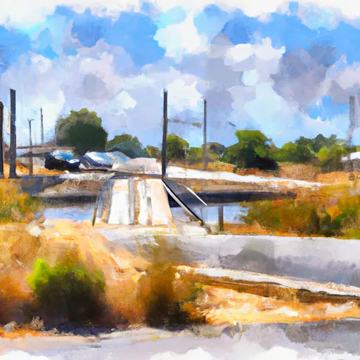
Canyon Road 20711, Los Banos Boat Launch
Community Reviews
Been here? Share the conditions.
Reviews, ratings & photos are added in the free Snoflo iOS app — rate a spot, tag the conditions, and your visit is verified by location. Add or manage your reviews from the app.
Canyon Road 20711, Los Banos
The boat ramp services San Luis Reservoir, which is a popular recreational spot for boating, fishing, and camping. San Luis Reservoir is a large artificial lake that was created by the construction of the San Luis Dam on the California Aqueduct. The lake covers an area of approximately 12,700 acres and has a maximum depth of 320 feet.
A variety of watercraft are permitted on San Luis Reservoir, including boats, jet skis, and sailboats. However, all vessels must comply with the California Boater Card law, which requires operators of motorized boats to complete a boater education course and carry a boater education card. Additionally, all boats must be properly registered and have the required safety equipment on board.
It's worth noting that due to changing water levels, it is best to check the current conditions and any restrictions before planning a trip to San Luis Reservoir. Also, access to the boat ramp may be limited during peak periods, so it's advisable to arrive early in the day to avoid crowds and ensure a good spot.
Plan your launch down to the hour
Same weather feed Snoflo's iOS app uses -- updated continuously from NOAA / yr.no.
Next 5 days, hour by hour
Temperature line with weather symbols on top, snow + rain accumulation as columns, humidity as a dotted line.
5-day forecast table
Every 3 hours, broken out across temperature, snow, rain, humidity, and wind.
| Time | Condition | Temp (°F) | Snow (in) | Rain (in) | Humidity (%) | Wind (mps) | Wind dir |
|---|---|---|---|---|---|---|---|
| Loading detailed forecast… | |||||||
15-day temperature & precipitation
Daily temperatures, snow, and rain projected over the next two weeks.
Area streamflow levels
USGS streamgauges around Canyon Road 20711, Los Banos -- the same readings that determine whether your launch is safe and your boat is the right craft.
| Streamgauge | Discharge | View |
|---|---|---|
| Salt Slough A Hwy 165 Nr Stevinson Ca | 48 cfs | → |
| Mud Slough Nr Gustine Ca | 1 cfs | → |
| San Joaquin R A Fremont Ford Bridge Ca | 66 cfs | → |
| Pacheco C Nr Dunneville Ca | · | → |
| Orestimba C Nr Newman Ca | · | → |
| San Joaquin R Ab Merced R Nr Newman Ca | 88 cfs | → |
Plan a longer trip
The closest paddle runs, fishing spots, and other boat launches so you can extend a day on the water.
Boating safety & etiquette
- Check the conditions before you launch
- Use the streamflow numbers, weather, and wind forecast on this page. High-cfs whitewater requires whitewater-specific craft and skill.
- Wear your life jacket
- Statistically the single biggest survival factor in a boating incident. State law often requires one per passenger.
- File a float plan
- Tell someone on shore your put-in, take-out, and expected return time. Especially for multi-day or remote trips.
- Yield at the ramp
- Prep gear in the parking lot, not on the ramp. Launch and clear quickly so others can use the lane.
- Clean, drain, dry
- Inspect, clean, drain and dry your boat between waters to prevent the spread of aquatic invasive species.
Set push alerts in the Snoflo app
Save Canyon Road 20711, Los Banos as a favorite, set a discharge threshold or a wind/precipitation alert, and the iOS app will push the moment conditions cross.
About Canyon Road 20711, Los Banos
Can I launch a motorboat here?
Most Snoflo-tracked launches support motorboats; check the operator for any horsepower restrictions, paddle-only zones, or seasonal closures.
How fresh is the streamflow data?
USGS streamgauges report continuously (every 15 minutes); the table on this page pulls the latest reading at page load.
Is there a fee?
Many federal and state boat launches charge a day-use fee. Check the operator's site before driving out.
What boat is right for these conditions?
Use the nearby streamflow numbers and river-run panel on this page to gauge current conditions. Wider, slower water is friendly for casual paddling and powerboats; high-cfs whitewater requires whitewater-specific craft and skill.
Can I get alerts when conditions change?
Yes -- alerts are managed in the Snoflo iOS app. Favorite this launch, set a threshold (discharge, wind), and you'll get a push the moment it crosses.
Other launches near here
Snoflo-tracked boat launches within driving distance of Canyon Road 20711, Los Banos.