Bear Pond dam

Bear Pond
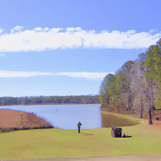
Bear Pond, located in Bells Chapel, Alabama, is a private water resource primarily used for recreation purposes. The earth dam, completed in 1956, stands at a hydraulic height of 22 feet and a structural height of 24 feet, with a length of 560 feet. The pond has a storage capacity of 106 acre-feet and a maximum discharge of 40 cubic feet per second. Despite its low hazard potential and a lack of recent condition assessment, Bear Pond offers a serene environment for water and climate enthusiasts to enjoy various outdoor activities.
Managed by the Mobile District of the US Army Corps of Engineers, Bear Pond is nestled within the picturesque landscape of Bullock County, Alabama. While it is not regulated by the state, the pond provides a tranquil setting for recreation seekers to engage in fishing, boating, and wildlife observation. Although the dam has not been recently inspected, its low hazard potential and historical significance make it a noteworthy destination for those interested in water resource management and climate-related activities.
With Martha Roby representing Congressional District 02, Alabama, Bear Pond remains a hidden gem for nature enthusiasts in the region. While lacking detailed information on maintenance and emergency preparedness, the pond's peaceful surroundings and recreational opportunities make it a charming spot for visitors seeking a tranquil escape in the heart of Alabama's beautiful countryside. For water resource and climate enthusiasts, Bear Pond offers a unique blend of natural beauty and outdoor activities to explore and enjoy.
Plan around the weather
Same NOAA / yr.no feed Snoflo's iOS app uses. Watch the precipitation column on the meteogram -- rain on the basin upstream typically lifts inflow 24-72 hours later.
Next 5 days, hour by hour
Temperature line with weather symbols on top, snow + rain accumulation as columns, humidity as a dotted line.
5-day forecast table
Every 3 hours, broken out across temperature, snow, rain, humidity, and wind. Each cell is colour-coded relative to the column min/max.
| Time | Condition | Temp (°F) | Snow (in) | Rain (in) | Humidity (%) | Wind (mps) | Wind dir |
|---|---|---|---|---|---|---|---|
| Loading detailed forecast… | |||||||
15-day temperature & precipitation
Daily temperatures, snow, and rain projected over the next two weeks.
Nearby streamflow gauges
USGS streamgauges around Bear Pond -- inflows here typically show up in storage 24-72 hours later.
| Streamgauge | Discharge | View |
|---|---|---|
| Catoma Creek Near Montgomery Al | 23 cfs | → |
| Tallapoosa River Near Mont.-Mont. Water Works | 1,630 cfs | → |
| Uphapee Creek Near Tuskegee Al | 116 cfs | → |
| Pea River Near Ariton Al | 60 cfs | → |
| Alabama River Near Montgomery | 18,500 cfs | → |
| Conecuh River At Brantley Al | 152 cfs | → |
Make a day of it
Boat launches, lakeside camping, fishing access, and other reservoirs near Bear Pond.
Boat launches
See all →


About Bear Pond
Where does the data for Bear Pond come from?
Structural and regulatory data come from the U.S. Army Corps of Engineers' National Inventory of Dams (NID). Weather forecast comes from NOAA / yr.no -- the same feed Snoflo's iOS app uses.
How often is the report updated?
NID structural data refreshes annually as the Corps publishes updated assessments. The weather forecast refreshes throughout the day.
What does the Low hazard rating mean?
The Corps of Engineers' hazard potential classification grades probable consequences if the dam fails: High = probable loss of human life; Significant = no probable loss of human life but possible economic loss / environmental damage; Low = no probable loss of human life, only minor economic / environmental losses. See the Dam Data Reference card below for the full definitions.
What's "% of normal"?
The current storage value compared to the historical average storage on this calendar day. 100% = right on average; values above 100% mean above-normal storage (wet year); values below mean below-normal (dry year or drought).
Can I get alerts when storage crosses a threshold?
Yes -- alerts are managed in the Snoflo iOS app. Favorite this dam, set a threshold, and you'll get a push the moment conditions cross.
Dam data reference
Condition Assessment
- Satisfactory
- No existing or potential dam safety deficiencies are recognized. Acceptable performance is expected under all loading conditions (static, hydrologic, seismic) in accordance with the minimum applicable state or federal regulatory criteria or tolerable risk guidelines.
- Fair
- No existing dam safety deficiencies are recognized for normal operating conditions. Rare or extreme hydrologic and/or seismic events may result in a dam safety deficiency. Risk may be in the range to take further action.
- Poor
- A dam safety deficiency is recognized for normal operating conditions which may realistically occur. Remedial action is necessary. POOR may also be used when uncertainties exist as to critical analysis parameters which identify a potential dam safety deficiency.
- Unsatisfactory
- A dam safety deficiency is recognized that requires immediate or emergency remedial action for problem resolution.
- Not Rated
- The dam has not been inspected, is not under state or federal jurisdiction, or has been inspected but, for whatever reason, has not been rated.
Hazard Potential Classification
- High
- Dams assigned the high hazard potential classification are those where failure or mis-operation will probably cause loss of human life.
- Significant
- Dams assigned the significant hazard potential classification are those dams where failure or mis-operation results in no probable loss of human life but can cause economic loss, environmental damage, disruption of lifeline facilities, or impact other concerns. Significant hazard potential classification dams are often located in predominantly rural or agricultural areas but could be in areas with population and significant infrastructure.
- Low
- Dams assigned the low hazard potential classification are those where failure or mis-operation results in no probable loss of human life and low economic and/or environmental losses. Losses are principally limited to the owner's property.
- Undetermined
- Dams for which a downstream hazard potential has not been designated or is not provided.