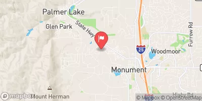
Kiowa Crk Wtrshd J-33 Reservoir Report
Last Updated: February 22, 2026
Kiowa Creek Watershed J-33, located in Elbert County, Colorado, is a crucial water resource infrastructure project primarily designed for flood risk reduction.
Summary
Constructed in 1956, this earth dam stands at a height of 23 feet and has a structural height of 28 feet. With a maximum storage capacity of 87 acre-feet and a normal storage of 42 acre-feet, this dam serves multiple purposes including fire protection, stock, or small fish pond, in addition to flood risk reduction.
Managed by the U.S. Soil Conservation Service, USDA NRCS, this dam on Kiowa Creek boasts a low hazard potential and has been deemed to be in satisfactory condition. With a drainage area of 1 square mile and a maximum discharge of 3575 cubic feet per second, the dam features an uncontrolled spillway with a width of 130 feet. Despite being a local government-owned structure, the dam is regulated, permitted, inspected, and enforced by the Colorado Department of Water Resources, ensuring its safety and functionality for the community.
In the event of an emergency, the dam has emergency action plans in place, although the specifics of these plans and their adherence to guidelines are not detailed in the available information. With a moderate risk assessment rating and a designated risk management measure of 3, Kiowa Creek Watershed J-33 serves as a critical piece of infrastructure in protecting the surrounding area from potential flooding events.
°F
°F
mph
Wind
%
Humidity
15-Day Weather Outlook
Year Completed |
1956 |
Dam Length |
642 |
Dam Height |
23 |
River Or Stream |
KIOWA CREEK-TR |
Primary Dam Type |
Earth |
Surface Area |
7 |
Hydraulic Height |
23 |
Drainage Area |
1 |
Nid Storage |
87 |
Structural Height |
28 |
Outlet Gates |
Uncontrolled |
Hazard Potential |
Low |
Foundations |
Soil |
Nid Height |
28 |
Seasonal Comparison
5-Day Hourly Forecast Detail
Nearby Streamflow Levels
Dam Data Reference
Condition Assessment
SatisfactoryNo existing or potential dam safety deficiencies are recognized. Acceptable performance is expected under all loading conditions (static, hydrologic, seismic) in accordance with the minimum applicable state or federal regulatory criteria or tolerable risk guidelines.
Fair
No existing dam safety deficiencies are recognized for normal operating conditions. Rare or extreme hydrologic and/or seismic events may result in a dam safety deficiency. Risk may be in the range to take further action. Note: Rare or extreme event is defined by the regulatory agency based on their minimum
Poor A dam safety deficiency is recognized for normal operating conditions which may realistically occur. Remedial action is necessary. POOR may also be used when uncertainties exist as to critical analysis parameters which identify a potential dam safety deficiency. Investigations and studies are necessary.
Unsatisfactory
A dam safety deficiency is recognized that requires immediate or emergency remedial action for problem resolution.
Not Rated
The dam has not been inspected, is not under state or federal jurisdiction, or has been inspected but, for whatever reason, has not been rated.
Not Available
Dams for which the condition assessment is restricted to approved government users.
Hazard Potential Classification
HighDams assigned the high hazard potential classification are those where failure or mis-operation will probably cause loss of human life.
Significant
Dams assigned the significant hazard potential classification are those dams where failure or mis-operation results in no probable loss of human life but can cause economic loss, environment damage, disruption of lifeline facilities, or impact other concerns. Significant hazard potential classification dams are often located in predominantly rural or agricultural areas but could be in areas with population and significant infrastructure.
Low
Dams assigned the low hazard potential classification are those where failure or mis-operation results in no probable loss of human life and low economic and/or environmental losses. Losses are principally limited to the owner's property.
Undetermined
Dams for which a downstream hazard potential has not been designated or is not provided.
Not Available
Dams for which the downstream hazard potential is restricted to approved government users.


 Kiowa Crk Wtrshd J-33