W. Cherry Creek Det. #1 Reservoir Report
Last Updated: February 21, 2026
W.
Summary
Cherry Creek Det. #1 is a vital flood risk reduction structure located in El Paso County, Colorado. Built in 1961 by the USDA NRCS, this earth dam stands at a height of 34 feet and stretches for 757 feet along the West Cherry Creek-TR. With a storage capacity of 119 acre-feet and a maximum discharge of 3360 cubic feet per second, this dam plays a crucial role in protecting the surrounding area from potential flooding.
Despite its age, W. Cherry Creek Det. #1 is in satisfactory condition according to the last inspection in April 2018, with a low hazard potential. The dam's primary purpose is flood risk reduction, and it is regulated, permitted, inspected, and enforced by the Colorado Department of Water Resources. With a risk assessment rating of high (2), measures for risk management are likely in place to ensure the structure's continued effectiveness in safeguarding the community against potential flooding events.
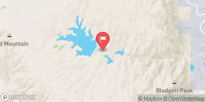
Located in the city of Franktown, this dam is a key component of the region's water resource infrastructure. With its strategic design and engineering, W. Cherry Creek Det. #1 serves as a testament to the importance of proactive flood mitigation efforts in the face of changing climatic conditions and increasing water-related risks.
°F
°F
mph
Wind
%
Humidity
15-Day Weather Outlook
Year Completed |
1961 |
Dam Length |
757 |
Dam Height |
32 |
River Or Stream |
WEST CHERRY CREEK-TR |
Primary Dam Type |
Earth |
Surface Area |
11 |
Hydraulic Height |
32 |
Drainage Area |
2 |
Nid Storage |
119 |
Structural Height |
34 |
Hazard Potential |
Low |
Nid Height |
34 |
Seasonal Comparison
5-Day Hourly Forecast Detail
Nearby Streamflow Levels
Dam Data Reference
Condition Assessment
SatisfactoryNo existing or potential dam safety deficiencies are recognized. Acceptable performance is expected under all loading conditions (static, hydrologic, seismic) in accordance with the minimum applicable state or federal regulatory criteria or tolerable risk guidelines.
Fair
No existing dam safety deficiencies are recognized for normal operating conditions. Rare or extreme hydrologic and/or seismic events may result in a dam safety deficiency. Risk may be in the range to take further action. Note: Rare or extreme event is defined by the regulatory agency based on their minimum
Poor A dam safety deficiency is recognized for normal operating conditions which may realistically occur. Remedial action is necessary. POOR may also be used when uncertainties exist as to critical analysis parameters which identify a potential dam safety deficiency. Investigations and studies are necessary.
Unsatisfactory
A dam safety deficiency is recognized that requires immediate or emergency remedial action for problem resolution.
Not Rated
The dam has not been inspected, is not under state or federal jurisdiction, or has been inspected but, for whatever reason, has not been rated.
Not Available
Dams for which the condition assessment is restricted to approved government users.
Hazard Potential Classification
HighDams assigned the high hazard potential classification are those where failure or mis-operation will probably cause loss of human life.
Significant
Dams assigned the significant hazard potential classification are those dams where failure or mis-operation results in no probable loss of human life but can cause economic loss, environment damage, disruption of lifeline facilities, or impact other concerns. Significant hazard potential classification dams are often located in predominantly rural or agricultural areas but could be in areas with population and significant infrastructure.
Low
Dams assigned the low hazard potential classification are those where failure or mis-operation results in no probable loss of human life and low economic and/or environmental losses. Losses are principally limited to the owner's property.
Undetermined
Dams for which a downstream hazard potential has not been designated or is not provided.
Not Available
Dams for which the downstream hazard potential is restricted to approved government users.


 W. Cherry Creek Det. #1
 Palmer Lake
 Upper Reservoir - Palmer Lake
 Deadmans Creek