Wray Watershed District #3 Reservoir Report
Last Updated: January 12, 2026
Wray Watershed District #3, located in Yuma County, Colorado, is a crucial entity dedicated to flood risk reduction in the area.
°F
°F
mph
Wind
%
Humidity
Summary
Managed by the local government and designed by the USDA NRCS, this dam structure along the N. Fork Republican River plays a vital role in safeguarding the surrounding communities from potential flooding events. Completed in 1958, this earth dam stands at a height of 34 feet and has a normal storage capacity of 39 acre-feet.
With a significant hazard potential and a satisfactory condition assessment as of April 2018, the Wray Watershed District #3 dam is regularly inspected to ensure its effectiveness and safety. The spillway, with a width of 182 feet, helps manage high water levels during heavy rainfall periods, with a maximum discharge capability of 3141 cubic feet per second. While the risk assessment categorizes the dam as moderate, the district remains vigilant in its risk management measures to protect the local community and infrastructure from potential flood events. As a pivotal component in the region's water resource and climate resilience efforts, Wray Watershed District #3 serves as a critical piece in the overall safety and security of the area.
Year Completed |
1958 |
Dam Length |
250 |
Dam Height |
34 |
River Or Stream |
N. FORK REPUBLICAN RIVER-TR |
Primary Dam Type |
Earth |
Surface Area |
3 |
Hydraulic Height |
37 |
Nid Storage |
50 |
Structural Height |
38 |
Outlet Gates |
Uncontrolled - 0 |
Hazard Potential |
Significant |
Nid Height |
38 |
Seasonal Comparison
Weather Forecast
Nearby Streamflow Levels
Dam Data Reference
Condition Assessment
SatisfactoryNo existing or potential dam safety deficiencies are recognized. Acceptable performance is expected under all loading conditions (static, hydrologic, seismic) in accordance with the minimum applicable state or federal regulatory criteria or tolerable risk guidelines.
Fair
No existing dam safety deficiencies are recognized for normal operating conditions. Rare or extreme hydrologic and/or seismic events may result in a dam safety deficiency. Risk may be in the range to take further action. Note: Rare or extreme event is defined by the regulatory agency based on their minimum
Poor A dam safety deficiency is recognized for normal operating conditions which may realistically occur. Remedial action is necessary. POOR may also be used when uncertainties exist as to critical analysis parameters which identify a potential dam safety deficiency. Investigations and studies are necessary.
Unsatisfactory
A dam safety deficiency is recognized that requires immediate or emergency remedial action for problem resolution.
Not Rated
The dam has not been inspected, is not under state or federal jurisdiction, or has been inspected but, for whatever reason, has not been rated.
Not Available
Dams for which the condition assessment is restricted to approved government users.
Hazard Potential Classification
HighDams assigned the high hazard potential classification are those where failure or mis-operation will probably cause loss of human life.
Significant
Dams assigned the significant hazard potential classification are those dams where failure or mis-operation results in no probable loss of human life but can cause economic loss, environment damage, disruption of lifeline facilities, or impact other concerns. Significant hazard potential classification dams are often located in predominantly rural or agricultural areas but could be in areas with population and significant infrastructure.
Low
Dams assigned the low hazard potential classification are those where failure or mis-operation results in no probable loss of human life and low economic and/or environmental losses. Losses are principally limited to the owner's property.
Undetermined
Dams for which a downstream hazard potential has not been designated or is not provided.
Not Available
Dams for which the downstream hazard potential is restricted to approved government users.

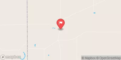
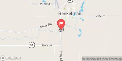
 Wray Watershed District #3