R. D. Nixon Reservoir Report
Nearby: Hanna Ranch Supernatant Calahan
Last Updated: February 22, 2026
R.
Summary
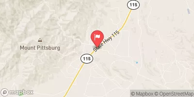
D. Nixon is a notable dam located in Pueblo, Colorado, along the Fountain Creek-TR river system. Completed in 1979, this earth dam stands at a height of 64 feet with a length of 2000 feet, providing flood risk reduction and other essential purposes for the local community. With a storage capacity of 1557 acre-feet and a drainage area of 1 square mile, R. D. Nixon plays a significant role in managing water resources in the area.
Owned and regulated by the local government, R. D. Nixon is subject to inspections, permitting, and enforcement by the Colorado Division of Water Resources. The dam has a spillway width of 25 feet and a maximum discharge of 2900 cubic feet per second, ensuring effective water management during high flow events. The dam's hazard potential is categorized as significant, but its condition assessment is deemed satisfactory as of the last inspection in April 2019.
Managed by the Albuquerque District of the U.S. Army Corps of Engineers, R. D. Nixon's risk assessment is moderate, with a designated risk score of 3. While the dam meets guidelines for emergency action planning, further details on risk management measures and inundation maps prepared are not provided in the data. Overall, R. D. Nixon stands as a vital infrastructure for water resource management and climate resilience in El Paso County, Colorado.
°F
°F
mph
Wind
%
Humidity
15-Day Weather Outlook
Year Completed |
1979 |
Dam Length |
2000 |
Dam Height |
28 |
River Or Stream |
FOUNTAIN CREEK-TR |
Primary Dam Type |
Earth |
Surface Area |
92 |
Hydraulic Height |
28 |
Drainage Area |
1 |
Nid Storage |
1557 |
Structural Height |
64 |
Hazard Potential |
Significant |
Nid Height |
64 |
Seasonal Comparison
5-Day Hourly Forecast Detail
Nearby Streamflow Levels
Dam Data Reference
Condition Assessment
SatisfactoryNo existing or potential dam safety deficiencies are recognized. Acceptable performance is expected under all loading conditions (static, hydrologic, seismic) in accordance with the minimum applicable state or federal regulatory criteria or tolerable risk guidelines.
Fair
No existing dam safety deficiencies are recognized for normal operating conditions. Rare or extreme hydrologic and/or seismic events may result in a dam safety deficiency. Risk may be in the range to take further action. Note: Rare or extreme event is defined by the regulatory agency based on their minimum
Poor A dam safety deficiency is recognized for normal operating conditions which may realistically occur. Remedial action is necessary. POOR may also be used when uncertainties exist as to critical analysis parameters which identify a potential dam safety deficiency. Investigations and studies are necessary.
Unsatisfactory
A dam safety deficiency is recognized that requires immediate or emergency remedial action for problem resolution.
Not Rated
The dam has not been inspected, is not under state or federal jurisdiction, or has been inspected but, for whatever reason, has not been rated.
Not Available
Dams for which the condition assessment is restricted to approved government users.
Hazard Potential Classification
HighDams assigned the high hazard potential classification are those where failure or mis-operation will probably cause loss of human life.
Significant
Dams assigned the significant hazard potential classification are those dams where failure or mis-operation results in no probable loss of human life but can cause economic loss, environment damage, disruption of lifeline facilities, or impact other concerns. Significant hazard potential classification dams are often located in predominantly rural or agricultural areas but could be in areas with population and significant infrastructure.
Low
Dams assigned the low hazard potential classification are those where failure or mis-operation results in no probable loss of human life and low economic and/or environmental losses. Losses are principally limited to the owner's property.
Undetermined
Dams for which a downstream hazard potential has not been designated or is not provided.
Not Available
Dams for which the downstream hazard potential is restricted to approved government users.


 R. D. Nixon