
Crystal Lake Dam Reservoir Report
Nearby: Lake Satoko Dam Alumax Corp Dam
Last Updated: March 31, 2026
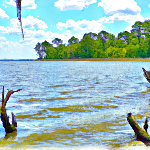
Crystal Lake Dam, located in Berkeley, South Carolina, was completed in 1973 and serves primarily for recreational purposes.
Summary
This privately owned earth dam stands at a height of 22 feet and spans a length of 1140 feet, with a storage capacity of 1344 acre-feet. The dam overlooks the picturesque Mill Branch river, offering visitors a serene lake environment for various water activities.
Despite its scenic beauty, Crystal Lake Dam poses a significant hazard potential with a poor condition assessment as of December 2017. It is subject to state regulation and inspection by the South Carolina Department of Health and Environmental Control (DHEC). With a history of poor maintenance, there is a pressing need for risk management measures to be implemented to ensure the safety of the surrounding community in the event of an emergency.
As water resource and climate enthusiasts explore the ecological significance of Crystal Lake Dam, its maintenance and risk assessment remain vital considerations for the local authorities. Efforts to improve the dam's condition and emergency response plans are crucial in safeguarding the environment and ensuring the sustainable use of this recreational water resource.
°F
°F
mph
Wind
%
Humidity
15-Day Weather Outlook
Year Completed |
1973 |
Dam Length |
1140 |
Dam Height |
22 |
River Or Stream |
MILL BRANCH |
Primary Dam Type |
Earth |
Surface Area |
140 |
Nid Storage |
1344 |
Hazard Potential |
Significant |
Foundations |
Soil |
Nid Height |
22 |
Seasonal Comparison
5-Day Hourly Forecast Detail
Nearby Streamflow Levels
 Back River At Dupont Intake Nr Kittredge
|
3780cfs |
 Lake Moultrie Tailrace Canal At Moncks Corner
|
1060cfs |
 Edisto River Nr Givhans
|
1420cfs |
 Santee River Near Pineville
|
596cfs |
 Santee River Nr Jamestown
|
1610cfs |
 Black River At Kingstree
|
306cfs |
Dam Data Reference
Condition Assessment
SatisfactoryNo existing or potential dam safety deficiencies are recognized. Acceptable performance is expected under all loading conditions (static, hydrologic, seismic) in accordance with the minimum applicable state or federal regulatory criteria or tolerable risk guidelines.
Fair
No existing dam safety deficiencies are recognized for normal operating conditions. Rare or extreme hydrologic and/or seismic events may result in a dam safety deficiency. Risk may be in the range to take further action. Note: Rare or extreme event is defined by the regulatory agency based on their minimum
Poor A dam safety deficiency is recognized for normal operating conditions which may realistically occur. Remedial action is necessary. POOR may also be used when uncertainties exist as to critical analysis parameters which identify a potential dam safety deficiency. Investigations and studies are necessary.
Unsatisfactory
A dam safety deficiency is recognized that requires immediate or emergency remedial action for problem resolution.
Not Rated
The dam has not been inspected, is not under state or federal jurisdiction, or has been inspected but, for whatever reason, has not been rated.
Not Available
Dams for which the condition assessment is restricted to approved government users.
Hazard Potential Classification
HighDams assigned the high hazard potential classification are those where failure or mis-operation will probably cause loss of human life.
Significant
Dams assigned the significant hazard potential classification are those dams where failure or mis-operation results in no probable loss of human life but can cause economic loss, environment damage, disruption of lifeline facilities, or impact other concerns. Significant hazard potential classification dams are often located in predominantly rural or agricultural areas but could be in areas with population and significant infrastructure.
Low
Dams assigned the low hazard potential classification are those where failure or mis-operation results in no probable loss of human life and low economic and/or environmental losses. Losses are principally limited to the owner's property.
Undetermined
Dams for which a downstream hazard potential has not been designated or is not provided.
Not Available
Dams for which the downstream hazard potential is restricted to approved government users.
 Crystal Lake Dam
 Lake Moultrie Near Pinopolis
 Highway 402 To Old Santee Canal/Cooper River Confluence