
Lake Livingston Reservoir Report
Last Updated: April 1, 2026
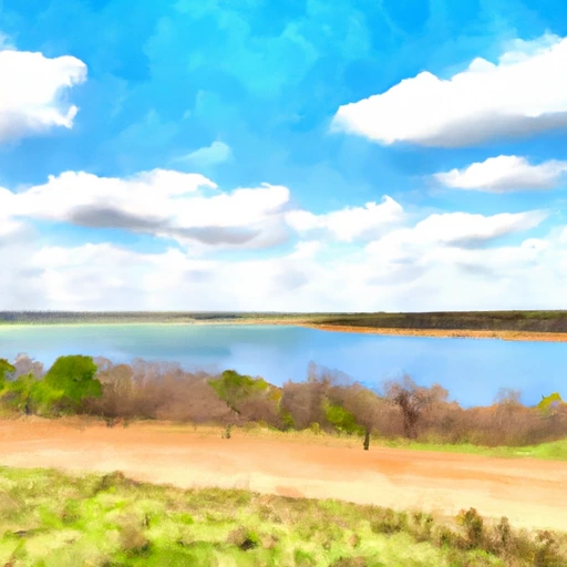
Lake Livingston, located in Goodrich, Texas, is a vital water resource managed by a public utility and regulated by the Texas Commission on Environmental Quality (TCEQ).
Summary
The dam, completed in 1969, stands at a height of 90 feet and boasts a storage capacity of over 3.2 million acre-feet. With a surface area of 83,000 acres and a drainage area of 16,594 square miles, Lake Livingston plays a crucial role in flood control, water supply, and recreational activities in the region.
Owned by the Federal Energy Regulatory Commission (FERC), Lake Livingston's dam features 12 Tainter radial gates for water release. The reservoir's high hazard potential necessitates regular inspections and emergency action planning, with a recent assessment indicating a need for further evaluation. Despite some data gaps in its condition assessment, Lake Livingston remains a key asset for water management in Texas, serving as a hub for water enthusiasts and climate advocates alike.
Surrounded by the natural beauty of San Jacinto County, Lake Livingston provides a picturesque backdrop for outdoor activities and eco-tourism. Its strategic location along the Trinity River and vast storage capacity make it a crucial resource for maintaining water quality, supporting wildlife habitats, and adapting to changing climate patterns. With ongoing regulatory oversight and a commitment to safety and sustainability, Lake Livingston continues to be a beacon of water stewardship in the Lone Star State.
°F
°F
mph
Wind
%
Humidity
15-Day Weather Outlook
Year Completed |
1969 |
Dam Length |
14000 |
Dam Height |
90 |
River Or Stream |
Trinity |
Surface Area |
83000 |
Drainage Area |
16594 |
Nid Storage |
3208450 |
Outlet Gates |
Tainter (radial) - 12 |
Hazard Potential |
High |
Nid Height |
90 |
Seasonal Comparison
5-Day Hourly Forecast Detail
Nearby Streamflow Levels
 Trinity Rv Nr Goodrich
|
1550cfs |
 Long King Ck At Livingston
|
4cfs |
 Trinity Rv At Romayor
|
1620cfs |
 Menard Ck Nr Rye
|
20cfs |
 Kickapoo Ck At Onalaska
|
1cfs |
 E Fk San Jacinto Rv Nr Cleveland
|
23cfs |
Dam Data Reference
Condition Assessment
SatisfactoryNo existing or potential dam safety deficiencies are recognized. Acceptable performance is expected under all loading conditions (static, hydrologic, seismic) in accordance with the minimum applicable state or federal regulatory criteria or tolerable risk guidelines.
Fair
No existing dam safety deficiencies are recognized for normal operating conditions. Rare or extreme hydrologic and/or seismic events may result in a dam safety deficiency. Risk may be in the range to take further action. Note: Rare or extreme event is defined by the regulatory agency based on their minimum
Poor A dam safety deficiency is recognized for normal operating conditions which may realistically occur. Remedial action is necessary. POOR may also be used when uncertainties exist as to critical analysis parameters which identify a potential dam safety deficiency. Investigations and studies are necessary.
Unsatisfactory
A dam safety deficiency is recognized that requires immediate or emergency remedial action for problem resolution.
Not Rated
The dam has not been inspected, is not under state or federal jurisdiction, or has been inspected but, for whatever reason, has not been rated.
Not Available
Dams for which the condition assessment is restricted to approved government users.
Hazard Potential Classification
HighDams assigned the high hazard potential classification are those where failure or mis-operation will probably cause loss of human life.
Significant
Dams assigned the significant hazard potential classification are those dams where failure or mis-operation results in no probable loss of human life but can cause economic loss, environment damage, disruption of lifeline facilities, or impact other concerns. Significant hazard potential classification dams are often located in predominantly rural or agricultural areas but could be in areas with population and significant infrastructure.
Low
Dams assigned the low hazard potential classification are those where failure or mis-operation results in no probable loss of human life and low economic and/or environmental losses. Losses are principally limited to the owner's property.
Undetermined
Dams for which a downstream hazard potential has not been designated or is not provided.
Not Available
Dams for which the downstream hazard potential is restricted to approved government users.
 Lake Livingston State Park
 Wolf Creek Park - Lake Livingston
 Double Lake Recreation Area: (936) 344-6205
 Double Lake Recreation Area
 Double Lake
 Lone Star Trail Primitive Camp Site Number 1
 Lake Livingston
 Livingston Res Nr Goodrich
 Livingston Trail Polk County