
Farmland Ranch 19 Dam Reservoir Report
Last Updated: December 25, 2025
Farmland Ranch 19 Dam, also known as Pride Packing Ranch 19 Dam, is a privately owned irrigation structure located in Sunnyside, Washington.
°F
°F
mph
Wind
%
Humidity
Summary
Completed in 1992, this earth dam stands at a hydraulic height of 35 feet and a structural height of 30 feet, with a length of 300 feet. It serves the primary purpose of irrigation, with a maximum storage capacity of 67 acre-feet and a normal storage level of 45.5 acre-feet. The dam is situated on an unnamed tributary of Sulphur Creek and covers a surface area of 4.3 acres, serving a drainage area of 0.68 square miles.
Despite its satisfactory condition assessment as of June 2021, Farmland Ranch 19 Dam is classified as having a high hazard potential. It is regulated and inspected by the Washington Department of Ecology, ensuring state jurisdiction and enforcement of safety standards. The dam's emergency action plan (EAP) status and risk management measures are not explicitly mentioned in the data, suggesting a potential area for improvement and further assessment. With its proximity to Congressional District 04 represented by Dan Newhouse, this vital irrigation structure plays a significant role in water resource management in the Yakima region.
Water resource and climate enthusiasts will find Farmland Ranch 19 Dam to be an intriguing case study, showcasing the intersection of private ownership, state regulation, and agricultural water management. The dam's design, construction, and operation reflect the complex interplay between human-made infrastructure and natural water systems. Its location in the Yakima Valley, a key agricultural region in Washington, underscores the importance of efficient irrigation systems in sustaining farming activities in semi-arid environments. As efforts to enhance water efficiency and resilience in the face of climate change continue, this dam serves as a crucial piece of infrastructure supporting sustainable agriculture in the region.
Year Completed |
1992 |
Dam Length |
300 |
River Or Stream |
Unnamed Trib - Sulphur Creek |
Primary Dam Type |
Earth |
Surface Area |
4.3 |
Hydraulic Height |
35 |
Drainage Area |
0.68 |
Nid Storage |
67 |
Structural Height |
30 |
Hazard Potential |
High |
Foundations |
Rock, Soil |
Nid Height |
35 |
Seasonal Comparison
Weather Forecast
Nearby Streamflow Levels
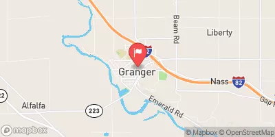 Granger Drain At Granger
|
13cfs |
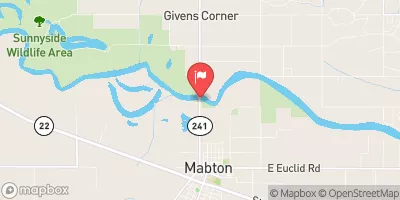 Yakima River At Mabton
|
9390cfs |
 Columbia River Below Priest Rapids Dam
|
174000cfs |
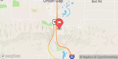 Yakima River Above Ahtanum Creek At Union Gap
|
7190cfs |
 Ahtanum Creek At Union Gap
|
226cfs |
 Yakima River At Kiona
|
9310cfs |
Dam Data Reference
Condition Assessment
SatisfactoryNo existing or potential dam safety deficiencies are recognized. Acceptable performance is expected under all loading conditions (static, hydrologic, seismic) in accordance with the minimum applicable state or federal regulatory criteria or tolerable risk guidelines.
Fair
No existing dam safety deficiencies are recognized for normal operating conditions. Rare or extreme hydrologic and/or seismic events may result in a dam safety deficiency. Risk may be in the range to take further action. Note: Rare or extreme event is defined by the regulatory agency based on their minimum
Poor A dam safety deficiency is recognized for normal operating conditions which may realistically occur. Remedial action is necessary. POOR may also be used when uncertainties exist as to critical analysis parameters which identify a potential dam safety deficiency. Investigations and studies are necessary.
Unsatisfactory
A dam safety deficiency is recognized that requires immediate or emergency remedial action for problem resolution.
Not Rated
The dam has not been inspected, is not under state or federal jurisdiction, or has been inspected but, for whatever reason, has not been rated.
Not Available
Dams for which the condition assessment is restricted to approved government users.
Hazard Potential Classification
HighDams assigned the high hazard potential classification are those where failure or mis-operation will probably cause loss of human life.
Significant
Dams assigned the significant hazard potential classification are those dams where failure or mis-operation results in no probable loss of human life but can cause economic loss, environment damage, disruption of lifeline facilities, or impact other concerns. Significant hazard potential classification dams are often located in predominantly rural or agricultural areas but could be in areas with population and significant infrastructure.
Low
Dams assigned the low hazard potential classification are those where failure or mis-operation results in no probable loss of human life and low economic and/or environmental losses. Losses are principally limited to the owner's property.
Undetermined
Dams for which a downstream hazard potential has not been designated or is not provided.
Not Available
Dams for which the downstream hazard potential is restricted to approved government users.
 Farmland Ranch 19 Dam