Upper Carmichael Lake Dam Dam

Upper Carmichael Lake Dam
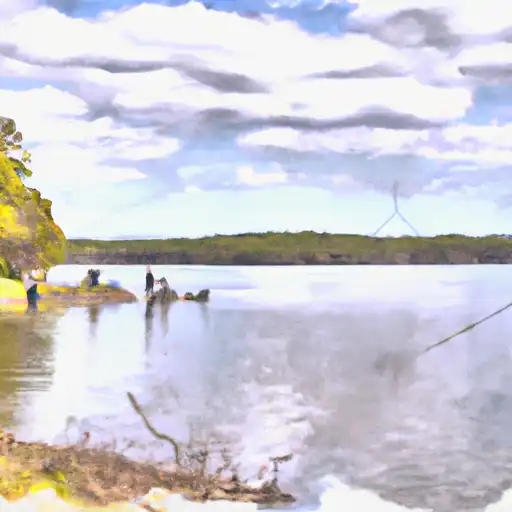
Upper Carmichael Lake Dam, located in Morgan, Georgia, is a private recreational dam designed by Weyman Carmichael. Standing at 21 feet tall and spanning 300 feet in length, this earth dam provides a storage capacity of 142 acre-feet with a surface area of 19 acres. While the dam has an uncontrolled spillway and outlet gates, its hazard potential is rated as low, with a moderate risk assessment.
Despite being state-jurisdiction regulated, Upper Carmichael Lake Dam has not undergone state permitting or enforcement. The last inspection in 1989 deemed its condition as not rated, with an inspection frequency of every five years. The dam's primary purpose is for recreation, with no associated structures and no federal agency involvement in funding, construction, or regulation. With a risk management plan in place, the dam's risk character is summarized as moderate, making it a noteworthy site for water resource and climate enthusiasts in the region.
Overall, Upper Carmichael Lake Dam offers a picturesque setting for recreational activities while maintaining a low hazard potential and moderate risk assessment. Its historical significance as a private earth dam designed by Weyman Carmichael adds to its allure, attracting visitors interested in water resource management and climate resilience. As a state-regulated structure with a focus on recreation, the dam provides a unique opportunity for exploration and study in the field of water resources and climate adaptation.
Plan around the weather
Same NOAA / yr.no feed Snoflo's iOS app uses. Watch the precipitation column on the meteogram -- rain on the basin upstream typically lifts inflow 24-72 hours later.
Next 5 days, hour by hour
Temperature line with weather symbols on top, snow + rain accumulation as columns, humidity as a dotted line.
5-day forecast table
Every 3 hours, broken out across temperature, snow, rain, humidity, and wind. Each cell is colour-coded relative to the column min/max.
| Time | Condition | Temp (°F) | Snow (in) | Rain (in) | Humidity (%) | Wind (mps) | Wind dir |
|---|---|---|---|---|---|---|---|
| Loading detailed forecast… | |||||||
15-day temperature & precipitation
Daily temperatures, snow, and rain projected over the next two weeks.
Nearby streamflow gauges
USGS streamgauges around Upper Carmichael Lake Dam -- inflows here typically show up in storage 24-72 hours later.
| Streamgauge | Discharge | View |
|---|---|---|
| Little River Near Eatonton | 51 cfs | → |
| Oconee River Near Penfield | 324 cfs | → |
| Apalachee River Near Bostwick | 70 cfs | → |
| Alcovy River Above Covington | 82 cfs | → |
| Murder Creek Below Eatonton | 50 cfs | → |
| Alcovy River Below Covington | 154 cfs | → |


About Upper Carmichael Lake Dam
Where does the data for Upper Carmichael Lake Dam come from?
Structural and regulatory data come from the U.S. Army Corps of Engineers' National Inventory of Dams (NID). Weather forecast comes from NOAA / yr.no -- the same feed Snoflo's iOS app uses.
How often is the report updated?
NID structural data refreshes annually as the Corps publishes updated assessments. The weather forecast refreshes throughout the day.
What does the Low hazard rating mean?
The Corps of Engineers' hazard potential classification grades probable consequences if the dam fails: High = probable loss of human life; Significant = no probable loss of human life but possible economic loss / environmental damage; Low = no probable loss of human life, only minor economic / environmental losses. See the Dam Data Reference card below for the full definitions.
What's "% of normal"?
The current storage value compared to the historical average storage on this calendar day. 100% = right on average; values above 100% mean above-normal storage (wet year); values below mean below-normal (dry year or drought).
Can I get alerts when storage crosses a threshold?
Yes -- alerts are managed in the Snoflo iOS app. Favorite this dam, set a threshold, and you'll get a push the moment conditions cross.
Dam data reference
Condition Assessment
- Satisfactory
- No existing or potential dam safety deficiencies are recognized. Acceptable performance is expected under all loading conditions (static, hydrologic, seismic) in accordance with the minimum applicable state or federal regulatory criteria or tolerable risk guidelines.
- Fair
- No existing dam safety deficiencies are recognized for normal operating conditions. Rare or extreme hydrologic and/or seismic events may result in a dam safety deficiency. Risk may be in the range to take further action.
- Poor
- A dam safety deficiency is recognized for normal operating conditions which may realistically occur. Remedial action is necessary. POOR may also be used when uncertainties exist as to critical analysis parameters which identify a potential dam safety deficiency.
- Unsatisfactory
- A dam safety deficiency is recognized that requires immediate or emergency remedial action for problem resolution.
- Not Rated
- The dam has not been inspected, is not under state or federal jurisdiction, or has been inspected but, for whatever reason, has not been rated.
Hazard Potential Classification
- High
- Dams assigned the high hazard potential classification are those where failure or mis-operation will probably cause loss of human life.
- Significant
- Dams assigned the significant hazard potential classification are those dams where failure or mis-operation results in no probable loss of human life but can cause economic loss, environmental damage, disruption of lifeline facilities, or impact other concerns. Significant hazard potential classification dams are often located in predominantly rural or agricultural areas but could be in areas with population and significant infrastructure.
- Low
- Dams assigned the low hazard potential classification are those where failure or mis-operation results in no probable loss of human life and low economic and/or environmental losses. Losses are principally limited to the owner's property.
- Undetermined
- Dams for which a downstream hazard potential has not been designated or is not provided.