Toponce Ditch Dam Lower Dam

Toponce Ditch Dam Lower
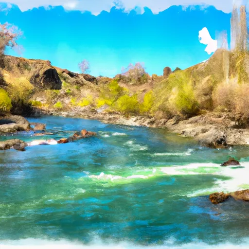
Toponce Ditch Dam Lower, located in Caribou, Idaho, plays a crucial role in irrigation, serving as a vital water resource for the surrounding area. This earth dam, constructed with a stone core, stands at a height of 18.1 feet and has a storage capacity of 78 acre-feet. The dam is regulated by the Idaho Department of Water Resources, ensuring proper inspection, permitting, and enforcement measures are in place to maintain its integrity and functionality.
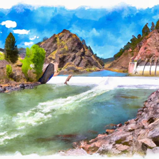
The dam, situated on the Portneuf River and Toponce Creek, has a spillway type of "Uncontrolled" with a slide (sluice gate) for outlet gates. Despite its low hazard potential and fair condition assessment, the risk assessment indicates a moderate risk level. The last inspection in July 2018 revealed no significant issues, with a scheduled inspection frequency of every five years. With its historical significance and ongoing role in sustaining agricultural activities in the region, Toponce Ditch Dam Lower remains a crucial piece of infrastructure for water resource management in Idaho.
As a private-owned structure, Toponce Ditch Dam Lower's primary purpose of irrigation underscores its importance in supporting local agriculture and maintaining water supply reliability. With its unique design and location, this dam serves as a key component in the water management system of the area, contributing to the economic and environmental sustainability of the region. Despite being classified as having a moderate risk level, the dam's overall condition is deemed fair, highlighting the ongoing need for regular monitoring and maintenance to ensure its continued functionality and safety for the community.
Plan around the weather
Same NOAA / yr.no feed Snoflo's iOS app uses. Watch the precipitation column on the meteogram -- rain on the basin upstream typically lifts inflow 24-72 hours later.
Next 5 days, hour by hour
Temperature line with weather symbols on top, snow + rain accumulation as columns, humidity as a dotted line.
5-day forecast table
Every 3 hours, broken out across temperature, snow, rain, humidity, and wind. Each cell is colour-coded relative to the column min/max.
| Time | Condition | Temp (°F) | Snow (in) | Rain (in) | Humidity (%) | Wind (mps) | Wind dir |
|---|---|---|---|---|---|---|---|
| Loading detailed forecast… | |||||||
15-day temperature & precipitation
Daily temperatures, snow, and rain projected over the next two weeks.
Nearby streamflow gauges
USGS streamgauges around Toponce Ditch Dam Lower -- inflows here typically show up in storage 24-72 hours later.
| Streamgauge | Discharge | View |
|---|---|---|
| Portneuf River At Topaz Id | 71 cfs | → |
| Marsh Creek Nr Mccammon Id | 37 cfs | → |
| Blackfoot River Ab Reservoir Nr Henry Id | 11 cfs | → |
| Portneuf River At Pocatello Id | 38 cfs | → |
| Grays Lk Div To Blackfoot R Basin Nr Wayan Id | 0 cfs | → |
| Blackfoot River Nr Shelley Id | 462 cfs | → |
Make a day of it
Boat launches, lakeside camping, fishing access, and other reservoirs near Toponce Ditch Dam Lower.
Boat launches
See all →


Campgrounds
See all →


Fishing spots
See all →
River runs
See all →


About Toponce Ditch Dam Lower
Where does the data for Toponce Ditch Dam Lower come from?
Structural and regulatory data come from the U.S. Army Corps of Engineers' National Inventory of Dams (NID). Weather forecast comes from NOAA / yr.no -- the same feed Snoflo's iOS app uses.
How often is the report updated?
NID structural data refreshes annually as the Corps publishes updated assessments. The weather forecast refreshes throughout the day.
What does the Low hazard rating mean?
The Corps of Engineers' hazard potential classification grades probable consequences if the dam fails: High = probable loss of human life; Significant = no probable loss of human life but possible economic loss / environmental damage; Low = no probable loss of human life, only minor economic / environmental losses. See the Dam Data Reference card below for the full definitions.
What's "% of normal"?
The current storage value compared to the historical average storage on this calendar day. 100% = right on average; values above 100% mean above-normal storage (wet year); values below mean below-normal (dry year or drought).
Can I get alerts when storage crosses a threshold?
Yes -- alerts are managed in the Snoflo iOS app. Favorite this dam, set a threshold, and you'll get a push the moment conditions cross.
Dam data reference
Condition Assessment
- Satisfactory
- No existing or potential dam safety deficiencies are recognized. Acceptable performance is expected under all loading conditions (static, hydrologic, seismic) in accordance with the minimum applicable state or federal regulatory criteria or tolerable risk guidelines.
- Fair
- No existing dam safety deficiencies are recognized for normal operating conditions. Rare or extreme hydrologic and/or seismic events may result in a dam safety deficiency. Risk may be in the range to take further action.
- Poor
- A dam safety deficiency is recognized for normal operating conditions which may realistically occur. Remedial action is necessary. POOR may also be used when uncertainties exist as to critical analysis parameters which identify a potential dam safety deficiency.
- Unsatisfactory
- A dam safety deficiency is recognized that requires immediate or emergency remedial action for problem resolution.
- Not Rated
- The dam has not been inspected, is not under state or federal jurisdiction, or has been inspected but, for whatever reason, has not been rated.
Hazard Potential Classification
- High
- Dams assigned the high hazard potential classification are those where failure or mis-operation will probably cause loss of human life.
- Significant
- Dams assigned the significant hazard potential classification are those dams where failure or mis-operation results in no probable loss of human life but can cause economic loss, environmental damage, disruption of lifeline facilities, or impact other concerns. Significant hazard potential classification dams are often located in predominantly rural or agricultural areas but could be in areas with population and significant infrastructure.
- Low
- Dams assigned the low hazard potential classification are those where failure or mis-operation results in no probable loss of human life and low economic and/or environmental losses. Losses are principally limited to the owner's property.
- Undetermined
- Dams for which a downstream hazard potential has not been designated or is not provided.