


Thompson Dam Reservoir Report
Last Updated: May 9, 2026
Nearby: Schroeder Dam Priester Lake Dam
°F
°F
mph
Wind
%
Humidity
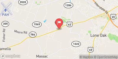
Thompson Dam, located in Livingston, Kentucky, stands as a vital water resource infrastructure designed by NRCS in 1997.
Summary
This private-owned earth dam, spanning 2,286 feet in length and reaching a height of 15 feet, serves the primary purpose of 'Other' with a storage capacity of 750 acre-feet. The dam, situated on an unnamed tributary, is regulated by the KY Division of Water and undergoes regular inspections and enforcement to ensure its structural integrity and safety.
Despite its low hazard potential and moderate risk assessment, Thompson Dam's condition assessment in 2018 revealed poor conditions, warranting attention and potential maintenance to enhance its longevity and functionality. The dam's spillway is designated as uncontrolled, with a surface area of 143 acres and a drainage area of 0.63 square miles. With a risk management plan yet to be detailed, Thompson Dam remains an essential structure in the Nashville District, contributing to water resource management in the region while posing manageable risks that require continual monitoring and upkeep.
Regional Streamflow Levels
 Massac Creek Near Paducah
|
2cfs |
 Ohio River At Metropolis
|
444000cfs |
 Little Bayou Creek Near Grahamville
|
1cfs |
 Bayou Creek Near Grahamville
|
5cfs |
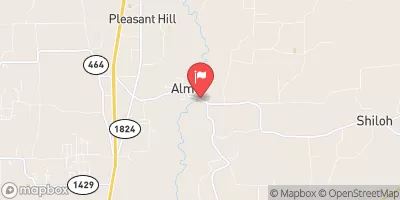 Clarks River At Almo
|
17cfs |
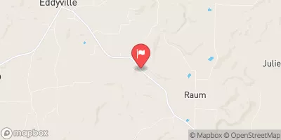 Lusk Creek Near Eddyville
|
30cfs |
15-Day Long Term Forecast
Year Completed |
1997 |
Dam Length |
2286 |
Dam Height |
15 |
River Or Stream |
UNNAMED TRIB |
Primary Dam Type |
Earth |
Surface Area |
143 |
Drainage Area |
0.63 |
Nid Storage |
750 |
Hazard Potential |
Low |
Nid Height |
15 |
Seasonal Comparison
5-Day Hourly Forecast Detail
Dam Data Reference
Condition Assessment
SatisfactoryNo existing or potential dam safety deficiencies are recognized. Acceptable performance is expected under all loading conditions (static, hydrologic, seismic) in accordance with the minimum applicable state or federal regulatory criteria or tolerable risk guidelines.
Fair
No existing dam safety deficiencies are recognized for normal operating conditions. Rare or extreme hydrologic and/or seismic events may result in a dam safety deficiency. Risk may be in the range to take further action. Note: Rare or extreme event is defined by the regulatory agency based on their minimum
Poor A dam safety deficiency is recognized for normal operating conditions which may realistically occur. Remedial action is necessary. POOR may also be used when uncertainties exist as to critical analysis parameters which identify a potential dam safety deficiency. Investigations and studies are necessary.
Unsatisfactory
A dam safety deficiency is recognized that requires immediate or emergency remedial action for problem resolution.
Not Rated
The dam has not been inspected, is not under state or federal jurisdiction, or has been inspected but, for whatever reason, has not been rated.
Not Available
Dams for which the condition assessment is restricted to approved government users.
Hazard Potential Classification
HighDams assigned the high hazard potential classification are those where failure or mis-operation will probably cause loss of human life.
Significant
Dams assigned the significant hazard potential classification are those dams where failure or mis-operation results in no probable loss of human life but can cause economic loss, environment damage, disruption of lifeline facilities, or impact other concerns. Significant hazard potential classification dams are often located in predominantly rural or agricultural areas but could be in areas with population and significant infrastructure.
Low
Dams assigned the low hazard potential classification are those where failure or mis-operation results in no probable loss of human life and low economic and/or environmental losses. Losses are principally limited to the owner's property.
Undetermined
Dams for which a downstream hazard potential has not been designated or is not provided.
Not Available
Dams for which the downstream hazard potential is restricted to approved government users.
Area Campgrounds
 Pearcy Camp
 Nickell Branch Basic Campground - Land Between the Lakes
 Demumbers Bay Backcountry Area & Boat Ramp at Land Between The Lakes
 Birmangham Ferry Backcountry Area & Boat Ramp at Land Between The Lakes
 Cravens Bay Campground & Boat Ramp at Land Between The Lakes
 Cedar Grove Camping Area
 The Foot of Broadway Paducah
River Runs
-
 Bridge At Eddyville Blacktop To Confluence With Ohio River At Golconda,Il
-
 1 Minle Southwest Of Delwood, Il (Sec. 18, T11S, R13E) To Reesville, 1/4 Mile South Of The Confluence With Sugar Creek
-
 Source, About 2 Miles East Of Delwood, Il (Sec 10, T11S, R6E) To Bridge At Eddyville Blacktop (Se1/4,Sec.16,T12S, R6E)
-
 Russell Cemetery, Approx 1/4 Mile North Of Karbers Ridge Road To Proclamation Boundary, 1 Mile Nw Of Elizabethtown,Il
-
 Wallace Cemetery Approx 2.5 Miles Nw Of Herod, Il To Confluence With Ohio River At Golconda Jobs Corp Center
 Lake Tecumseh
 One Horse Gap Lake
 Little Cache Lake #1 (Bowman Lake)
 Dutchman Lake
 Lake of Egypt